|
Metropolitan Area |
Transport Risk |
|
Dallas / Ft. Worth |
Low |
|
Austin |
Low |
|
San Antonio |
Low |
Mountain Cedar location(s): Edwards Plateau, Texas
Regional weather: Wednesday, December 13 - TX/OK/AR: Precipitation ending and clearing skies in western sections today while the nasty winter weather continues in the eastern areas. Precipitation will end in the eastern areas this evening. Highs in the 20's and 30's north today, 40's and 50's south and west. Becoming partly cloudy most areas on Thursday.
Trajectory weather: Freezing rain (if any) ending from west to east early, then decreasing clouds and warmer. High in the 40's. Partly cloudy tonight, low in the 30's. Partly to mostly cloudy on Thursday, high in the 50's.
Trajectory confidence: High.
OUTLOOK: *** Low Threat *** We are early in the release season with few cones ready to release. Conditions remain unfavorable for pollen release today with the continuance of cool temperatures and high humidities. Low Risk of pollen transport and any ill effects. TK
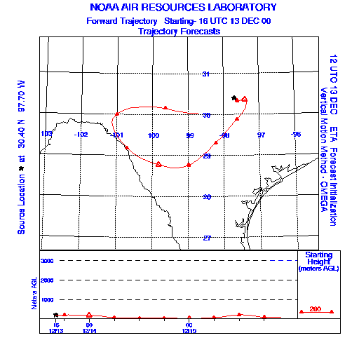
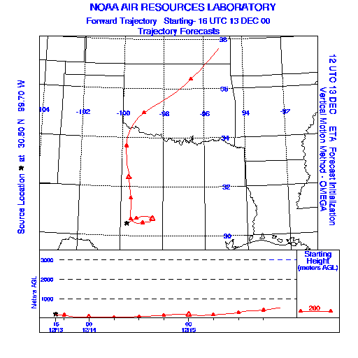
Trajectory Start(s) (shown by * on map): Austin, TX; Junction, TX; San Angelo, TX
Austin, TX
Junction, TX
San Angelo, TX
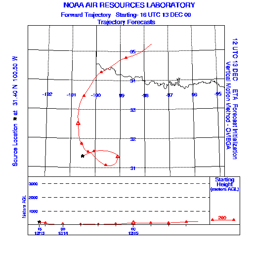
Prepared by: Thomas Keever (Department of Marine, Earth and Atmospheric Sciences, NCSU), Estelle Levetin (Faculty of Biological Science, The University of Tulsa, 600 S. College, Tulsa, OK 74104), and C.E. Main (Department of Plant Pathology, North Carolina State University, Raleigh, NC 27695-7618). This forecast gives the anticipated future track of released Mountain Cedar pollen, weather conditions over the region and along the forecast pathway, and an estimated time of arrival for various metropolitan areas.
Questions: Aerobiology Lab e-mail: pollen@utulsa.edu
Return to Forecasting Home Page