University of Tulsa
Mountain Cedar Pollen Forecast
Date Issued: 17 December 2000
Mountain Cedar location(s): Ozark Mountains, AR/MO
Regional weather: Sunday, December 17 - TX/OK/AR: High pressure area is centered right over the region. The center of the High will shift east as a low pressure/frontal system forms in the lee of the southern Rockies and heads towards OK/TX. Dry weather expected region-wide today with clear to partly cloudy skies. Highs today mostly 40's to 60's. Lows tonight mostly 20's to 40's.
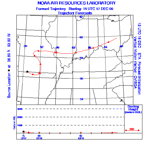
Trajectory weather: Sunny and cold today, high in the 20's. Increasing clouds tonight with a chance of light snow late, low in the 10's. Cloudy with a chance of snow Monday, high in the low 30's.
Trajectory confidence: High
OUTLOOK: *** Low Threat *** Most cones are likely immature this early in the season. Conditions are very unfavorable for pollen release today. Temperatures will remain locked in the 20's near the source. Humidities will be marginally favorable at best. Winds are light. Little to no release expected. TK
Trajectory Start(s) (shown by * on map): Oak Grove, AR
Prepared by: Thomas Keever (Department of Marine, Earth and Atmospheric Sciences, NCSU), Estelle Levetin (Faculty of Biological Science, The University of Tulsa, 600 S. College, Tulsa, OK 74104), and C.E. Main (Department of Plant Pathology, North Carolina State University, Raleigh, NC 27695-7618). This forecast gives the anticipated future track of released Mountain Cedar pollen, weather conditions over the region and along the forecast pathway, and an estimated time of arrival for various metropolitan areas.
Questions: Aerobiology Lab e-mail: pollen@utulsa.edu
Return to Forecasting Home Page