|
Metropolitan Area |
Exposure Risk |
|
Dallas / Ft. Worth |
Low |
|
Austin |
Low |
|
San Antonio |
Low |
Mountain Cedar location(s): Edwards Plateau, Texas
Regional weather: Saturday, December 23 - TX/OK/AR: Major winter storm for the region by Monday: A frontal disturbance is moving southeastward through TX today, while weak low pressure continues to develop near the southern TX coast. Fair to partly cloudy today in west TX, the Panhandles, and central and western OK; otherwise cloudy, with drizzle/fog in parts of southern and southeast TX. These two surface weather elements will merge near the coast overnight, continuing to strengthen on Sunday and Monday as upper-level energy comes into play. Meanwhile, another shot of arctic air will push into the region from the north on Sunday. The result.... rain will increase in intensity and expand westward and northward on Sunday. By Monday, virtually the entire region will be engulfed in a vigorous storm with everything from snow and sleet in the north to showers and thunderstorms in the south. This slow-moving system will take several days to move away and will likely affect the region through mid-week. Highs today mostly in the 40's and 50's, 30's north to 60's south on Sunday. Lows tonight in the 20's to 40's all but deep south TX.
Trajectory weather: Mostly cloudy east-central TX to mostly sunny west-central TX. Highs near 50 Austin trajectory, upper 50's San Angelo trajectory. Cloudy tonight with a low in the low 40's. Cloudy on Sunday, with fog or drizzle in central TX. Highs in the 40's central TX to 50's Big Bend region.
Trajectory confidence: High.
OUTLOOK: *** Low Threat *** We are early in the release season, though a few cones may be ready for release. Mostly unfavorable conditions for pollen release today. The weather varies over the Plateau today. Temperatures are somewhat favorable in the east (high near 50) to reasonably favorable in the west (highs near 60). Humidities are well out of the tolerance range in the east and south, with clouds and some drizzle or fog. In the western and northern sections, the humidities.... while still above the 50% tolerance range.... have dropped off during the late morning hours under sunny skies. Winds are light to moderate. Overall.... the warmer temperatures and falling humidities may be enough to induce some light pollen release in the far western or northwestern sections of the Plateau, while very little to no release is expected elsewhere. Low Risk of exposure. No major metropolitan areas should be affected. For Christmas Eve and Christmas Day... conditions will become less favorable for pollen release each day. Moisture will continue to increase, remaining well out the tolerance range. Temperatures will only be marginal to perhaps slightly favorable. Very little to no release is expected Sunday and Monday, with Low Exposure Risk to the populace. TK
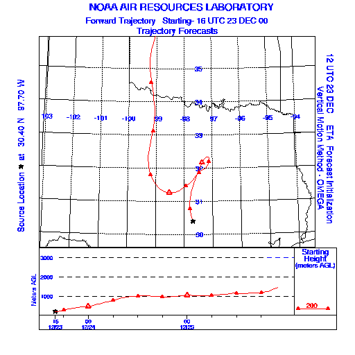
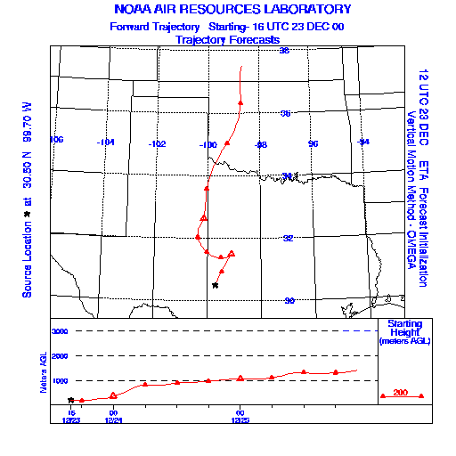
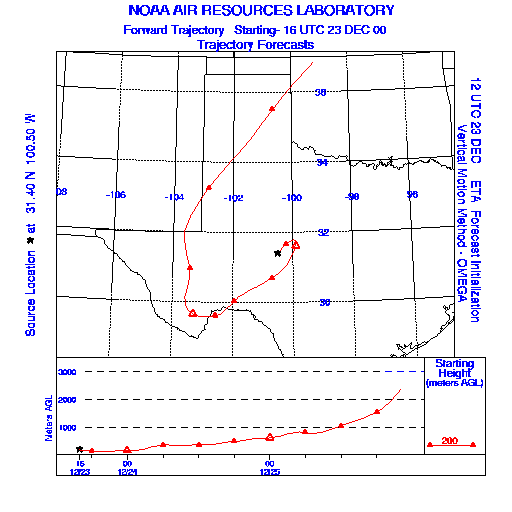
Trajectory Start(s) (shown by * on map): Austin, TX; Junction, TX; San Angelo, TX
Austin, TX
Junction, TX
San Angelo, TX
Prepared by: Thomas Keever (Department of Marine, Earth and Atmospheric Sciences, NCSU), Estelle Levetin (Faculty of Biological Science, The University of Tulsa, 600 S. College, Tulsa, OK 74104), and C.E. Main (Department of Plant Pathology, North Carolina State University, Raleigh, NC 27695-7618). This forecast gives the anticipated future track of released Mountain Cedar pollen, weather conditions over the region and along the forecast pathway, and an estimated time of arrival for various metropolitan areas.
Questions: Aerobiology Lab e-mail: pollen@utulsa.edu
Return to Forecasting Home Page