|
Metropolitan Area |
Exposure Risk |
|
Dallas / Ft. Worth |
Low |
|
Austin |
Low |
|
San Antonio |
Low |
Mountain Cedar location(s): Edwards Plateau, Texas
Regional weather: Wednesday, December 27 - TX/OK/AR: Major winter storm continues: System will heavily affect the region again today as is slowly moves to the east. Precipitation possible over all but the far western areas..... snow, sleet, or freezing rain north, rain to the south. Highs in the 20's to 40's, lows mostly in the 20's and 30's.
Trajectory weather: Cloudy with a chance of rain today, high in the low 40's. Decreasing clouds tonight, temperatures holding in the low 40's. Partly cloudy Thursday, high in the 50's.
Trajectory confidence: High.
OUTLOOK: *** Low Threat *** Very unfavorable conditions for pollen release today. Temperatures are too low and humidity levels are too high with neither approaching the toleranze ranges. Precipitation yesterday as well over nearly all the Plateau. No pollen release expected today, with Low Risk of exposure. TK
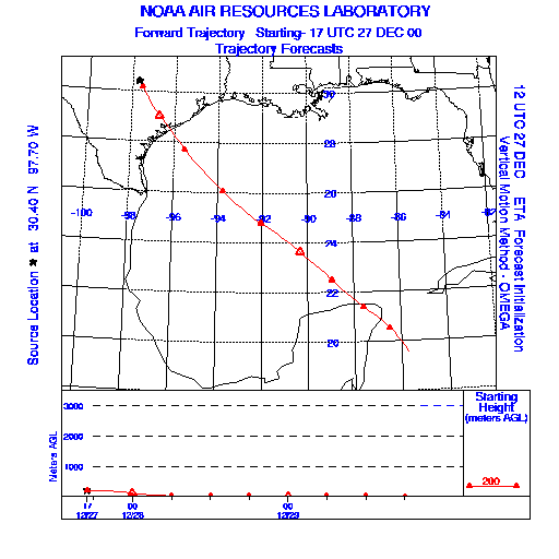
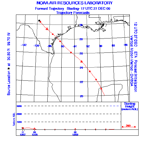
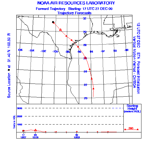
Trajectory Start(s) (shown by * on map): Austin, TX; Junction, TX; San Angelo, TX
Austin, TX
Junction, TX
San Angelo, TX
Prepared by: Thomas Keever (Department of Marine, Earth and Atmospheric Sciences, NCSU), Estelle Levetin (Faculty of Biological Science, The University of Tulsa, 600 S. College, Tulsa, OK 74104), and C.E. Main (Department of Plant Pathology, North Carolina State University, Raleigh, NC 27695-7618). This forecast gives the anticipated future track of released Mountain Cedar pollen, weather conditions over the region and along the forecast pathway, and an estimated time of arrival for various metropolitan areas.
Questions: Aerobiology Lab e-mail: pollen@utulsa.edu
Return to Forecasting Home Page