University of Tulsa
Mountain Cedar Pollen Forecast
Date Issued: 27 December 2000
Mountain Cedar location(s): Ozark Mountains, AR/MO
Regional weather: Wednesday, December 27 - TX/OK/AR: Major winter storm continues: System will heavily affect the region again today as is slowly moves to the east. Precipitation possible over all but the far western areas..... snow, sleet, or freezing rain north, rain to the south. Highs in the 20's to 40's, lows mostly in the 20's and 30's.
Trajectory weather: Cloudy with patchy drizzle or freezing drizzle today, high in the low 30's. Light rain or freezing rain likely tonight, low in the 20's. Light rain or freezing rain ending Thursday morning, continued cloudy. High in the 30's.
Trajectory confidence: High
OUTLOOK: *** Low Threat *** Conditions are highly unfavorable for release today. Freezing rain/drizzle/fog near the source most of the day. Highs only in the low 30's and humidities remain very high. No pollen release is expected. TK
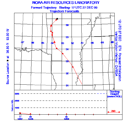
Trajectory Start(s) (shown by black star on map): Oak Grove, AR
Prepared by: Thomas Keever (Department of Marine, Earth and Atmospheric Sciences, NCSU), Estelle Levetin (Faculty of Biological Science, The University of Tulsa, 600 S. College, Tulsa, OK 74104), and C.E. Main (Department of Plant Pathology, North Carolina State University, Raleigh, NC 27695-7618). This forecast gives the anticipated future track of released Mountain Cedar pollen, weather conditions over the region and along the forecast pathway, and an estimated time of arrival for various metropolitan areas.
Questions: Aerobiology Lab e-mail: pollen@utulsa.edu
Return to Forecasting Home Page