University
of Tulsa
Mountain Cedar Pollen Forecast
|
Metropolitan Area |
Exposure Risk |
|
|
Low |
|
|
Low |
|
|
Low |
Date Issued:
Mountain Cedar location(s): Edwards Plateau, Texas
Regional weather: Tuesday, December10 TX/OK/AR: Conditions will be improving today as the system
that brought the heavy rains continues to move to the east. High
pressure begins to build over the region and will continue for the next couple of days.
Winds will be light today from the south to southeast in the north, shifting to a general south to north
direction during the day over the rest of the area. High temperatures across the
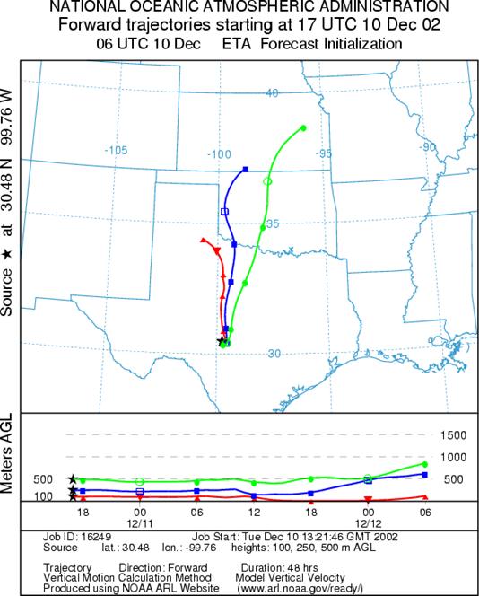
Trajectory weather: The air mass trajectories from
OUTLOOK: ***Low threat today *** unfavorable conditions for pollen release today. Over the plateau
temperatures will begin to warm as high pressure begins to build in the region.
However, with yesterday's weather high humidity levels will occur as the region begins to dry.
Partly cloudy skies should begin to clear and sunnier conditions begin, especially to the south.
Because of the overall cool conditions and high humidity, conditions are unfavorable for pollen release. Our field informants have yet to see actively pollinating trees. In addition, the air masses trajectory characteristics only show moderately
rising air today and low windspeeds, which is not conducive to entrainment and travel.
Any pollen that is released and entrained will move to the north to northeast over the
Trajectory Start(s) (shown by *on map):
Austin, TX
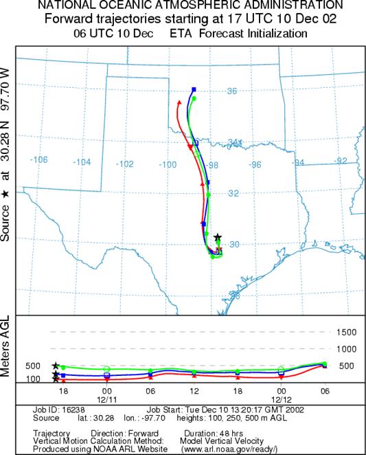
Junction, TX
Prepared by: Peter K.Van de Water(Department of Geosciences, Oregon State University),and Estelle Levetin (Faculty of Biological Science, TheUniversity of Tulsa, 600 S. College, Tulsa, OK 74104) This forecastgives the anticipated future track of released Mountain Cedar pollen, weatherconditions over the region and along the forecast pathway, and an estimatedtime of arrival for various metropolitan areas.
Questions: Aerobiology Lab e-mail: pollen@utulsa.edu
Return to ForecastingHome Page