University
of Tulsa
Mountain Cedar Pollen Forecast
|
Metropolitan Area |
Exposure Risk |
|
|
Low |
|
|
Low |
|
|
Low |
Date Issued: 11 December 2002
Mountain Cedar location(s): Edwards Plateau, Texas
Regional weather: Wednesday, December 11 TX/OK/AR: Conditions across the region will continue
to improve as high pressure is stationed over eastern Texas Temperatures
will continue to warm but humidity will continue to be relatively high.
The skies will continue to clear with partly cloudy conditions forecast across the region.
On Thursday a weather system will move through Oklahoma and northern Texas bringing the chance of showers
to the region. Winds will be light to moderate with greater strength
to the west of the Edwards Plateau and out of the south. Overnight and
into tomorrow their strength will remain but shift coming from the west on the western side of the plateau.
To the north, in Oklahoma and the
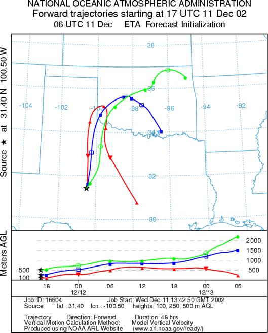
Trajectory weather: The air mass trajectories from the sites in
OUTLOOK: ***Low threat today *** mixed conditions for pollen release today. Over the plateau temperatures will warm into the upper 50s but humidity will remain moderately high. Skies will clear today but cloudy conditions will reappear as the possibility of showers increases on Thursday. For these reasons the conditions for pollen release are judged to be mixed. As the week progresses these conditions should deteriorate tomorrow with more weather on its way. The air masses trajectory characteristics only show rising air conditions today with low wind speeds, characteristics that are good for entrainment and limited travel. However, there is no indication that the trees have begun to pollinate; therefore, the downwind threat is considered to be low over the forecast period - especially with the chance of rain increasing tomorrow.
Trajectory Start(s) (shown by *on map):
Austin, TX
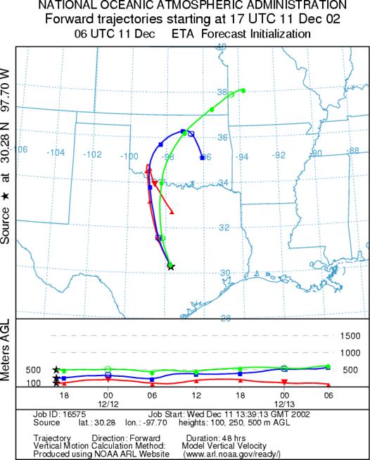
Junction, TX
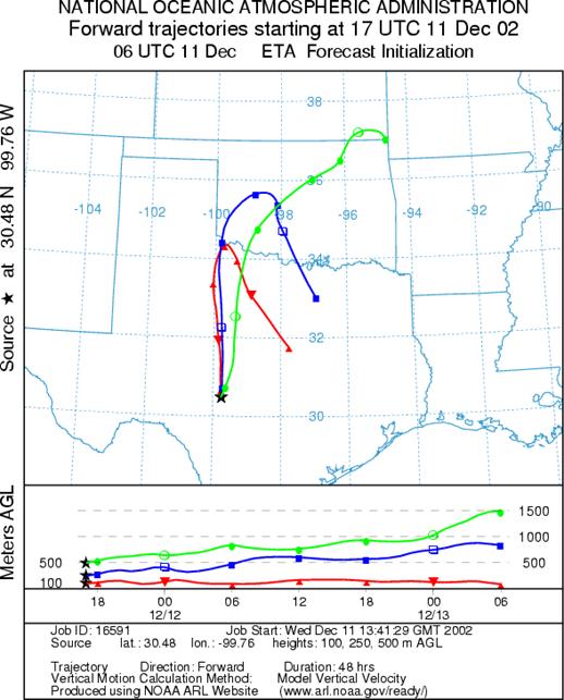
San Angelo, TX
Prepared by: Peter K.Van de Water(Department of Geosciences, Oregon State University),and Estelle Levetin (Faculty of Biological Science, The University of Tulsa, 600 S. College, Tulsa, OK 74104) This forecast gives the anticipated future track of released Mountain Cedar pollen, weather conditions over the region and along the forecast pathway, and an estimated time of arrival for various metropolitan areas.
Questions: Aerobiology Lab e-mail: pollen@utulsa.edu
Return to Forecasting Home Page