Metropolitan Area |
Exposure Risk |
|
Dallas/Fort Worth |
Moderate |
|
Austin |
Moderate to High |
|
San Antonio |
Moderate to High |
Date Issued: 29 December 2007
Mountain Cedar Location(s): Edwards Plateau, Texas
Regional Weather: Saturday and Sunday, December 29 and
30 TX/OK: The weather today will be the beginning of a warming trend for the weekend. Temperatures in Oklahoma
will be in the mid 40s to lower 50s, with partly cloudy skies and morning patches of fog. Winds will be from the
south around 10 mph decreasing into the evening to light and variable conditions. Warmer temperatures will rule
throughout Texas with the highs in the lower to mid 60's over and around the Edwards Plateau. Skies will be partly
cloudy along the northwestern area and sunny across the eastern and southeastern regions. Winds will be light,
5 to 10 mph, from the east to southeast along the eastern edge of the Edward Plateau and from the south to southwest
over western regions. Overnight winds will decrease overnight becoming light and variable in most areas. Skies
will be clearing overnight with low morning temperatures.
On Sunday, sunny conditions will return to the region with high temperatures in Oklahoma reaching into the 50s
with upper 50s along the southern border with Texas Winds will increase from ~10 mph to 10/15 mph from the south
to southwest. In Texas, high temperatures will rise by 5-10 degrees into the upper 60s to low 70s across the region.
Winds will increase during the day. Sunday morning winds will be ~10 mph from the south to southwest increasing
into the evening hours to 10 to 15 mph. During the day, winds will begin to turn from the southwest to the northwest,
especially at the surface level. Overnight low temperatures will be in the mid to low 30s to on the Edwards Plateau,
to mid to low 40s along the eastern Edwards Plateau communities.
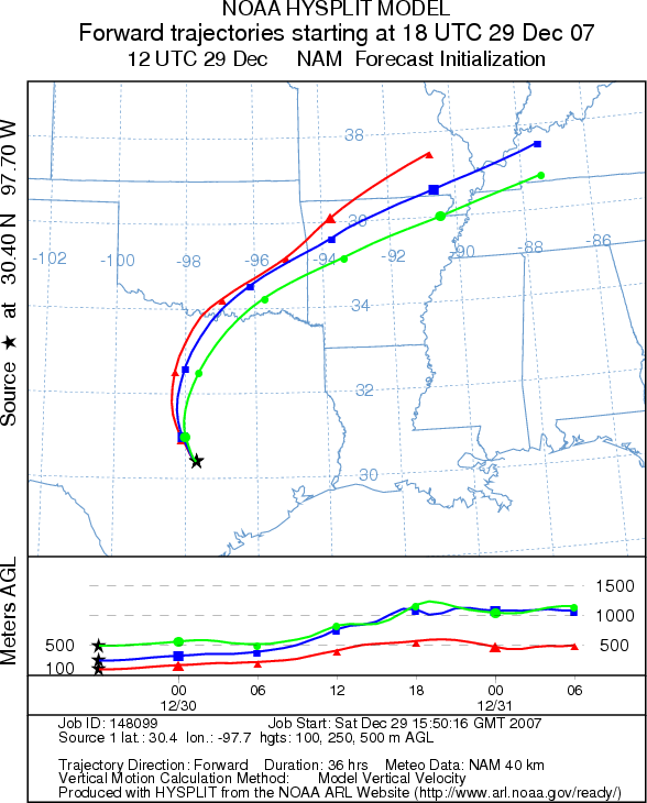
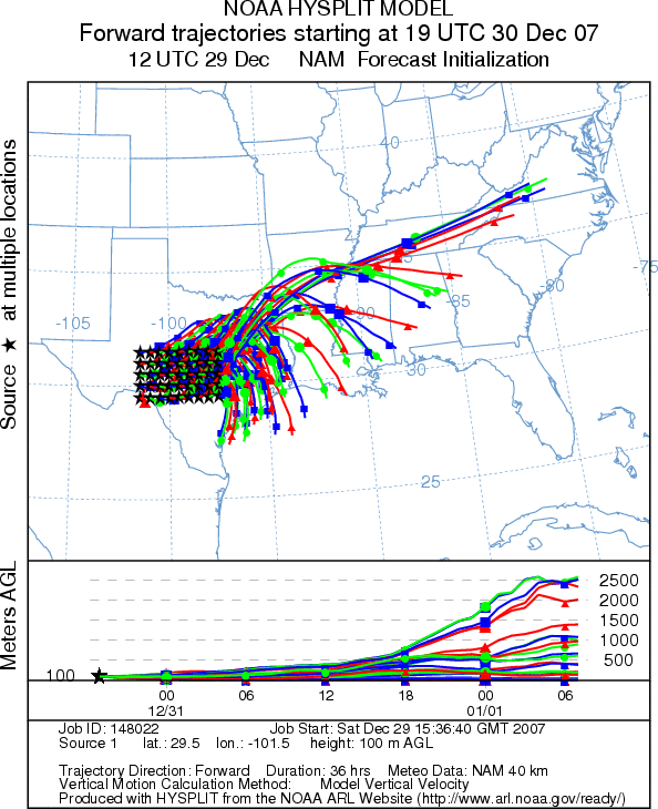
Trajectory weather: The air mass trajectories from the Edwards Plateau Texas move to the north-northeast from the
primary area with Juniperus asheii trees over the southeastern corner of Oklahoma into Arkansas and onto the southeastern
corner of Missouri. The trajectories are associated with warm buoyant air traveling rising along the trajectory,
conditions good for pollen entrainment and long-distance travel. The winds from the Arbuckle Mountains move more
to the north-northeast crossing between Oklahoma City and Tulsa. The trajectories also show rising atmospheric
conditions, and are thus good for pollen entrainment and travel.
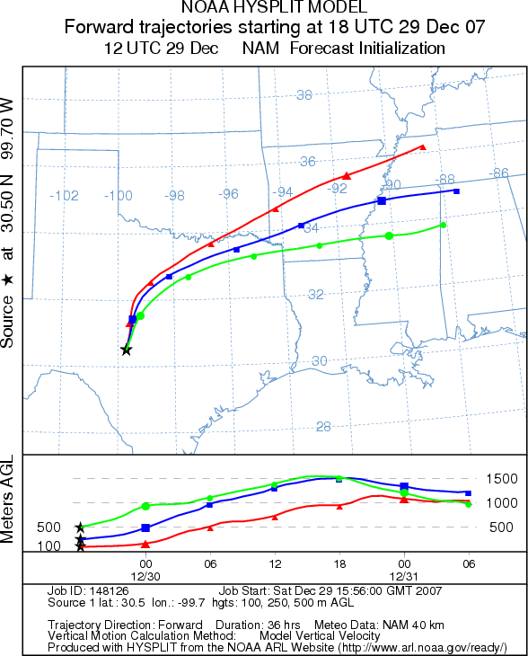
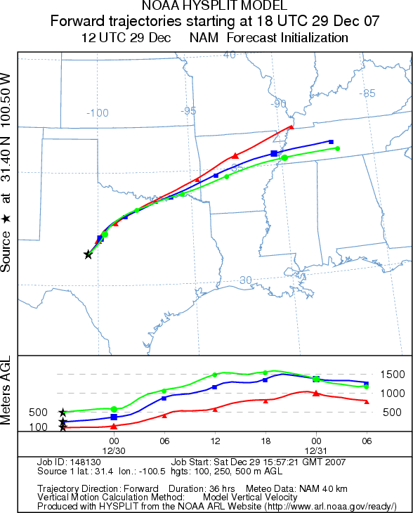
On Sunday winds will continue to be from the southwest until later in the day when they switch to the northwest.
Trajectories move more towards the northeast traveling across the southeastern corner of Oklahoma into Arkansas.
Atmospheric conditions are less buoyant and more stable than on Saturday, but warm temperatures will result in
the highest potential pollen release conditions of the season, to date. Surface winds will be affected by the
shift in winds to a greater extent than at upper elevations, where the trajectories continue on towards the Ohio
River valley.
OUTLOOK: *** Moderate threat today and tomorrow *** Warm temperatures and lower
humidity will be optimal for pollen release on the Edwards Plateau and in Oklahoma today and especially tomorrow.
Cold morning lows on both days will limit pollen release to afternoon hours. However, significant amounts of pollen
may be shed during this warming trend. With atmospheric conditions showing light buoyant air, significant pollen
dispersion downwind will put allergy sufferers in southeastern Oklahoma, Arkansas and southeastern Missouri at
risk today and tomorrow. On Sunday evening surface winds will turn from the southwest to the northwest moving potentially
pollen laden winds southeasterly over eastern Texas and Louisiana. Light to moderate pollen levels may be dispersed
over this area
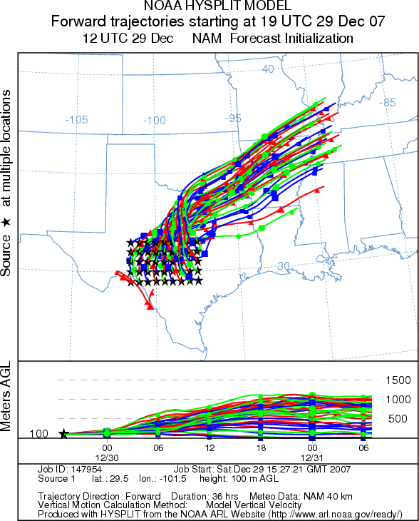
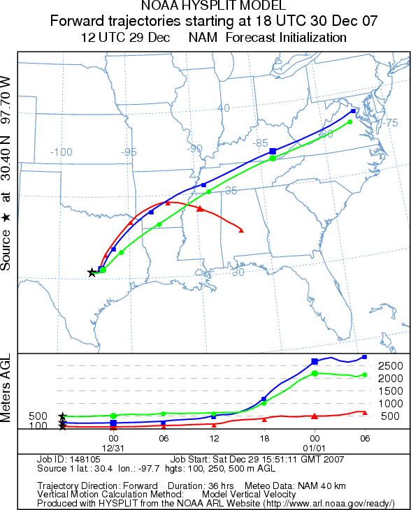
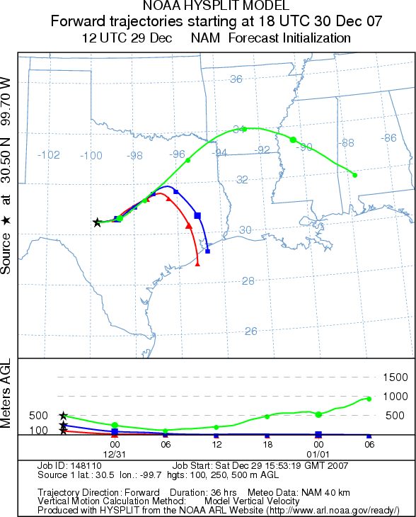
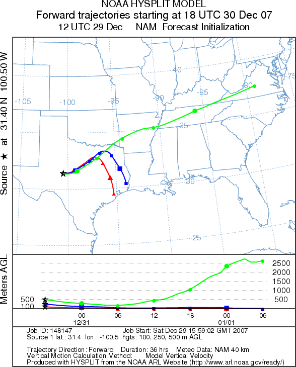
Trajectory Start (s) (shown by *
on map): Austin, TX; Junction, TX; San Angelo, TX.
AUSTIN (SATURDAY)
JUNCTION (SATURDAY)
SAN ANGELO (SATURDAY)
EDWARDS PLATEAU COMPOSITE (SATURDAY)
AUSTIN (SUNDAY)
JUNCTION (SUNDAY)
SAN ANGELO (SUNDAY)
EDWARDS PLATEAU COMPOSITE (SUNDAY)
Prepared by: Estelle
Levetin (Faculty of Biological
Science, The University
of Tulsa, 600 S. College, Tulsa, OK 74104) and ) and Peter K Van de Water (Department of Earth and
Environmental Science, California State University Fresno, 2576 East San Ramon Avenue, M/S ST24, Fresno CA 93740-8039).
This forecast gives the anticipated future track of released Mountain Cedar pollen, weather conditions over the
region and along the forecast pathway, and an estimated time of arrival for various metropolitan areas.
Questions: Aerobiology Lab e-mail: pollen@utulsa.edu
Return to Forecasting Home Page