
The University of Tulsa
Mountain Cedar Pollen Forecast
Metropolitan Area |
Exposure Risk |
|
Dallas/Fort Worth |
Low |
|
Austin |
Low |
|
San Antonio |
Low |
Date Issued:14 December 2009
Mountain Cedar location(s): Edwards Plateau, Texas
Regional weather: Monday, December 14 TX/OK: Across the region the weather will transition from
warm to cold as a cold front moves through the area. Winds will switch from a southerly direction early to coming
from the north. Temperatures today will reach into the 50s in Oklahoma, into the 60s in northern Texas and along
the edge of the Edward Plateau and into the low 70s across the Plateau itself. High humidity with fog in northern
Texas and southern Oklahoma will occur this morning. Rain is expected along the eastern and southern Edwards Plateau.
Tonight temperatures will be in the upper teens to low 20s in Oklahoma and range from the 30s in north Texas to
the low 40s toward the south. The chance of rain in the edge communities will build to ~50%. Winds will build
across the region from the north to moderate levels of 5 to 15 miles per hour. Tuesday will be much cooler with
highs in the upper 30s to mid 40s in Oklahoma and just reaching into the upper 40s and low to mid 50s across the
Edwards Plateau region. The chance of rain will persist in the edge communities of Austin and San Antonio. Winds
will remain from the north at moderate levels of 10 to 15 miles per hour.
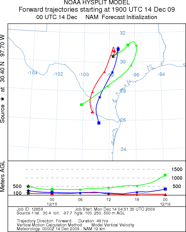
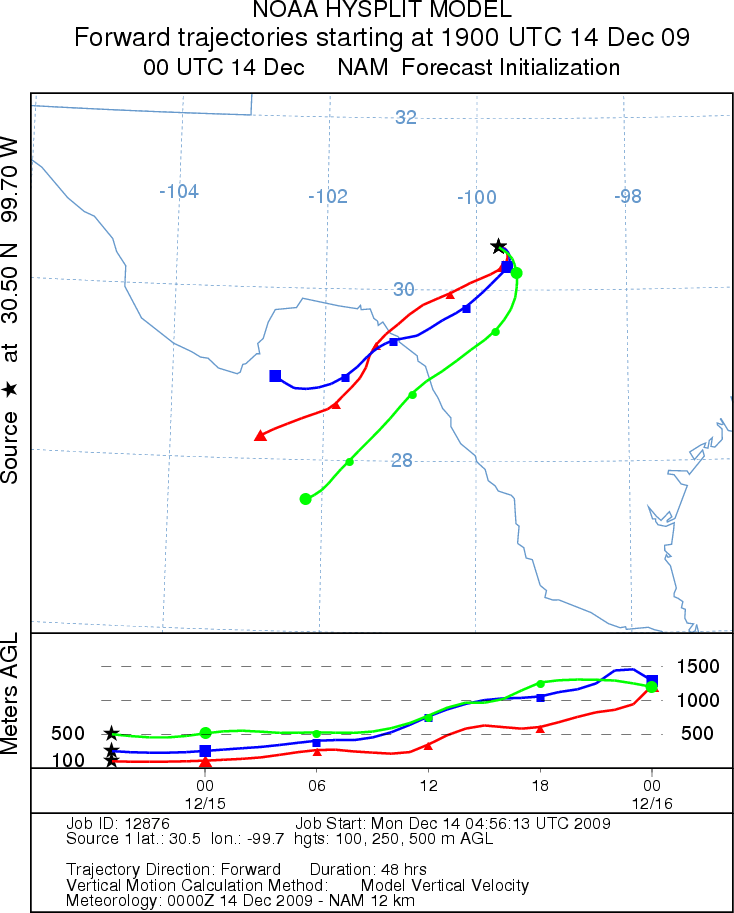
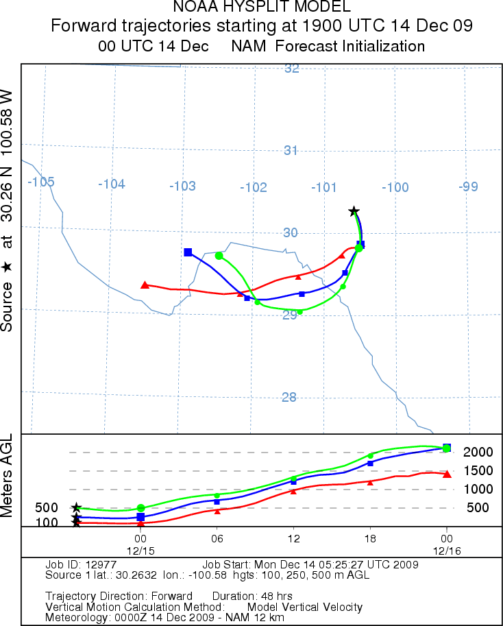
Trajectory weather: Air mass trajectories from the Edwards Plateau show shifting patterns as the cold front
moves across the region with the resulting direction toward southwest Texas and on into Mexico. Partly cloudy skies
will occur in the eastern and southeastern part of the Plateau and clear conditions in the west. Temperatures
in the upper 60s off the Plateau and into the low to mid 70s on the Plateau. Moist conditions will prevail this
morning along the southeast with fog expected and a chance of rain. Winds will start from the southwest but quickly
switch from the north as colder air moves into the area. Partly to mostly cloudy skies are expected tonight as
temperatures cool into the upper 30s and low 40s. The air appears somewhat buoyant and may entrain pollen today,
however release conditions will be mixed as high humidity will occur in some areas.
OUTLOOK: *** Low to Moderate Threat today *** mixed conditions
for pollen release and transport today. Warm conditions but with high humidity will occur today as moderate
winds and cloudy to mostly cloudy skies occur across the region today, tonight and tomorrow. A chance of precipitation
is possible in the northern Texas and the southeastern Edwards Plateau region. High humidity but with cooling
temperatures tomorrow will result in a low threat and poor conditions for release. Reports indicate that the trees
are ready to pollinate but conditions will be marginal at best. With that being said some local dispersal may
occur leading to spotty high concentrations.
Trajectory Start (s) (shown by *
on map): Austin, TX; Junction, TX; Sonora, TX.
AUSTIN
JUNCTION
SONORA
EDWARDS PLATEAU COMPOSITE
Prepared by: Estelle
Levetin (Faculty of Biological
Science, The
University of Tulsa, 800 S. Tucker Dr., Tulsa, OK 74104) and ) and Peter
K Van de Water (Department of Earth and Environmental Science, California State University Fresno,
2576 East San Ramon Avenue, M/S ST24, Fresno CA 93740-8039). This forecast gives the anticipated future track of
released Mountain Cedar pollen, weather conditions over the region and along the forecast pathway, and an estimated
time of arrival for various metropolitan areas.
Questions: Aerobiology Lab e-mail: pollen@utulsa.edu
Return to Forecasting Home Page