The University of Tulsa
Mountain Cedar Pollen Forecast

The University of Tulsa
Mountain Cedar Pollen Forecast
Thursday / Friday
Metropolitan Area |
Exposure Risk |
|
Oklahoma City |
Low |
|
Tulsa |
Low |
|
St. Louis MO |
Low |
Date Issued: 24 December 2009
Mountain Cedar Location(s): Arbuckle Mountains, OK
Regional Weather: Thursday, December 24 TX/OK:
Across the region the weather will start to improve from yesterday and last nights rain and snow. Cold conditions
will continue across the region today, however skies will be clearing and temperatures beginning to climb back
to seasonal normals towards the south. The cold front that moved through yesterday and last night brought chili
temperatures as Oklahoma will not get out of the 30s today. Skies will remain partly cloudy with a chance of snow
showers. Winds will be from the northwest and very strong at 20 to 30 miles per hour and gust reaching into the
40 miles per hour range. Similar conditions will exist across northern Texas with snow and freezing rain towards
the west in the panhandle region. Temperatures will be 5 degrees warmer, topping out in the low 40s. On the Edwards
Plateau skies will be mostly cloudy with temperatures in the 40s today. The edge communities will see sunny skies
and temperatures in the 50s in most localities. Across the region winds will be very strong, 20 to 30 miles per
hour, from the northwest. Overnight, cloudy skies will be maintained to the north in Oklahoma to the Dallas/Fort
Worth area. Southward skies will clear. Across the region expect low temperatures to dip well into the 20s, except
for the southern most locations which will be in the low 30s. On Christmas Day, skies will remain partly cloudy
north but mostly sunny across the rest of the area. The northern areas will remain in the 30s with winds from
the west moderating in strength. To the south temperatures will be in the 40s across the Edwards Plateau and 10
degrees warmer heading toward the mid 50s along the eastern and southern edge of the Plateau. Christmas night
will see chili conditions settle in once again with moderate winds mostly from the north.
Trajectory weather: partly cloudy skies will occur across Oklahoma today and tomorrow. Temperatures will
be in the mid to lower 30s across Oklahoma today and tomorrow. Precipitation of rain and snow is forecast for
the region today and tonight with very strong winds out of the northwest. Tonight temperatures will drop into
the teens and lower 20s with an ongoing chance of precipitation. Friday, the precipitation should quit but cold
air and strong winds will remain. High temperatures on Friday will only reach into the mid to upper 30s. Friday
night temperatures will dip once again into the teens and lower 20s. The atmosphere will be heavy and moist both
today and tonight, although the winds will be caught up in the Low Pressure system moving across the area and show
some buoyancy. Tomorrow, the trajectories move southeast then quickly move to a northeast direction. Heavy atmospheric
conditions will move the trajectories along the ground.
OUTLOOK: *** Low Threat today; Low threat tomorrow *** Poor conditions for pollen
release today and Poor conditions tomorrow; Poor conditions for entrainment and transport today,Poor conditions
tomorrow. A low threat exists today with cloudy skies, precipitation and strong wind speeds. Temperatures
will be cold today barely getting into the mid to upper 30s. Overnight temperatures will drop into the teens and
lower 20s across the region. Winds will remain strong from the northwest. Poor conditions exist for any pollen
dispersal today, tomorrow the chance of precipitation declines but temperatures remain cold, in the thirties, with
strong winds. Poor conditions exist for any release, entrainment and transport from the Oklahoma Juniperus ashei
population today and tonight. There will be no new forecast tomorrow, Christmas day, but a new forecast will be
posted Saturday for Saturday and Sunday.
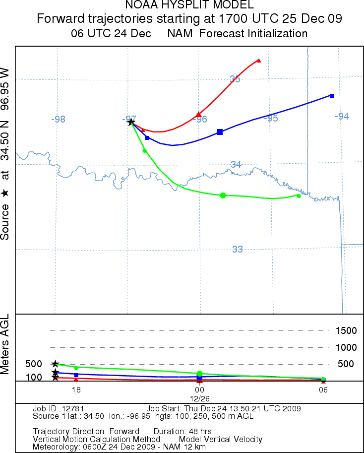
Trajectory Start (s) (shown by black
star on map): Davis, OK.
THURSDAY
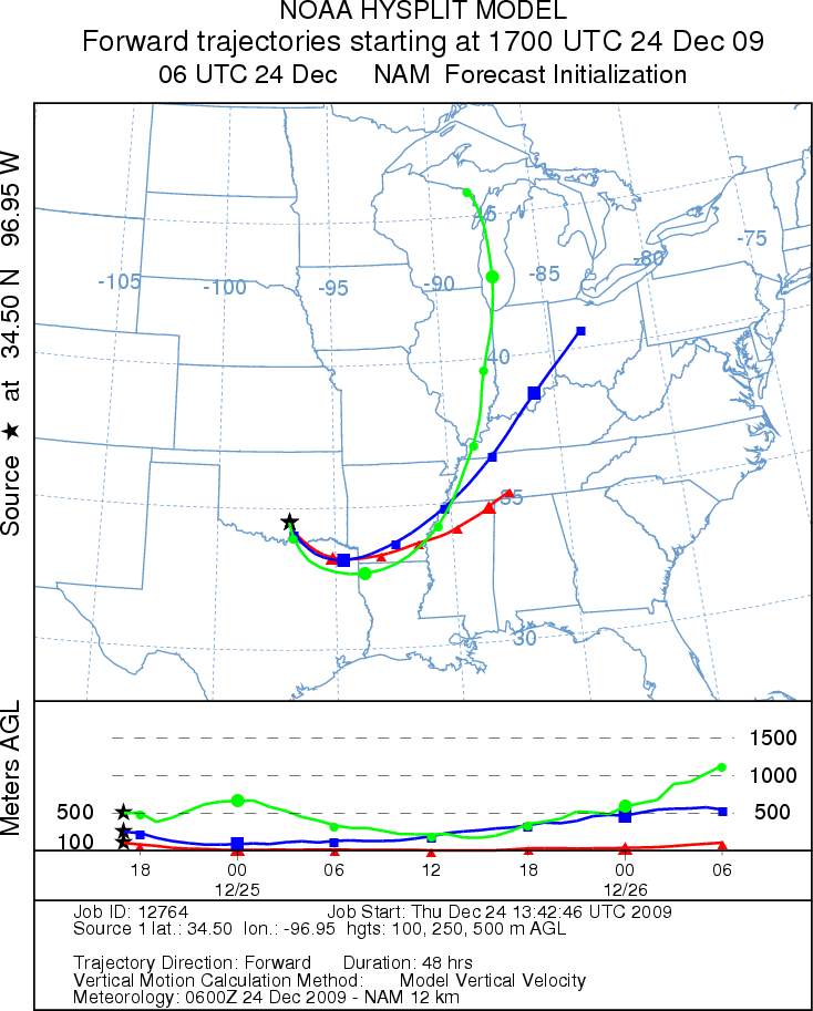
FRIDAY
Prepared by: Estelle
Levetin
(Faculty
of Biological Science, The University of Tulsa, 800 S. Tucker Dr., Tulsa, OK 74104) and Peter
K Van de Water
(Department of Earth and Environmental Science, California State University Fresno, 2576 East San Ramon Avenue,
M/S ST24, Fresno CA 93740-8039). This forecast gives the anticipated future track of released Mountain Cedar pollen,
weather conditions over the region and along the forecast pathway, and an estimated time of arrival for various
metropolitan areas.
Questions: Aerobiology Lab e-mail: pollen@utulsa.edu
Return to Forecasting Home Page