
The University of Tulsa
Mountain Cedar Pollen Forecast
Metropolitan Area |
Exposure Risk |
|
Dallas/Fort Worth |
Low |
|
Austin |
Low |
|
San Antonio |
Low |
Date Issued: 26 December 2012
Mountain Cedar Location(s): Edwards Plateau, Texas
Regional Weather: Wednesday, December 26 TX/OK:
Across the region the weather begins to climb back from the storm that passed through mid-portion of the country
over the holiday. Conditions will be cold today but begin to warm tomorrow, especially in the southern forecast
area. Starting to the north, in Oklahoma today mostly sunny skies will occur with moderate winds from the northwest.
Through the day the winds will relax especially along the border with Texas. Temperatures will work to get into
the upper 30s. Tonight partly cloudy conditions will return and temperatures will fall into the upper teens.
Across Texas today mostly sunny conditions will occur along the eastern edge of the Edwards Plateau northward
into the Dallas/Fort Worth metro area. Temperatures will work to get into the mid to upper 40s with a dominantly
northerly flow at moderate levels. Austin may be especially gusty with the potential of 25 mph gusts this morning
and afternoon. To the west across the Edwards Plateau partly cloudy skies will build into cloudy skies during
the day. Winds will be from the north in the western most communities, changing to an eastern source at light
levels later in the day. The other communities on the Edwards Plateau will experience the easterly winds earlier.
Temperatures will be in the mid to low 40s for their high temperatures today. Overnight mostly cloudy skies will
predominate with temperatures in the mid to low 20s. Winds will be out of the south at light to moderate levels.
Tomorrow, the northern areas will continue to be cold with southerly winds at moderate levels. High temperatures
will barely get into the upper 30s to 40 degrees. Tomorrow night mostly to partly cloudy skies will occur with
temperatures in the 20s and light winds. In Texas Tomorrow will be sunny to mostly sunny across the region.
Temperatures will begin to warm on winds from the south at light to moderate levels. High temperatures for most
of the region will be in the 50s. It should be in the upper 50s to 60 in the southernmost communities along
the edge of the Edwards Plateau. Tomorrow night partly cloudy to cloudy conditions will build back in. Lows will
drop into the 40s in the edge communities with a 20% chance of showers in the Austin area. On the Plateau low
temperatures will be in the mid to low 30s. Winds will remain from the southwest at light to moderate levels.
Trajectory weather: Air mass trajectories over the Edwards Plateau move southward today then turn this
evening and move northwards tonight and tomorrow. On the ground, light to moderate winds will dominate. Temperatures
today and tomorrow will begin to recover from the storm that moved through the area on Christmas day. The winds
do not appear to be more buoyant than recent days. Skies will be mostly sunny in the areas surrounding the Edwards
Plateau and partly to mostly cloudy on the Plateau, itself. Tonight low temperatures will fall well into the
upper teens and twenties. Dense air will move northward on lite to moderate winds. Tomorrow the southerly flow
will be maintained at lite to moderate levels. Conditions will begin to warm and temperatures in the 50s will
occur across the Texas tree population.
OUTLOOK: *** Low threat today and Low threat tomorrow *** Poor conditions for
pollen release today and tomorrow as the area warms from the incursion of very cold air from the north. Poor conditions
for entrainment and transport will occur today and tomorrow with heavy cold air and only lite to moderate winds.
Very little pollen is expected to be released today. Tomorrow, local pollen will have a greater chance of release
but the recent cold snap and precipitation usually delays pollination for a day or so until warm conditions dries
the area out. Temperatures in the 40s0s today and moving into the 50s tomorrow but with lite to moderate wind
speeds should reduce the amount of pollen released. Lite to moderate wind speeds and cold dense air should keep
anything entrained within the air, close to the ground where it is easily removed by impaction on other plants
and obstacles. Overnight winds will remain from the southerly bringing warming tomorrow. Local pollination
may begin again tomorrow and then the season will begin to progress. We are beginning to get into the heart of
the historic pollination season. We continue to have patients contact the modeling team to report strong allergy
symptoms. In those areas with significant numbers of trees patients susceptible to J. ashei pollen should expect
increasing exposure and allergy outcomes as the temperatures warm.
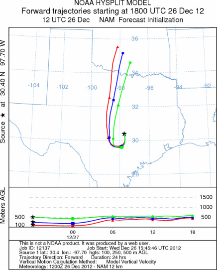
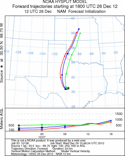
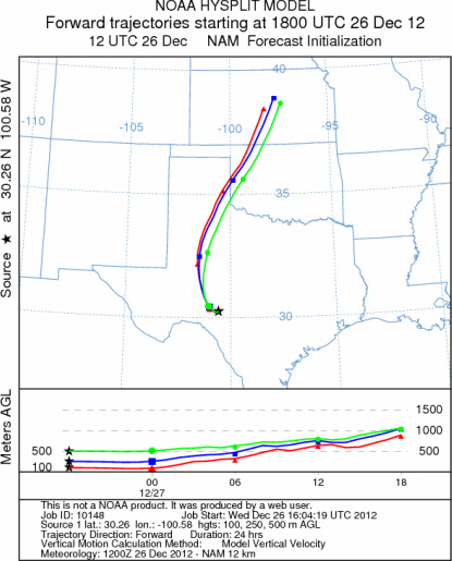
Trajectory Start (s) (shown by *
on map): Austin, TX; Junction, TX; Sonora, TX.
AUSTIN
JUNCTION
SONORA
EDWARDS PLATEAU COMPOSITE
Prepared by: Estelle
Levetin (Faculty of Biological
Science, The
University of Tulsa, 800 S. Tucker Dr., Tulsa, OK 74104) and ) and Peter
K Van de Water (Department of Earth and Environmental Science, California State University Fresno,
2576 East San Ramon Avenue, M/S ST24, Fresno CA 93740-8039). This forecast gives the anticipated future track of
released Mountain Cedar pollen, weather conditions over the region and along the forecast pathway, and an estimated
time of arrival for various metropolitan areas.
Questions: Aerobiology Lab e-mail: pollen@utulsa.edu
Return to Forecasting Home Page