
The University of Tulsa
Mountain Cedar Pollen Forecast
Metropolitan Area |
Exposure Risk |
|
Dallas/Fort Worth |
Low |
|
Austin |
Moderate |
|
San Antonio |
Moderate |
Date Issued: 27 December 2012
Mountain Cedar Location(s): Edwards Plateau, Texas
Regional Weather: Thursday, December 27 TX/OK:
Across the region the weather begins to climb back from cold conditions. Today and tonight winds will be from
the south at moderate levels with sunny and partly sunny skies. In Oklahoma today partly cloudy skies will occur
with high temperatures in the low to mid 40s. Winds will be from the south to southeast at moderate levels.
Towards the evening mostly cloudy to partly cloudy skies will build and low temperatures will fall into the 20s.
Winds will become light and variable. Across Texas today, mostly sunny skies will occur to the east and partly
cloudy skies will occur over the Edwards Plateau. High temperatures will run from the upper 40s in the Dallas/Fort
Worth area into the 50s to low 60s across the central Edwards Plateau. Winds will remain at lite to moderate
from the south. Overnight the edge communities will build fog with the potential of drizzle. The region will
stay above the freezing point with temperatures in the 30s to the north and across the Edwards Plateau, and in
the 40s in the surrounding edge communities. Early morning winds will begin to switch back, coming from the northwest
for Friday. On Friday, the northern areas will have an increasing chance of showers from southern Oklahoma across
the Dallas/Fort Worth metro areas and along the eastern edge of the Edwards Plateau. There is a 20% chance of
showers along with fog and drizzle in these areas. Conditions will be warm and humid. High temperatures to the
north will remain in the 40s today but along the Edwards Plateau temperatures will warm into the 60s. The western
side of the Edwards Plateau will rise into the upper 50s. Winds will be lite to moderate from the northwest throughout
the day and overnight. Skies will be mostly clear allowing for a cool down Friday night. Low temperatures will
fall into the 30s in the surrounding communities and into the 20s across the Plateau. Winds will remain from
the northwest at lite to moderate levels.
Trajectory weather: Air mass trajectories over the Edwards Plateau move northward and off to the northeast
crossing southeastern Oklahoma today. Overnight winds will eventually turn, coming from the northwest at lite
to moderate levels for tomorrow. On the ground, light to moderate winds will occur across the region. The edge
communities may experience slightly higher flow than over the Plateau. Temperatures today and tomorrow will continue
to increase with highs across the Texas in the mid to lower 60s and upper 50s. The winds continue to appear
as buoyant as in recent days. Tonight low temperatures will stay above freezing with readings in the 30s and
40s. Tomorrow night most areas will flirt with the freezing levels in the surrounding communities and into the
20s across the Edwards Plateau and northward towards Oklahoma.
OUTLOOK: *** Moderate Threat today and Moderate threat Tomorrow *** Moderate conditions
for pollen release today and tomorrow as the area warms into the upper 50s and lower 60s. Moderate conditions
for entrainment and transport will occur today and tomorrow with cool air and only lite to moderate winds. Pollen
is expected to be released today, because we are entering into the main portion of the pollination period. However,
yesterdays recorded levels appear to be minor. Conditions will be improving but will continue to be cold at night
and there will be increasing humidity across the region tomorrow. Temperatures in the 50s to low 60s today
and tomorrow but with lite to moderate wind speeds and high humidity should reduce the amount of pollen released.
Lite to moderate wind speeds and cool denser air should keep entrained pollen close to the ground where it is
easily removed by impaction on other plants and obstacles. Overnight winds will remain from relatively light
but switch from a southerly direction moving in from the northwest tomorrow. We are approaching the heart of the
historic pollination season. We continue to have patients contact the modeling team to report strong allergy symptoms.
In those areas with significant numbers of trees patients susceptible to J. ashei pollen should expect increasing
exposure and allergy outcomes. Areas outside of the tree population will have less chance of exposure.
Trajectory Start (s) (shown by *
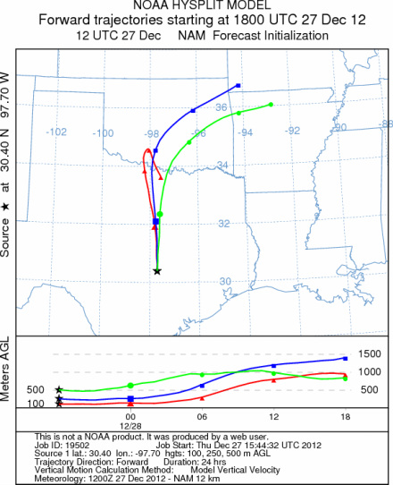
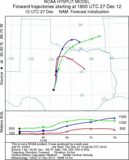
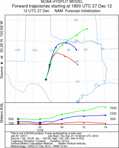
on map): Austin, TX; Junction, TX; Sonora, TX.
AUSTIN
JUNCTION
SONORA
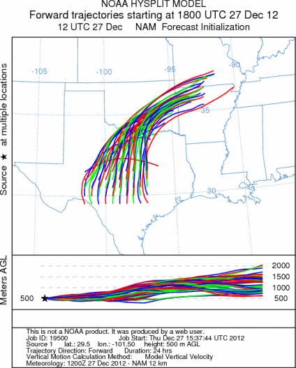
EDWARDS PLATEAU COMPOSITE
Prepared by: Estelle
Levetin (Faculty of Biological
Science, The
University of Tulsa, 800 S. Tucker Dr., Tulsa, OK 74104) and ) and Peter
K Van de Water (Department of Earth and Environmental Science, California State University Fresno,
2576 East San Ramon Avenue, M/S ST24, Fresno CA 93740-8039). This forecast gives the anticipated future track of
released Mountain Cedar pollen, weather conditions over the region and along the forecast pathway, and an estimated
time of arrival for various metropolitan areas.
Questions: Aerobiology Lab e-mail: pollen@utulsa.edu
Return to Forecasting Home Page