
The University of Tulsa
Mountain Cedar Pollen Forecast
Metropolitan Area |
Exposure Risk |
|
Dallas/Fort Worth |
Low |
|
Austin |
Moderate |
|
San Antonio |
Moderate |
Date Issued: 30 December 2013
Mountain Cedar Location(s): Edwards Plateau, Texas
Regional Weather: Monday, December 30 TX/OK:
Across the region today and tomorrow the weather will be mild with mostly sunny to sunny skies from the north,
in Oklahoma, to the southern populations across the Edwards Plateau and in the surrounding communities. Clouds
this morning will begin to break up in most areas by noon but with cool conditions. Highs across the region will
remain in the upper 40s across the Edwards Plateau region and in the upper 30s to lower 40s further north. Winds
will be from the north at 5 to 10 miles per hour declining towards the evening with 5 mph winds remaining. Tonight
low temperatures will be in the lower 30s in the communities surrounding the Edwards Plateau and in the 20s across
the rest of the region, including north across Oklahoma. The cold air will remain entrenched across the region
tomorrow, with sunny skies and slightly warmer conditions than today. Most areas will get into the mid 50s to
the east and north, whereas the western Edwards Plateau will bump up to the upper 50s. Winds will remain mostly
light, however a southerly wind will increase from the west late in the afternoon and evening. Overnight mostly
clear to clear skies will remain with lows in the mid to lower 30s. To the north across Oklahoma temperatures
will fall below freezing again.
Trajectory weather: Air mass trajectories over the Edwards Plateau move slowly southward on the dominant
northerly air flow. The winds will be light thus the trajectories move slowly across Texas today. Over night
and into tomorrow the trajectories will slowly turn and move more northward as southerly air movement starts on
the western side of the Edwards Plateau. Over the next two days, the trajectories will remain within the region
of their initiation. High temperatures today will barely get into the upper 40s but warming will occur tomorrow
with highs expected in the mid to upper 50s. Tonight temperatures will drop and be at or below freezing across
the area. Tomorrow night, after the warmer conditions, lows will be in the mid to upper 30s. Winds tomorrow night
will begin to increase from the south to southwest but at light levels. With today temperatures in the 40s and
light winds, pollen release will be low and if in the air localized to the immediate area of the population. Tomorrow,
warmer conditions could lead to greater amounts of pollen being released. However, light winds will remain and
thus entrainment and travel is expected to be limited. There are now indications that the southernmost populations
are getting pollen into the atmosphere.
OUTLOOK: *** Moderate Threat today and Moderate Threat Tomorrow *** Better conditions
for pollen release tomorrow than today in most of the populations. Today light winds and dense air will restrict
pollen release, with poor conditions for entrainment and travel. Pollen may be in the atmosphere, however large
amounts are not expected and long distance transport will be minimal. Temperatures will be warming only into the
40s in most areas. Tomorrow, warming will begin with highs expected in the mid- to upper 50s. Winds will begin
to switch coming out of the south to southwest, however light wind conditions will limit entrainment and travel.
The past couple of days, pollen has been recorded at increasing levels in San Antonio Austin, and Waco. Heavier
concentrations are expected sooner not later. This suggests that the trees are beginning to release pollen. But
with mixed conditions, communities in Texas to central Oklahoma may see some pollen in the atmosphere, but not
heavy accumulations and not a lot of entrainment and travel downwind.
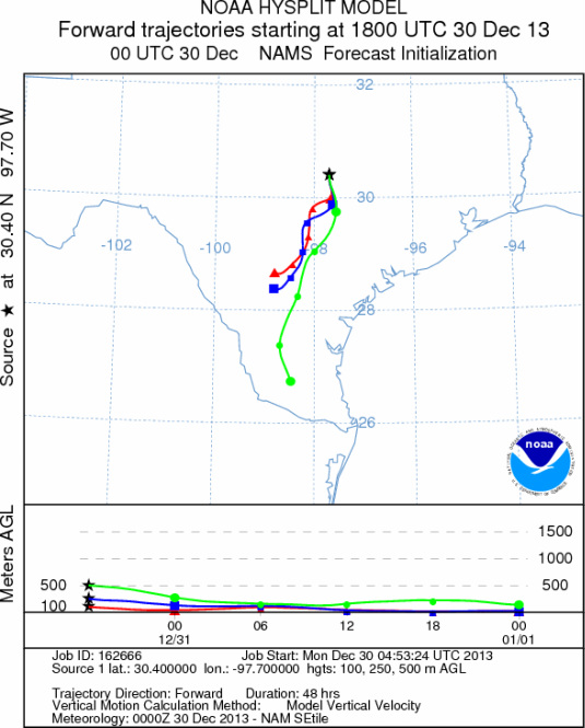
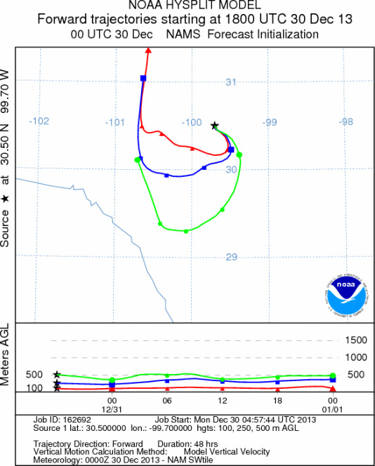
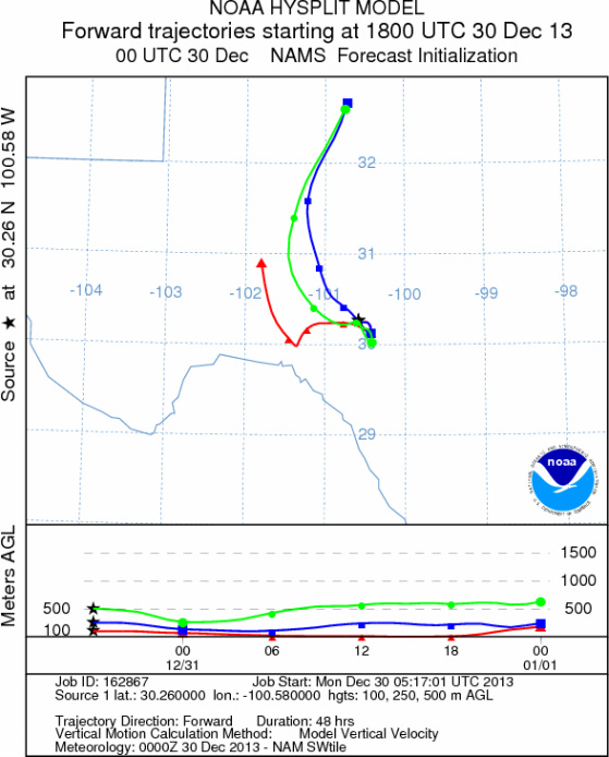
Trajectory Start (s) (shown by *
on map): Austin, TX; Junction, TX; Sonora, TX.
AUSTIN
JUNCTION
SONORA
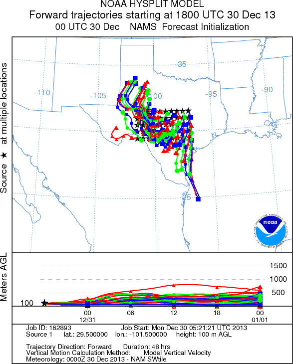
EDWARDS PLATEAU COMPOSITE
Prepared by: Estelle
Levetin (Faculty of Biological
Science, The
University of Tulsa, 800 S. Tucker Dr., Tulsa, OK 74104) and ) and Peter
K Van de Water (Department of Earth and Environmental Science, California State University Fresno,
2576 East San Ramon Avenue, M/S ST24, Fresno CA 93740-8039). This forecast gives the anticipated future track of
released Mountain Cedar pollen, weather conditions over the region and along the forecast pathway, and an estimated
time of arrival for various metropolitan areas.
Questions: Aerobiology Lab e-mail: pollen@utulsa.edu
Return to Forecasting Home Page