Date Issued: 14 December 1999
Mountain Cedar location(s): Edwards Plateau, Texas
Regional weather: Tuesday, December 14 - TX/OK: Low pressure/frontal system moving through the region today, proceeding to the northeast with the cold front swinging by to the south. Other than a slight chance of precipitation in parts of the TX panhandle, northern OK and northwestern AR, dry the next two days with sunny to partly cloudy skies. Highs ranging from the 40's north and west to 70's south and east. Lows tonight in the 10's Panhandles to 30's much of TX. Cooler Wednesday, highs in the 40's OK, mostly 50's TX.
Trajectory weather: Mostly sunny today, high in the upper 60's. Clear to partly cloudy tonight, lows in the 40's both southeast TX and LA. Sunny Wednesday, high in the upper 60's.
Trajectory confidence: High.
OUTLOOK: *** Low Threat *** Little release expected. Though temperatures, winds, and humidities will be in the favorable ranges for release today, observer reports indicate few cones are ready to release any pollen. Ill effects on the populace should be minimal. TK
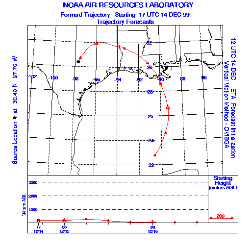
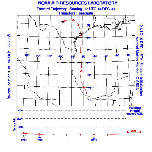
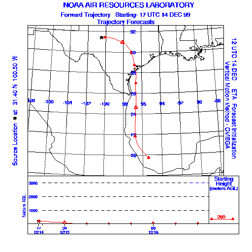
Trajectory Start(s) (shown by * on map): Austin, TX; Junction, TX; San Angelo, TX
Austin, TX
Junction, TX
San Angelo, TX
Prepared by: Thomas Keever (Department of Marine, Earth and Atmospheric Sciences, NCSU), Estelle Levetin (Faculty of Biological Science, The University of Tulsa, 600 S. College, Tulsa, OK 74104), and C.E. Main (Department of Plant Pathology, North Carolina State University, Raleigh, NC 27695-7618). This forecast gives the anticipated future track of released Mountain Cedar pollen, weather conditions over the region and along the forecast pathway, and an estimated time of arrival for various metropolitan areas.
Questions: Aerobiology Lab e-mail: pollen@utulsa.edu
Return to Forecasting Home Page