
The University of Tulsa
Mountain Cedar Pollen Forecast
Metropolitan Area |
Exposure Risk |
|
Dallas/Fort Worth |
Low |
|
Austin |
Low |
|
San Antonio |
Low |
Date Issued: 10 February 2011
Mountain Cedar Location(s): Edwards Plateau, Texas
Regional Weather: Thursday, February 10 TX/OK:
Conditions across the region will begin to pull out of the most recent shot of cold weather that pushed into the
area yesterday. In Oklahoma, partly cloudy skies and cold conditions will be the hallmark for today with sunny
skies expected tomorrow. Today the high temperatures are expected to only be in the upper 20s to just approaching
30 with light and variable winds in some areas and winds from the northwest, up to 10 miles per hour, in other
areas. The calm winds will be a happy relief from yesterdays gusty conditions. Tonight some clearing will occur
with partly cloudy skies to the north and clear skies to the south. Temperatures will be in the low teens across
the region and winds will vary being up to 10 miles per hour or less. Tomorrow temperatures will start to warm
with high temperatures increasing but not expected to get out of the 40s. Winds will be light to moderate from
the southwest. Tomorrow night temperatures will be in the 20s with light and variable conditions. In Texas today,
Sunny skies will prevail across the region. Temperatures will climb out of yesterdays cold conditions with most
areas in the mid to upper 40s for high temperatures. Areas to the north and west will remain in the 30s. Winds
will be light to moderate from the north in most areas. Tonight clear skies will predominate with low temperatures
dropping into the upper teens to low twenties. Winds will be light from the north and from a more southerly direction
in southern Texas. Tomorrow sunny skies will return with temperatures in most areas in the 50s. Winds will remain
light from the south, a southwesterly breeze will occur to the west whereas a southeasterly breeze will blow along
the eastern side of the Edwards Plateau. Tomorrow night clear conditions will prevail with temperatures in the
20s in all regions except to the far west where teens will predominate. Winds will remain light with the wind
direction switching to a more southerly source.
Trajectory weather: Air mass trajectories from the Edwards Plateau move south on the remnant northerly winds
that are over the region, then swing towards the west and loop back up over northern Texas. In the next 24 to
48 hour very light winds will keep most of the air mass within the Texas region. Temperatures will be in the 40s
in most areas with only the furthers south communities toying with crossing the 50 degree mark. Overnight lows
will be in the upper teens to low twenties tonight with a warming of about five degrees. Tomorrow temperatures
during the day will climb into the 50s for the highs under very sunny conditions. The air remains dense today
and tonight until tomorrows heating begins to make the air less dense. Light and variable winds will move any
entrained pollen over short distances keeping most of the atmosphere relatively close to where it originated from.
Tomorrow winds will continue to be light to moderate, skies will be sunny and high temperatures slightly warmer.
Tomorrow night slightly warmer low temperatures and light winds will remain.
OUTLOOK: *** Low Threat today and Moderate Threat Tomorrow
*** poor conditions for pollen release today, slightly improving tomorrow with cold temperatures in the area.
Poor conditions for entrainment and travel today and tomorrow. Cold conditions, partly but sunny skies and light
winds today and tomorrow. Today lows will be in the mid 40s across the region. These temperatures are seen as
being marginal for pollen release. However the sunny skies, especially tomorrow may result in pollen being shed.
Today, cold temperatures will remain below the mid-forties for high temperatures. These conditions are poor for
pollen cones to open and shed their pollen. In addition poor conditions will occur for shed pollen to become entrained
into the atmosphere with cold dense air across the region. Tomorrow, calm conditions will continue, but with a
five to ten degree warming. Conditions will be much better for pollen release, but entrainment will remain problematic
and light winds will move the pollen regionally and not outside of the state. There is some indication that
the pollination season is beginning to wrap up. Some of the stations that report very heavy pollen levels are
showing a significant reduction in pollen in the atmosphere. During the last string of days with good conditions
across Texas little pollen was observed at some of these monitoring stations.
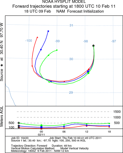
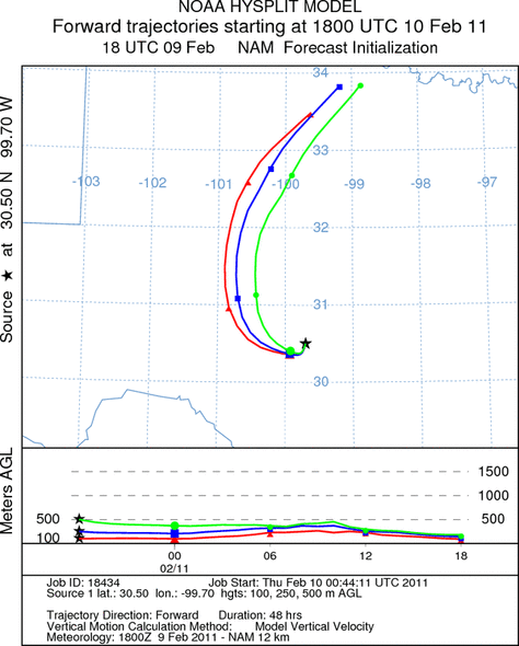
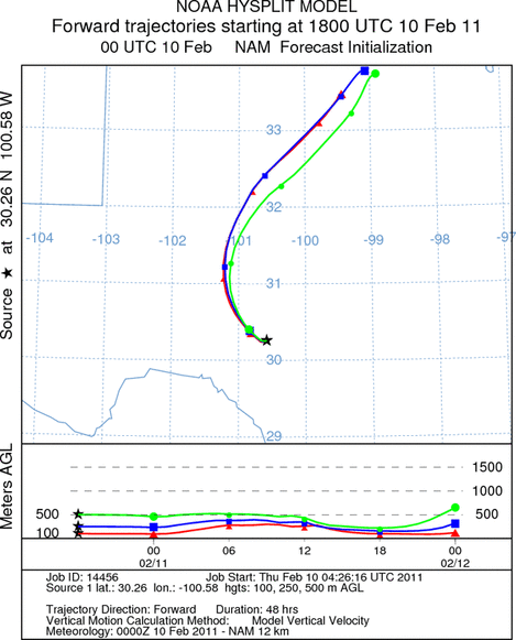
Trajectory Start (s) (shown by *
on map): Austin, TX; Junction, TX; Sonora, TX.
AUSTIN
JUNCTION
SONORA
EDWARDS PLATEAU COMPOSITE
Prepared by: Estelle
Levetin (Faculty of Biological
Science, The
University of Tulsa, 800 S. Tucker Dr., Tulsa, OK 74104) and ) and Peter
K Van de Water (Department of Earth and Environmental Science, California State University Fresno,
2576 East San Ramon Avenue, M/S ST24, Fresno CA 93740-8039). This forecast gives the anticipated future track of
released Mountain Cedar pollen, weather conditions over the region and along the forecast pathway, and an estimated
time of arrival for various metropolitan areas.
Questions: Aerobiology Lab e-mail: pollen@utulsa.edu
Return to Forecasting Home Page