Date Issued: 20 January 2000
Mountain Cedar location(s): Edwards Plateau, Texas
Regional weather: Thursday-Saturday, January 20-22 - TX/OK: Cold front pushes all the way through the region today. High pressure building in from the north is in control. The high will move off to the east on Friday..... while the next system forms in the western sections of this region. Moisture levels will be on the increase each day, especially for SAturday. Chance of rain northern half of the region on Saturday. Highs ranging from the 40's north to 70's south each day with some 80's in parts of TX on Saturday. Lows mostly from the 20's north to 50's south.
Trajectory weather: Mostly sunny today, high in the low 60's. Clear tonight, lows in the 20's. On Friday... partly cloudy OK, mostly cloudy KS. Highs ranging from 40 to 50.
Trajectory confidence: High
OUTLOOK: *** Serious Threat -- Conditions are favorable for pollen release. Temperatures and humidities are favorable and winds are brisk. Strong release expected. Residents of west-central TX may be affected today and tonight.... central OK and eastern KS on Friday. TK
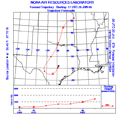
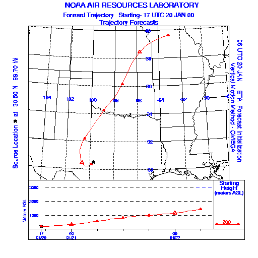
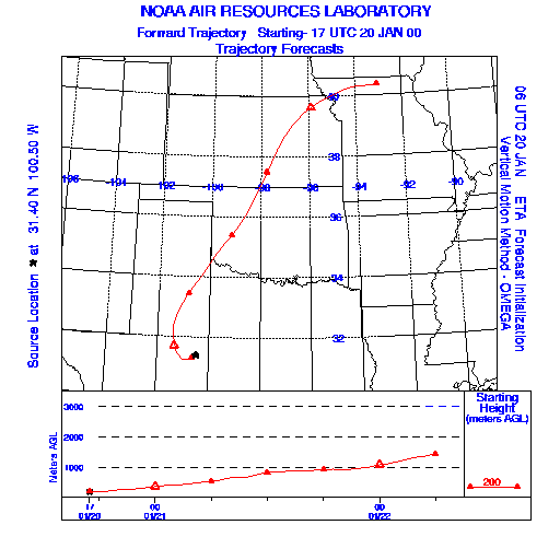
Trajectory Start(s) (shown by * on map): Austin, TX; Junction, TX; San Angelo, TX
Austin, TX
Junction, TX
San Angelo, TX
Prepared by: Thomas Keever (Department of Marine, Earth and Atmospheric Sciences, NCSU), Estelle Levetin (Faculty of Biological Science, The University of Tulsa, 600 S. College, Tulsa, OK 74104), and C.E. Main (Department of Plant Pathology, North Carolina State University, Raleigh, NC 27695-7618). This forecast gives the anticipated future track of released Mountain Cedar pollen, weather conditions over the region and along the forecast pathway, and an estimated time of arrival for various metropolitan areas.
Questions: Aerobiology Lab e-mail: pollen@utulsa.edu
Return to Forecasting Home Page