Date Issued: 1 February 2000
Mountain Cedar location(s): Arbuckle Mountains, OK
Regional weather: Tuesday, February 1 - TX/OK: A low pressure area is centered just off the TX coast and another is forming in the western sections of the region. The two will move east in time. Lots of moisture is being pumped into the region from the Gulf of Mexico. Cloudy most areas today. Decreasing clouds and dry for most northern sections tonight and Wednesday. For most of TX.... clouds and a chance of rain or some sort of freezing precipitation today and Wednesday. Cooler many areas of TX Wednesday. Highs today from the 30's north to 60's south, ranging from the 30's north to mostly 50's south on Wednesday. Lows tonight in the 10's and 20's north, 40's with some 50's south.
Trajectory weather: Partly cloudy early, becoming mostly cloudy with a chance of rain later this afternoon. High in the 40's. Rain changing to snow tonight, ending late. Low in the 20's. Becoming partly cloudy on Wednesday, high in the 40's.
Trajectory confidence: High.
OUTLOOK: *** Low Threat *** Little to no pollen release expected today. Temperatures may creep into the favorable range for several hours, but humidity levels will likely remain above the tolerance zone. Few effects on the populace expected. TK
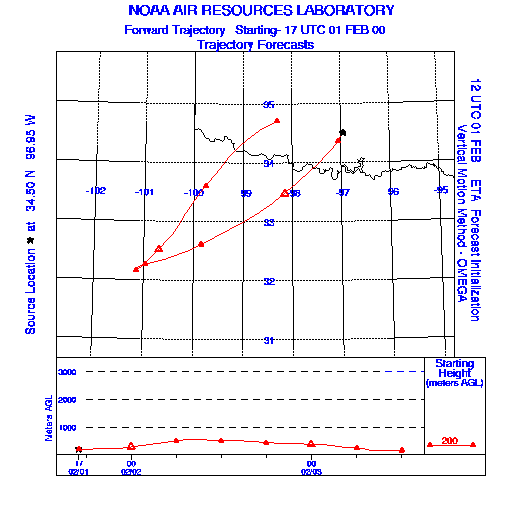
Trajectory Start(s) (shown by the * on map): Sulfur, Oklahoma
Prepared by: Thomas Keever (Department of Marine, Earth and Atmospheric Sciences, NCSU), Estelle Levetin (Faculty of Biological Science, The University of Tulsa, 600 S. College, Tulsa, OK 74104), and C.E. Main (Department of Plant Pathology, North Carolina State University, Raleigh, NC 27695-7618). This forecast gives the anticipated future track of released Mountain Cedar pollen, weather conditions over the region and along the forecast pathway, and an estimated time of arrival for various metropolitan areas.
Questions: Aerobiology Lab e-mail: pollen@utulsa.edu
Return to Forecasting Home Page