Date Issued: 11 February 2000
Mountain Cedar location(s): Edwards Plateau, Texas
Regional weather: Friday, February 11 - TX/OK: Cold front now over central TX will sag southward tonight and Saturday. Partly cloudy many areas with some thicker clouds over OK and the Panhandles. Not much chance of rain today or Saturday with a wide range of temperatures on either side of the front. Highs ranging from the 40's north to 80's south both days; lows ranging from the 20's to the 50's.
Trajectory weather: Partly cloudy today with a high from 75-80. Clear tonight, low in the low 40's. Partly cloudy Saturday, high in the 50's.
Trajectory confidence: High
OUTLOOK: *** Low to Mild Threat *** We are nearing the end of the pollen season, so there is little pollen available for release. As in previous days..... temperatures are favorable with a range of humidities across the Plateau, higher and unfavorable in the east, lower and favorable in the west. Winds are light. Some light release is possible from the western sections of the Plateau. Residents of central and northeast TX are most likely to feel any ill effects. TK
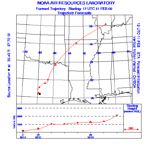
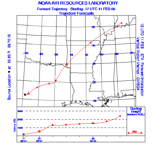
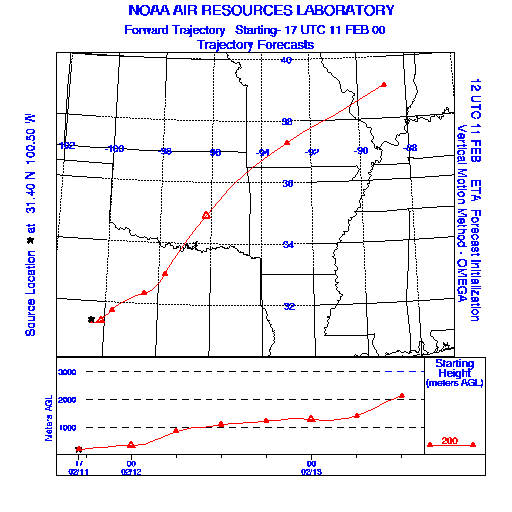
Trajectory Start(s) (shown by * on map): Austin, TX; Junction, TX; San Angelo, TX
Austin, TX
Junction, TX
San Angelo, TX
Prepared by: Thomas Keever (Department of Marine, Earth and Atmospheric Sciences, NCSU), Estelle Levetin (Faculty of Biological Science, The University of Tulsa, 600 S. College, Tulsa, OK 74104), and C.E. Main (Department of Plant Pathology, North Carolina State University, Raleigh, NC 27695-7618). This forecast gives the anticipated future track of released Mountain Cedar pollen, weather conditions over the region and along the forecast pathway, and an estimated time of arrival for various metropolitan areas.
Questions: Aerobiology Lab e-mail: pollen@utulsa.edu
Return to Forecasting Home Page