University of Tulsa
Mountain Cedar Pollen Forecast
|
Metropolitan Area |
Exposure Risk |
|
Dallas / Ft. Worth |
Mod |
|
Austin |
High |
|
San Antonio |
Mod |
Date Issued: 16 January 2002
Mountain Cedar location(s): Edwards Plateau, Texas
Regional weather: Wednesday, January 16 TX/OK/AR: The weather across the southern plains will be dominated today by westerly flow and a week cold front that will drop over the area tonight. Across Texas temperatures will be warm with highs reaching the low 70 s to upper 60 s and low temperatures being in the 40 s or warmer along the southern edge of the Edwards Plateau. Winds will be from the south to southwest and moderate calming overnight. Mid and upper level moisture will result in mixed sky conditions and building to partly cloudy tonight. To the north southerly winds will warm conditions early but a cold front will pass over Oklahoma this afternoon and evening. High temperatures will be close to 60 to the south and in the mid 50s north and east, including the Ozark Mountain areas. Winds will initially be from the south/southwest but will switch to the north/northeast as the cold front passes. On Thursday, the weak cold front will shift the winds further south with the eastern side of the Edwards Plateau seeing north to northeasterly wind patterns. The winds will remain light. High temperatures will drop 5 to 7 degrees and sky conditions will remain mixed to partly cloudy across the area as mid to high level moisture continues to flow in from the west. Instability in the atmosphere is forecast for the Dallas area and to the west with a chance of showers Thursday afternoon and into the evening.
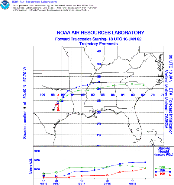
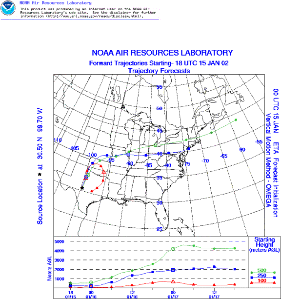
Trajectory weather: The air mass trajectories from the sites in Texas sites show a northward component and then eastward movement with very buoyant air. In Austin and Junction, surface winds initially move northward and then southward with restricted travel distances compared to the upper level winds. The trajectories from the northern area around San Angelo move northeasterly passing over southern Oklahoma. Skies will be mixed to partly cloudy today as humidity builds in the mid to upper levels but temperatures will remain warm and a chance of showers is forecast for tomorrow afternoon and evening.
Trajectory confidence: High.
OUTLOOK: *** High threat of travel today *** favorable conditions for pollen release. Over the plateau warm temperatures and moderate wind speeds today will produce conditions favorable for pollen release, however increasing humidity and cloudy conditions throughout the region may dampen some of the heavy pollination. Reports indicate pollen release continues therefore areas where trees are growing may continue to be severely affected. Trajectories characteristics show very good conditions for pollen entrainment and travel as well. The movement of pollen to the north and then eastward may affect the Dallas/Ft. Worth area but not as much as the previous week therefore a moderate threat is forecast. Similar conditions exist for pollen moving off the western edge of the Edwards Plateau into the areas around Austin and Waco however their proximity to the blooming population makes the potential continue to be severe.
Trajectory Start(s) (shown by *on map): Austin, TX; Junction, TX; San Angelo, TX
Austin, TX
Junction, TX
San Angelo, TX
Prepared by: Peter K. Van de Water (Department of Geosciences, Oregon State University), and Estelle Levetin (Faculty of Biological Science, The University of Tulsa, 600 S. College, Tulsa, OK 74104) This forecast gives the anticipated future track of released Mountain Cedar pollen, weather conditions over the region and along the forecast pathway, and an estimated time of arrival for various metropolitan areas.
Questions: Aerobiology Lab e-mail: pollen@utulsa.edu
Return to ForecastingHome Page