The
Mountain
Cedar Pollen Forecast
Date Issued:
Mountain Cedar Location(s):
Regional Weather: Monday, January 6 TX/OK/AR: Low pressure centered over northeastern Arizona and a jet stream positioned south of Texas will significantly influence the region today. The weather system will move across the region bringing cloudy conditions to the Texas area and heightened humidity levels. Skies from Oklahoma City southward will be mostly cloudy to cloudy. However the chance for rain will be relatively small. The greatest effect will be that low pressure to the southwest and high pressure in the central plains will result in strong northeasterly winds blowing across the area. Cold air will drain southward with the jet stream so far south resulting in cold temperatures region wide. In Texas, high temperatures will be below 60 region wide with the high 50s to the south and low 50s to upper 40s in the north and west. A slight chance of snow or rain is forecast for the panhandle region. Conditions will begin to improve tonight, but cloudy conditions will linger. Temperatures near freezing will occur as far south as San Angelo with a frost warning for northern Texas. Winds will calm overnight. Tomorrow, high temperatures will continue to be cool with highs barely reaching the mid 50s to the south and the mid 40s in north Texas. Skies will begin to clear with sunny to partly cloudy conditions from north to south. In Oklahoma, conditions will be colder with temperatures staying in the 40s. Partly cloudy to mostly cloudy skies and humidity levels around 50% will prevail across the state. Winds will also be strong out of the north to northeast. Overnight clear conditions will drop temperatures into the mid to low 20s region wide with a hard freeze. Sunny but cold conditions will return to the area on Tuesday with high temperatures in the low 50s to mid 40s from south to north.
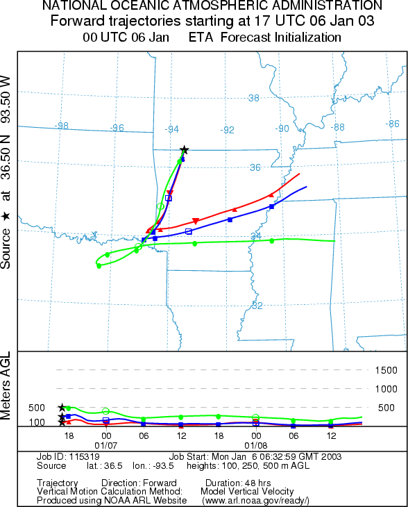
Trajectory weather: The air mass trajectories from
the
OUTLOOK: *** Low Threat today*** unfavorable conditions for pollen release. Cloudy skies with heightened humidity coupled with cold temperatures results in unfavorable conditions for pollen release today. In addition the trajectories show poor characteristics for pollen entrainment and travel away from the source. With the lack of pollen to entrain there is a low threat to any downwind communities. Conditions will remain marginal tomorrow with sunny skies and lower humidity but only slightly warmer temperatures.
Trajectory Start (s)
(shown by black star
on map):
Prepared by: Peter
K. Van de Water (Department of Geosciences,
Questions: Aerobiology Lab e-mail: pollen@utulsa.edu
Return to Forecasting Home Page