The
Mountain
Cedar Pollen Forecast
Date Issued:
Mountain Cedar Location(s):
Regional Weather: Thursday, January 23 TX/OK/AR: Conditions across the forecast region will be influenced by the current push of arctic air coming from the north. Partly cloudy to mostlycloudy conditions will occur across the region today with cold temperatures as far south as San Antonio, Texas. Todays highs will be in the low 30s around Dallas to the low 40s on the southern edge of the Edwards Plateau. Winds will be from the north to northeast and light and moderate resulting in even colder wind chill conditions. Skies will be partly cloudy to cloudy over the region. Overnight temperatures will get cold with lows on the Plateau in the mid 20s and including locations along the southern edge of the Edwards Plateau. Similar conditions will return on Friday, with some little amelioration of conditions expected. To the north in Oklahoma high temperatures today will stay in the 20s with cloudy conditions and moderate winds out of the north to northeast. Temperatures overnight will dip into the teens then return to similarly chilly conditions on Friday.
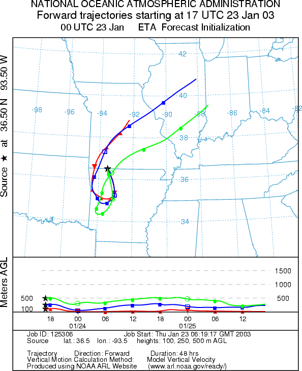
Trajectory weather: The air mass trajectories from
the
OUTLOOK: *** Low Threat Today*** Unfavorable Conditions for Pollen Release. Cloudy skies, moderate humidity levels and very cold temperatures with the highs remaining well below freezing result in unfavorable conditions for pollen release today. In addition, the trajectories show poor characteristics for pollen entrainment and travel downwind. The trees are nearing the end of the pollination season and the amount of pollen to be dispersed is unknown at this time, but because of the conditions no pollen dispersal is expected therefore a low threat exists. Similar conditions are expected tomorrow.
Trajectory Start (s)
(shown by black star
on map):
Prepared by: Peter K. Van de Water (Department of Geosciences,
Questions: Aerobiology Lab e-mail: pollen@utulsa.edu
Return to Forecasting Home Page