The
Mountain
Cedar Pollen Forecast
Metropolitan Area |
Exposure Risk |
|
|
Low/Low to Moderate |
|
|
Low/Low to
Moderate |
|
|
Low/Low |
Date Issued:
Mountain Cedar Location(s):
Regional Weather: Saturday, January 25 and Sunday, January 26 TX/OK/AR: High pressure has moved to the east of the region bringing warmer air and alleviating some of the cold conditions. The southerly flow will bring increased humidity and cloudy skies across much of the region. Temperatures in Texas will rebound nicely with highs near or just above 50 degrees across the state. Humidity levels will be well above 50 percent across the region especially towards the eastern sections of central Texas. There is a slight chance of a few scattered sprinkles but not much more. Winds will be from the south to southeast and moderate. Overnight temperatures will be cool but mild compared to last week with lows across the region staying in the 40s. Winds will switch direction and be from the north to northeast but light. Tomorrow will be warmer as high temperatures rebound by up to 5 degrees depending on your location. The atmosphere will dry out some with lower humidity levels occurring on the western side of the Plateau. Winds will eventually back to a south to southwestern flow staying moderate. In Oklahoma, warming will occur today bringing the high temperatures into the upper 40s however skies will remain partly to mostly cloudy with a slight chance of some sprinkles over the region. Winds will be moderate to strong from the south. Overnight, temperatures will dip towards freezing as the winds switch to a north to northwesterly flow. Winds will be light to moderate. Sunday will continue to see cloudy skies with a slight chance of precipitation and a 5 to 10 degree cool down from Saturday. Highs are expected only in the upper 30s to low 40s. Strong winds will occur from the north.
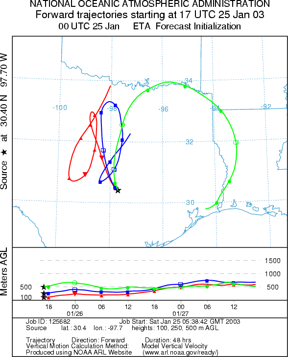
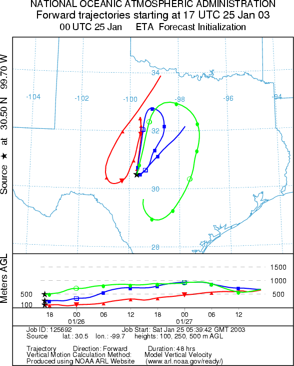
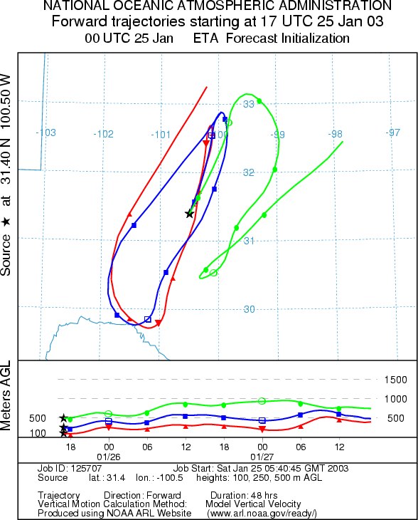
Trajectory weather: The air mass trajectories from Texas do not move significant distances today with a general northerly movement today, reversing overnight and then moving northward again tomorrow. All of the source localities show the trajectories staying within the central to south-central Texas region. The trajectories show good conditions for entrainment and travel as the atmosphere is buoyant and rising across the region. However, cool conditions with cloudy skies and high humidity are expected across the region, should dampen any pollen release today. Sunday: Sunday conditions will improve with a 5 to 10 degree warm up across the region. In addition, overnight low temperatures will be well above freezing. Sunny skies with lower humidity and moderate to light winds will prevail across the western regions while cloudy conditions and higher humidity will be seen to the east. The trajectories loop towards the west then move to the north to northeast across Oklahoma and into Kansas with rising, bouyant atmospheric conditions along the pathway.
OUTLOOK: *** Saturday: Low Threat today***Poor conditions for pollen release today. ***Sunday: Low to Moderate Threat ***mixed conditions for pollen release today. Cloudy skies and humid conditions with chilly temperatures today result in a forecast for poor conditions for pollen release today. The more northern populations are less at risk for pollen release because temperatures will be cold during most of the day, but the more southern populations may see conditions just reach 50 degrees before the day is done. In addition, the trees should be nearing the end of the pollination season and therefore there may not be significant amounts of pollen to be dispersed. The trajectory characteristics show good conditions for entrainment and travel today but with poor conditions for release results in a low threat to downwind communities. Sunday: On Sunday similar conditions will exist but temperatures will ameliorate with a 5 to 10 degree warm up across the region. Humidity will be dropping on the western side of the Plateau but cloudy conditions will remain to the east. Therefore favorable conditions for pollen release are expected westward sliding towards unfavorable conditions to the east. Similarly, the trajectories show good conditions for entrainment and travel therefore the potential for deposition of pollen along the trajectories is possible and a Moderate threat to downwind communities is forecast. The pathways move north to northwest off of the Plateau putting northern Texas (Dallas/Ft. Worth westward past Wichita Falls) and southwestern to northeastern Oklahoma at risk for moderate amounts. Again it is late in the season and indications are that there are reduced numbers of cones left to release pollen.
Trajectory Start (s)
(shown by *
on map):

Junction, TX

San Angelo,

Prepared by: Peter
K. Van de Water (Department of Geoscience,
Questions: Aerobiology Lab e-mail: pollen@utulsa.edu
Return to Forecasting Home Page