The
Mountain
Cedar Pollen Forecast
Date Issued:
Mountain Cedar Location(s):
Regional Weather: Saturday, January 25 and Sunday, January 26 TX/OK/AR: High pressure has moved to the east of the region bringing warmer air and alleviating some of the cold conditions. The southerly flow will bring increased humidity and cloudy skies across much of the region. Temperatures in Texas will rebound nicely with highs near or just above 50 degrees across the state. Humidity levels will be well above 50 percent across the region especially towards the eastern sections of central Texas. There is a slight chance of a few scattered sprinkles but not much more. Winds will be from the south to southeast and moderate. Overnight temperatures will be cool but mild compared to last week with lows across the region staying in the 40s. Winds will switch direction and be from the north to northeast but light. Tomorrow will be warmer as high temperatures rebound by up to 5 degrees depending on your location. The atmosphere will dry out some with lower humidity levels occurring on the western side of the Plateau. Winds will eventually back to a south to southwestern flow staying moderate. In Oklahoma, warming will occur today bringing the high temperatures into the upper 40s however skies will remain partly to mostly cloudy with a slight chance of some sprinkles over the region. Winds will be moderate to strong from the south. Overnight, temperatures will dip towards freezing as the winds switch to a north to northwesterly flow. Winds will be light to moderate. Sunday will continue to see cloudy skies with a slight chance of precipitation and a 5 to 10 degree cool down from Saturday. Highs are expected only in the upper 30s to low 40s. Strong winds will occur from the north.
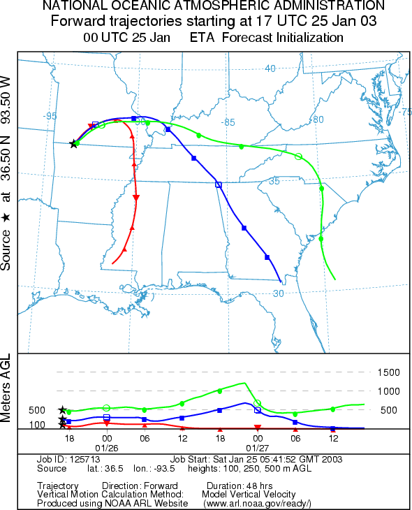
Trajectory weather: The air mass trajectories from
the
OUTLOOK: Saturday***Low Threat Today*** Unfavorable for Pollen Release Sunday: *** Low Threat Today*** Unfavorable for Pollen Release. Conditions today and tomorrow will be mired in the 30s with cloudy skies and moderate to strong winds. Conditions will be cold overnight. These conditions result in poor conditions for pollen release and therefore unfavorable conditions. The trajectories show good conditions for entrainment and travel but little pollen should be available from the source sites. Therefore there is a low threat for both Saturday and Sunday.
Trajectory Start (s)
(shown by black star
on map):
Prepared by: Peter
K. Van de Water (Department of Geosciences,
Questions: Aerobiology Lab e-mail: pollen@utulsa.edu
Return to Forecasting Home Page