The
Mountain
Cedar Pollen Forecast
Metropolitan Area |
Exposure Risk |
|
|
Low |
|
|
Low |
|
|
Low |
Date Issued:
Mountain Cedar Location(s):
Regional Weather: Wednesday, January 29 TX/OK/AR: Calm conditions will exist across the region today with slightly cooler weather moving in. Moisture will build throughout the region today and many areas in Texas will see thick fog this morning along with drizzle. In Texas temperatures will cool with high temperatures in the upper 50s to the low 60s from north to south. Skies will be mostly cloudy to cloudy today with fog and drizzle this morning along the eastern edge of the Edwards Plateau. Light to moderate winds from the north to northeast overnight and into tomorrow. Overnight temperatures will be in the 40s with mostly cloudy to cloudy skies. On Thursday, temperatures will cool a few degrees with most reading in the upper 50s and with increasing humidity readings. To the north in Oklahoma high temperatures today will be in the 40s across the region. Mostly cloudy to cloudy skies with relatively high humidity readings are expected. Winds will be moderate from the north to northeast. Overnight temperatures will be around freezing in most areas with mostly cloudy skies. Winds will be light from the north to northeast. On Thursday, conditions will warm into the low 50s with light to moderate winds from the southeast. Conditions will dry with lower humidity readings but a slight chance of some precipitation.
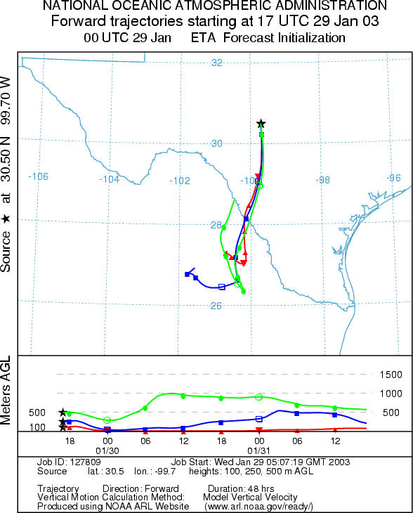
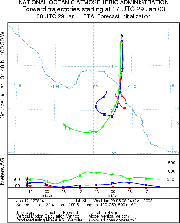
Trajectory weather: All of the air mass trajectories move to the south on dominant northerly winds. At the lowest elevations the winds travel at ground level, whereas at upper elevation more buoyant conditions occur. The trajectory from the east side of the Edwards Plateau moves into south Texas whereas those from the western side quickly move into Mexico. Temperatures across the region will warm into the upper 50s and low 60s today but very high humidity to the east and dryer conditions westward. Skies will be mostly cloudy to cloudy and light to moderate winds from the north. Overnight temperatures will only dip into the upper 30s to low 40s but the winds with highs on Thursday in the upper 50s and cloudy to mostly cloudy skies.
OUTLOOK: *** Low to Moderate Threat today *** Unfavorable to Mixed Conditions for Pollen Release. Partly cloudy to mostly cloudy skies with warm temperatures across the region, but high humidity will result in unfavorable conidtions in some areas. Mixed conditions will occur in others as the humidity drops in the afternoon. As a result there may be some limited release in these areas. However, all indication are that we are at the end of the pollination season and the amount of pollen to be dispersed is at very low levels. Recent good conditions did not lead to significant amounts of pollen being reported which leads us to believe that the amount of unopened cones in the populations is small. Therefore the potential amount of pollen in the atmosphere should not be significant and a low threat exists for most areas. Cooler conditions are expected tomorrow with high humidity conditions continuing. With the end of the season near, the Friday (January 31st) forecast will be the last for the season.
Trajectory Start (s)
(shown by *
on map):
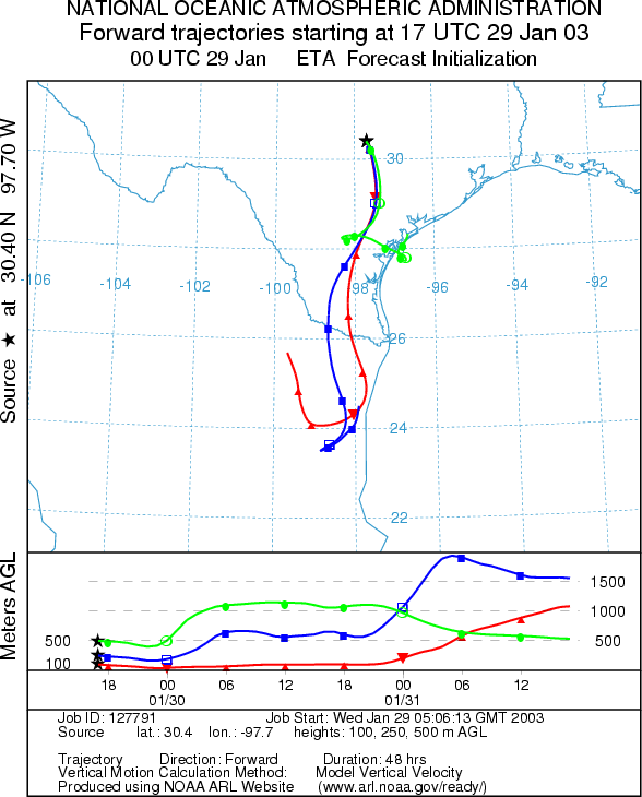
Junction, TX
Prepared by: Peter
K. Van de Water (Department of Geoscience,
Questions: Aerobiology Lab e-mail: pollen@utulsa.edu
Return to Forecasting Home Page