The University of Tulsa
Mountain Cedar Pollen Forecast
Metropolitan Area |
Exposure Risk |
|
Dallas/Fort Worth |
Low |
|
Austin |
Low |
|
San Antonio |
Low |
Date Issued: 31 January 2005
Mountain Cedar Location(s): Edwards Plateau, Texas
Regional Weather: Monday and Tuesday, Jan 31 and Feb
1. TX/OK: Cool wet conditions continue in the southern plains for the next couple of day. Daytime highs
both days will be in the upper 30s in northern half of Oklahoma and the 40s in southern Oklahoma and Texas. Skies
will be clousy with patchy fog and low to moderate winds from the north.Rain is likely both Monday and Tuesday
especially in Texas.
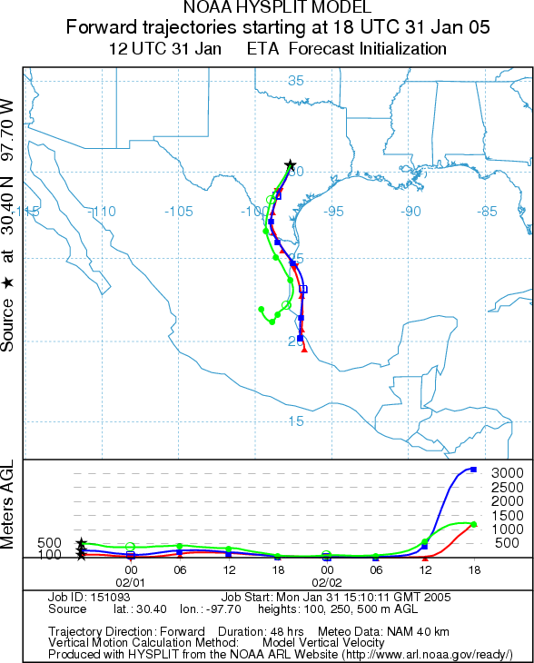
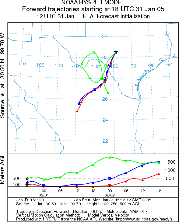
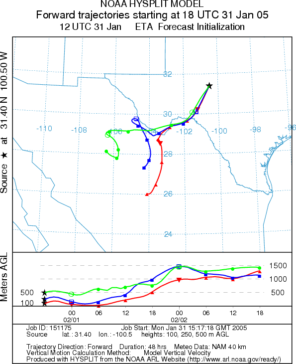
Trajectory weather: The air mass trajectories from the
Edwards Plateau move to the south, southwest towards Mexico both Monday and Tuesday. Conditions at the sources
will be cold and wet both days. In addition atmospheric conditions are not particularly good for pollen entrainment
and transport downwind.
OUTLOOK: *** Low Threat ***
unfavorable conditions for pollen release. Cloudy skies, low temperatures,
and likelihood of rain will reduce the chance of any significant pollen release making for unfavorable conditions. In addition it is past the peak for mountain cedar pollen and poor atmospheric
conditions exist for pollen entrainment With cold, wet conditions little release is expected and therefore a Low threat exists.
Trajectory Start (s) (shown by *
on map): Austin, TX; Junction, TX; San Angelo, TX.
AUSTIN
JUNCTION
SAN ANGELO
Prepared by: Estelle
Levetin (Faculty of Biological
Science, The University
of Tulsa, 600 S. College, Tulsa, OK 74104). This forecast gives the anticipated future track of released
Mountain Cedar pollen, weather conditions over the region and along the forecast pathway, and an estimated time
of arrival for various metropolitan areas.
Questions: Aerobiology Lab e-mail: pollen@utulsa.edu
Return to Forecasting Home Page