The University of Tulsa
Mountain Cedar Pollen Forecast
Metropolitan Area |
Exposure Risk |
|
Dallas/Fort Worth |
Severe |
|
Austin |
Severe |
|
San Antonio |
Moderate |
Date Issued: 6 January 2006
Mountain Cedar Location(s): Edwards Plateau, Texas
Regional Weather: Fri
and Sat, Jan 06 and 07. TX/OK: High
pressure remains over the central Rockies and builds over central Texas today and tomorrow. High pressure to the
northwest will continue to funnel cooler air southward, as the southern high pressure will bring warmer air northward.
In Oklahoma, low temperatures will be below freezing both nights with daytime highs in the upper 40s and low 50s
today rising into the 60s tomorrow. In Texas, low temperatures will approach freezing both nights, especially
in the western Edwards Plateau region. Daytime temperatures will remain warm for this time of year, rising significantly
on Saturday. Temperatures in the 60s today will be followed tomorrow by readings in the mid to upper 70s. Humidity
will remain very low during the day, region wide and there is again no chance of precipitation over the weekend.
Winds will move from the south to southwest but should be calmer than the last few days. Wind speeds will increase
overnight and into Sunday as a dry line from a developing low pressure to the northwest moves across the region.
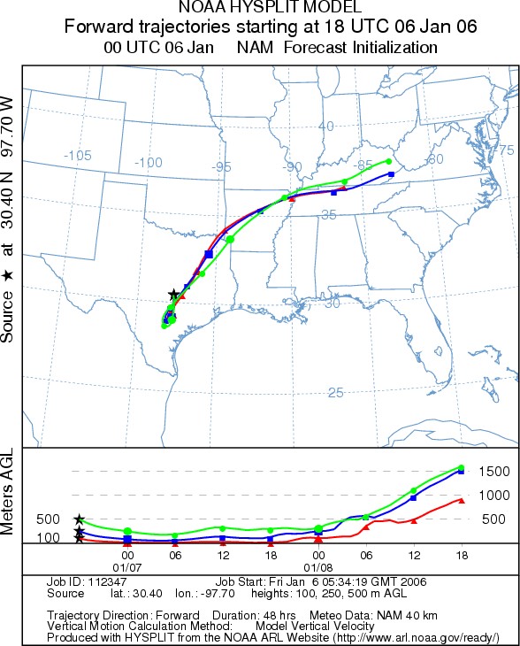
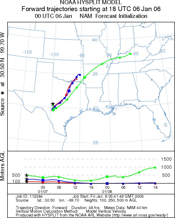
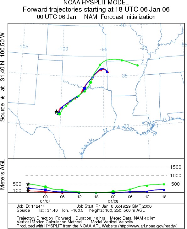
Trajectory weather: The air mass trajectories from the Edwards
Plateau Texas move to the northeast today. The trajectories are associated with sinking atmospheric conditions
that show poor characteristics for entrainment and travel. The trajectories from the western side of the plateau
continue to move over the Dallas/ Fort Worth area on Saturday and may bring significant amounts of pollen from
the populations growing to the west. Further spread of pollen will be hampered by the ground level movement of
the winds overnight and into tomorrow
OUTLOOK: *** Severe threat *** Temperatures
are very good for pollen release and therefore the proximity of the Austin and Waco areas just outside the primary
population indicates that severe levels of pollen should occur in these regions. Continuing high atmospheric concentrations
in the Austin area indicate that the primary pollination season is occurring. To the north, the trajectories pass
over the Dallas/Fort Worth area but at low levels with sinking atmospheric conditions. Significant amounts of
pollen may occur, and thus the severe warning ,but spread further north should be limited. Release and entrainment
from the eastern side of the Edwards Plateau may affect regions of northeastern Texas across central Arkansas with
severe to moderate threats. Initial southward movement of the air masses prior to turning northwest may also impact
communities along the southern Edwards Plateau such as San Antonio, New Braunfels, and San Marco today.
Trajectory Start (s) (shown by *
on map): Austin, TX; Junction, TX; San Angelo, TX.
AUSTIN
JUNCTION
SAN ANGELO
Prepared by: Estelle
Levetin (Faculty of Biological
Science, The University
of Tulsa, 600 S. College, Tulsa, OK 74104) in conjunction with Peter K Van de Water. This forecast
gives the anticipated future track of released Mountain Cedar pollen, weather conditions over the region and along
the forecast pathway, and an estimated time of arrival for various metropolitan areas.
Questions: Aerobiology Lab e-mail: pollen@utulsa.edu
Return to Forecasting Home Page