The University of Tulsa
Mountain Cedar Pollen Forecast
Metropolitan Area |
Exposure Risk |
|
Dallas/Fort Worth |
Low |
|
Austin |
Moderate to High |
|
San Antonio |
Moderate to High |
Date Issued: 23 January 2006
Mountain Cedar Location(s): Edwards Plateau, Texas
Regional Weather: Monday and Tuesday, Jan 23 and 24.
TX/OK: For the next two days the region should see clear to partly cloundy skies, light northerly winds
and mild temperatures. Patchy fog in Oklahoma should burn off by noon on Monday leaving temperatures ranging from
the low 50s in northern Oklahoma to the low 60s in south Texas. Overnight lows will be in the 30s throughout the
region. Light winds and partly cloudy skies will continue on Tuesday with temperatures in the 60s.
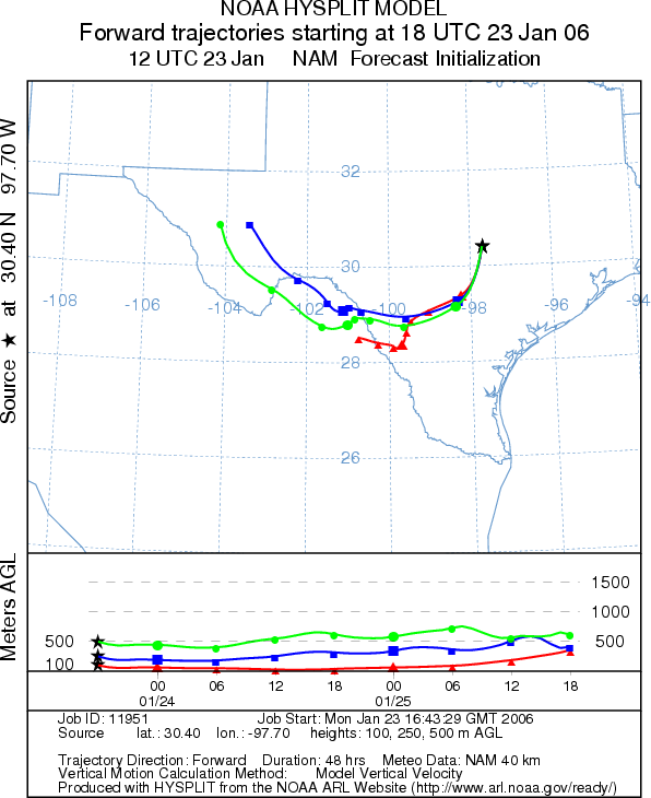
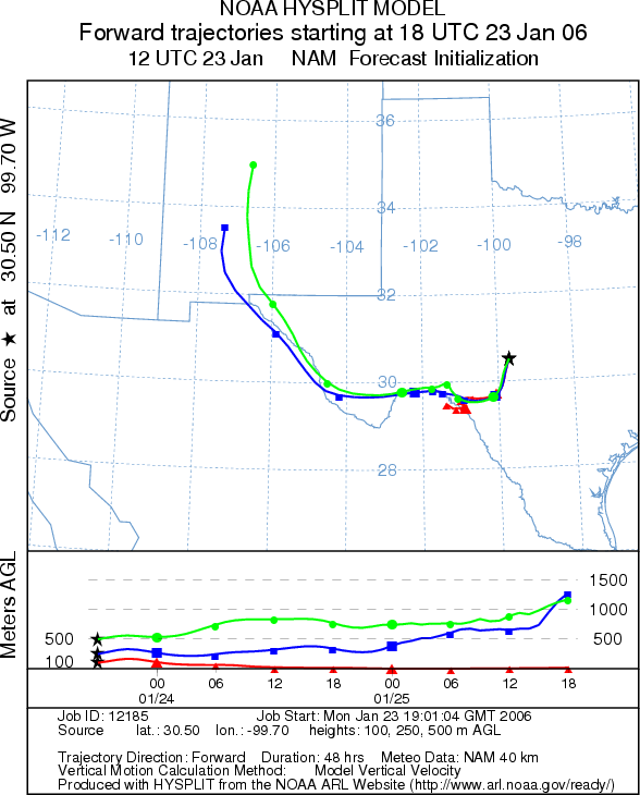
Trajectory weather: The air mass trajectories from the
Edwards Plateau move to the southwest then circle around to the west and then northwest. The trajectories
show mixed characteristics for pollen transport. Conditions at the sources will be cool this morning but will be
favorable in the afternoon. Low temperatures again tonight might limit monring pollen release on Tuesday.Tuesday's
trajectories move initially to the west then northwest over west Texas.
OUTLOOK: *** Moderate to high risk
*** Good conditions for pollen release this afternoon after low morning temperatures.
The trajectory characteristics show mixed conditions leading to entrainment and travel downwind.
Trajectory Start (s) (shown by *
on map): Austin, TX; Junction, TX; San Angelo, TX.
AUSTIN
JUNCTION
SAN ANGELO
Prepared by: Estelle
Levetin (Faculty of Biological
Science, The University
of Tulsa, 600 S. College, Tulsa, OK 74104). This forecast gives the anticipated future track of released
Mountain Cedar pollen, weather conditions over the region and along the forecast pathway, and an estimated time
of arrival for various metropolitan areas.
Questions: Aerobiology Lab e-mail: pollen@utulsa.edu
Return to Forecasting Home Page