The University of Tulsa
Mountain Cedar Pollen Forecast
Metropolitan Area |
Exposure Risk |
|
Dallas/Fort Worth |
Low |
|
Austin |
Low |
|
San Antonio |
Low |
Date Issued: 13 January 2007
Mountain Cedar Location(s): Edwards Plateau, Texas
Regional Weather: Sat and Sun, Jan 13 and 14. TX/OK:
A major winter storm and arctic cold front moving across the region this weekend. Freezing rain and sleet will
occur in Oklahoma and north Texas with highs in the 20s and moderate north winds today and Sunday. The front will
slowly push through central Texas dropping temperatures. Heavy rains are possible in central Texas with winds shifting
to northerly during the morning and afternoon today.
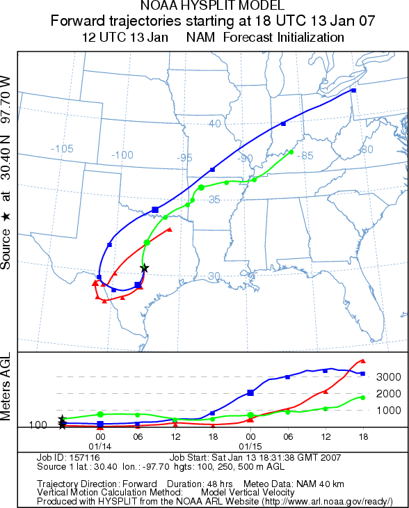
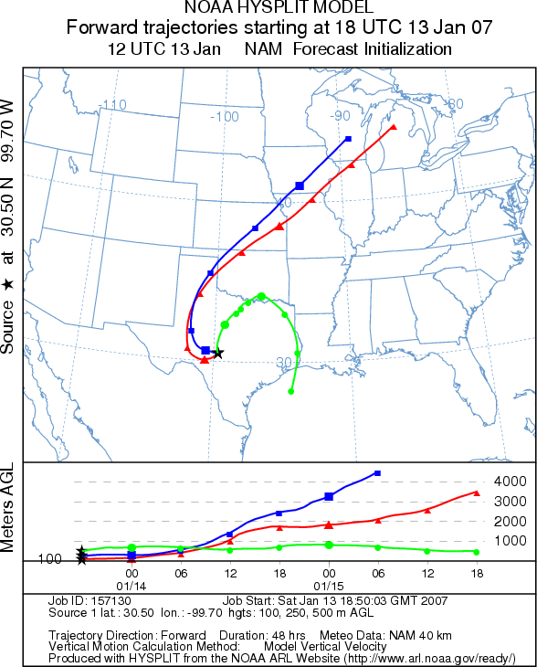
Trajectory weather: The air mass trajectories from Edwards Plateau Texas move to the southwest and then
curve to the northeast. The trajectories show mixed characteristics for entrainment and travel. Conditions at the
source areas on the Plateau are mostly unfavorable for pollen release. Favorable temperatures only along the southern
edge of the Plateau and San Antonio but rain in this area will limit pollen release. Sunday's trajectories show
movement around southwest Texas. Conditions at the source areas will again be unfavorable for pollen release on
Sunday.
OUTLOOK: *** Low threat *** Conditions are unfavorable for pollen release
today and Sunday.
Trajectory Start (s) (shown by *
on map): Austin, TX; Junction, TX; San Angelo, TX.
AUSTIN
JUNCTION
SAN ANGELO
Prepared by: Estelle
Levetin (Faculty of Biological
Science, The University
of Tulsa, 600 S. College, Tulsa, OK 74104). This forecast gives the anticipated future track of released
Mountain Cedar pollen, weather conditions over the region and along the forecast pathway, and an estimated time
of arrival for various metropolitan areas.
Questions: Aerobiology Lab e-mail: pollen@utulsa.edu
Return to Forecasting Home Page