The University of Tulsa
Mountain Cedar Pollen Forecast
Metropolitan Area |
Exposure Risk |
|
Dallas/Fort Worth |
Low |
|
Austin |
Low |
|
San Antonio |
Low |
Date Issued: 16 January 2007
Mountain Cedar Location(s): Edwards Plateau, Texas
Regional Weather: Tues and Wed, Jan 16 and 17. TX/OK:
Frigid conditions continue across the region today and Wednesday. Highs today will range from the low 20s to the
low 30s with moderate to strong northerly winds. Skies will be partly cloudy in Oklahoma and cloudy in Texas with
a continuing chance of freezing rain and sleet in central Texas. Overnight lows will be in the single digits in
Oklahoma and the 20s in Texas. Termperatures on Wednesday will be in the low to mid 30s with winds shifting to
southeast in Oklahoma. Chances of freezing rain and sleet continue in Texas
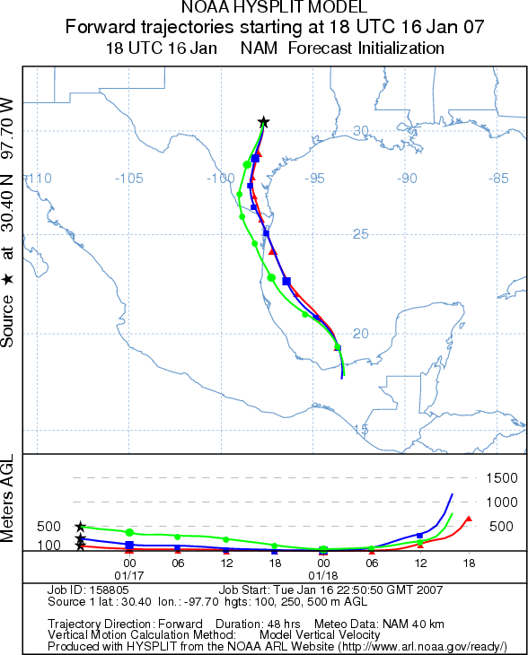
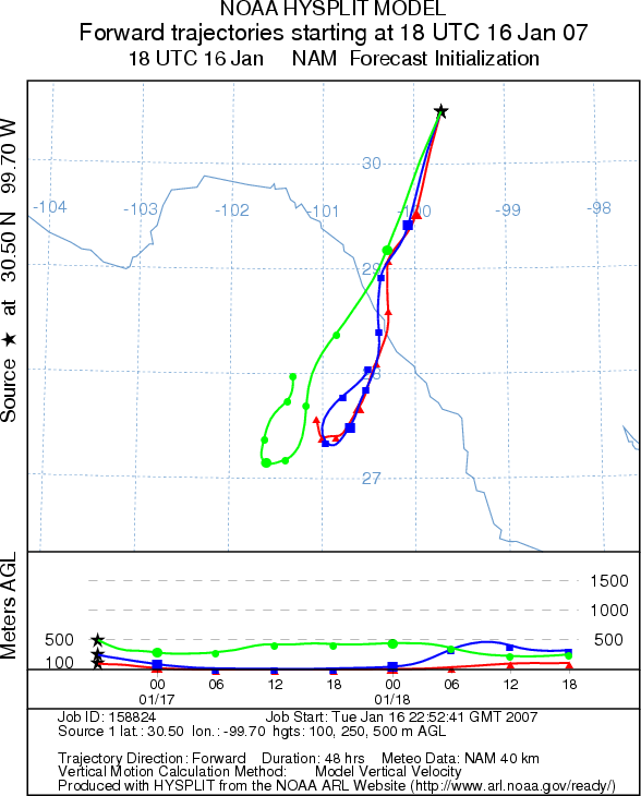
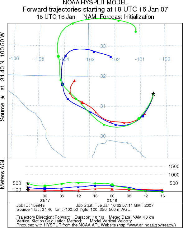
Trajectory weather: The air mass trajectories from the Edwards Plateau Texas move to the south and southwest.
Trajectories from the western side of the Plateau curve around to the northwest tomorrow. Wednesday's trajectories
circle around west Texas as winds shift around. The trajectories on both days are associated with cold sinking
air and show poor characteristics for entrainment and travel. Conditions at the source are unfavorable for pollen
release today and will continue unfavorable tomorrow.
OUTLOOK: *** Low threat *** Conditions are unfavorable pollen release
today and Wednesday
Trajectory Start (s) (shown by *
on map): Austin, TX; Junction, TX; San Angelo, TX.
AUSTIN
JUNCTION
SAN ANGELO
Prepared by: Estelle
Levetin (Faculty of Biological
Science, The University
of Tulsa, 600 S. College, Tulsa, OK 74104). This forecast gives the anticipated future track of released
Mountain Cedar pollen, weather conditions over the region and along the forecast pathway, and an estimated time
of arrival for various metropolitan areas.
Questions: Aerobiology Lab e-mail: pollen@utulsa.edu
Return to Forecasting Home Page