Metropolitan Area |
Exposure Risk |
|
Dallas/Fort Worth |
Low/Moderate |
|
Austin |
Moderate/Moderate to High |
|
San Antonio |
Moderate/Moderate to High |
Date Issued: 19 January 2008
Mountain Cedar Location(s): Edwards Plateau, Texas
Regional Weather: Saturday and Sunday, Jan 19 and 20.
TX/OK: A large Arctic air mass extends through the central U.S. bringing cold temperatures throughout the
region today. This high pressure system will begin shifting east late this afternoon and overnight with south,
southeast winds returning to the region. In Oklahoma, the high temperatures today will remain in the 30s with partly
cloudy skies and moderate north to northeast winds. Overnight lows will be in the low to mid 20s. Highs in Texas
will range from the 40s in the north to the low 50s in the south. Skies will be clear in most areas and moderate
winds from the north, north east. Overnight lows in Texas will be in the 20s to low 30s.
On Sunday temperatures will be 10 to 15 degrees warmer throughout the region with high temperatures in the mid
to upper 40s in Oklahoma and 50s in Texas. Skies will be clear to partly cloudy throughout the region with moderate
to strong south, southeast winds.
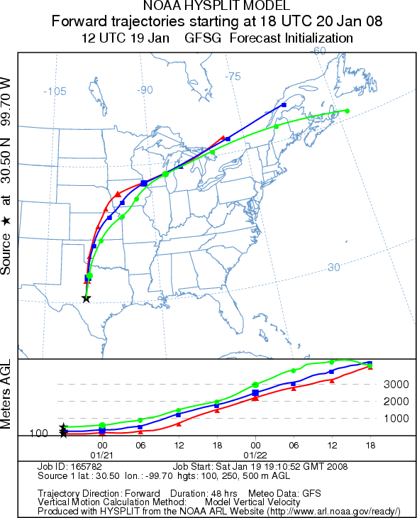
Trajectory weather: The air mass trajectories from the Edward's Plateau move to the southwest then curve
around to the north as the winds shift around to southerly. The shift to southerly winds occurs first in the west
this afternoon and later tonight in the eastern part of the plateau. Each of the trajectories shows only moderate
characteristics for downwind dispersal. Conditions at the sources will be cold today but dry with sunny clear skies.
The trees are near the peak of the pollen release season therefore some pollen may be released but the cold temperatures
should discourage it today but with a greater chance tomorrow. Sunday's trajectories move to the north over central
Oklahoma and then veer northeast into Kansas with mixed characteristics for downwind dispersal.
OUTLOOK: *** Moderate Threat today, Moderate to high threat
tomorrow *** Temperatures at the source area are cold just reaching the favorable range in the afternoon.
Since the trees are nearing their peak release period significant amounts of pollen release might be expected in
sheltered areas where localized temperatures may be greater. However, overall the cold conditions should restrain
significant release. Conditions will be better tomorrow with highs in the 50s across the Plateau. Pollen release
will occur but trajectory characteristics are only moderate for downwind dispersal.
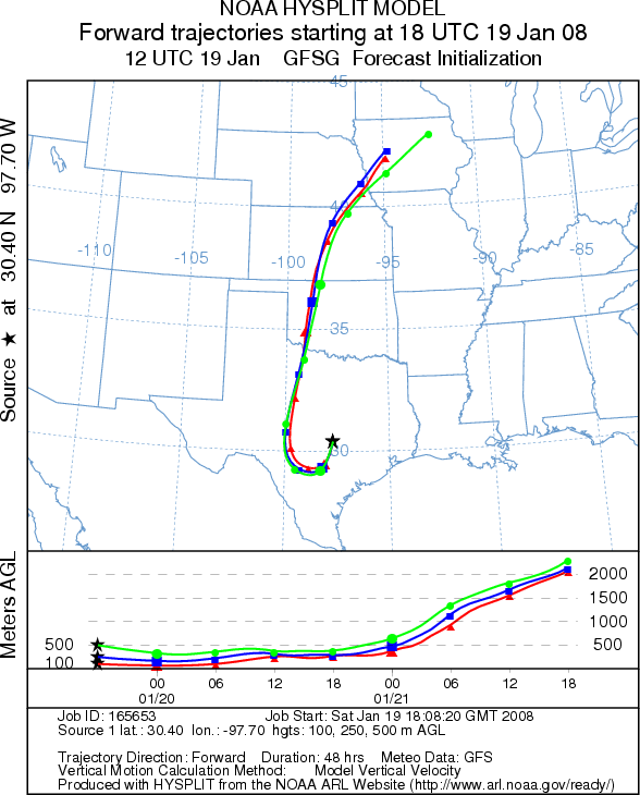
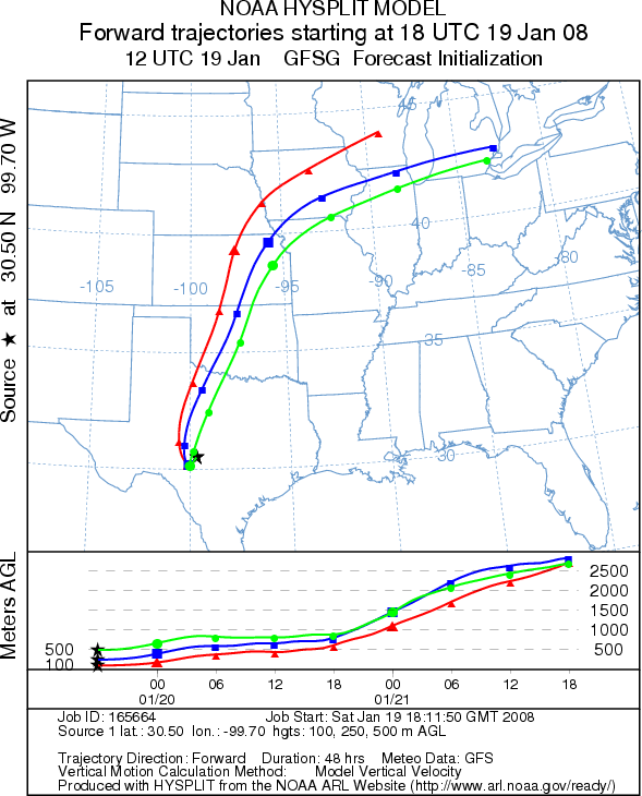
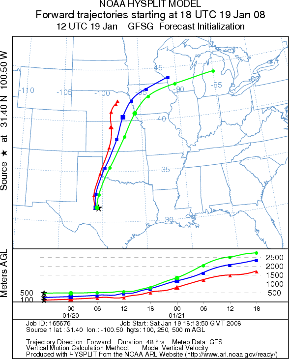
Trajectory Start (s) (shown by *
on map): Austin, TX; Junction, TX; San Angelo, TX.
AUSTIN (SATURDAY)
JUNCTION (SATURDAY)
SAN ANGELO (SATURDAY)
AUSTIN (SUNDAY)
JUNCTION (SUNDAY)
SAN ANGELO (SUNDAY)
Prepared by: Estelle
Levetin (Faculty of Biological
Science, The University
of Tulsa, 600 S. College, Tulsa, OK 74104) and ) and Peter K Van de Water (Department
of Earth and Environmental Science, California State University Fresno, 2576 East San Ramon Avenue, M/S ST24, Fresno
CA 93740-8039). This forecast gives the anticipated future track of released Mountain Cedar pollen, weather conditions
over the region and along the forecast pathway, and an estimated time of arrival for various metropolitan areas.
Questions: Aerobiology Lab e-mail: pollen@utulsa.edu
Return to Forecasting Home Page