The University of Tulsa
Mountain Cedar Pollen Forecast
Metropolitan Area |
Exposure Risk |
|
Dallas/Fort Worth |
High |
|
Austin |
High |
|
San Antonio |
High |
Date Issued: 9 January 2009
Mountain Cedar Location(s): Edwards Plateau, Texas
Regional Weather: Friday, Jan 9. TX/OK: Warm and
windy conditions will occur across the region today ahead of a cold front that is moving through Colorado this
morning. The front is forecast to reach northwest Oklahoma early this afternoon and central Oklahoma later this
afternoon. South of the front the air will become very warm with gusty southwest winds. As the cold front approaches,
winds will diminish before shifting to the northwest. The northwest winds will be strong and gusty as the front
pushes farther east and south into Oklahoma and Texas. This morning skies range from partly to mostly cloudy to
overcast representing a return of moist Gulf air ahead of the cold front. Areas of fog and drizzle were reported
overnight in Austin and San Antonio and may continue in scattered areas this morning and early afternoon. Clouds
will gradually dissipate during the afternoon. Temperatures today will be about 20 degrees above normal with 60s
in Oklahoma and 70s in Texas. Temperatures tomorrow will be much colder in the upper 30s and 40s in Oklahoma and
50s in Texas. Winds tomorrow will be fairly strong throughout the region with the possibility of wind advisories
being issued in some areas.
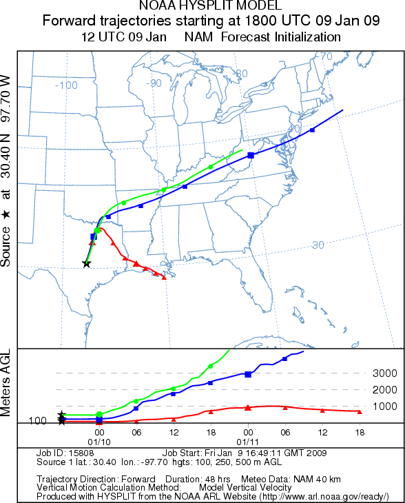
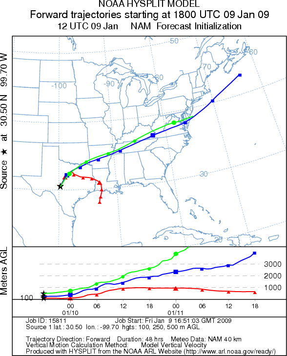
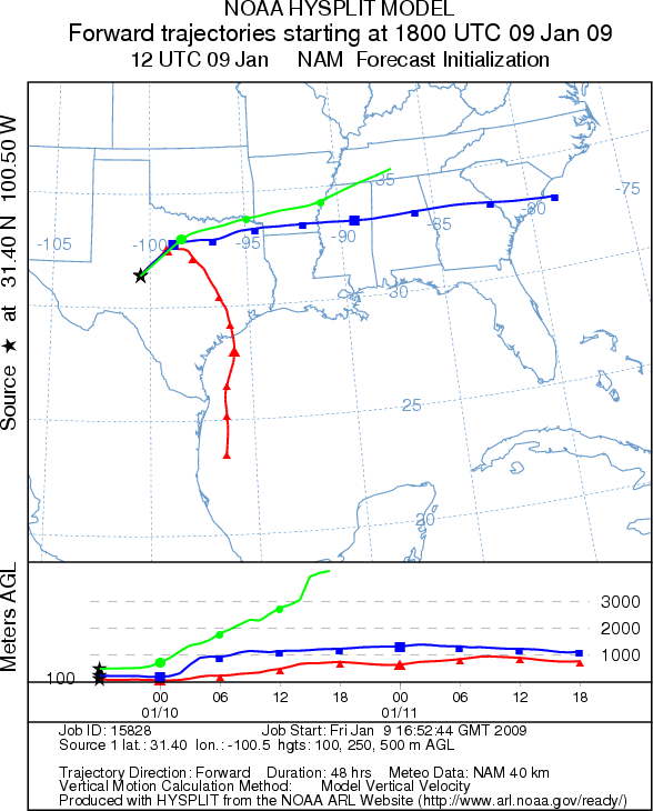
Trajectory weather: The air mass trajectories from the Edwards Plateau move to the northeast this afternoon
under the influence of strong south to southwest winds. As the cold front moves into the area with cold sinking
air and strong northwest winds the low level trajectories curve to the southeast. The upper level trajectories
continue moving to the northeast. Conditions at the source population along the Edwards Plateau are warm today
with above average temperatures and strong southwest winds. Overnight drizzle and warm moist Gulf air raised humidity
levels in the eastern side of the Plateau which may reduce pollen dispersal. The strong cold front will pass through
the region tonight and bring strong northwest winds to the area and much cooler temperatures tomorrow.
OUTLOOK: *** Moderate to High Threat today ***
Most areas have favorable conditions for pollen release and transport with warm temperatures and strong winds.
However, high humidity levels in some areas along the eastern side of the Plateau may reduce pollen levels. Since
the trees are in their peak release period significant amounts of pollen might be expected. The trajectory characteristics
do not show perfect atmospheric conditions leading to entrainment and travel downwind. However, since the trees
are in the peak pollen release period, high pollen levels can be expected.
Trajectory Start (s) (shown by *
on map): Austin, TX; Junction, TX; San Angelo, TX.
AUSTIN
JUNCTION
SAN ANGELO
EDWARDS PLATEAU COMPOSITE
Prepared by: Estelle
Levetin (Faculty of Biological
Science, The University
of Tulsa, 800 S. Tucker Dr., Tulsa, OK 74104) and ) and Peter K Van de Water (Department
of Earth and Environmental Science, California State University Fresno, 2576 East San Ramon Avenue, M/S ST24, Fresno
CA 93740-8039). This forecast gives the anticipated future track of released Mountain Cedar pollen, weather conditions
over the region and along the forecast pathway, and an estimated time of arrival for various metropolitan areas.
Questions: Aerobiology Lab e-mail: pollen@utulsa.edu
Return to Forecasting Home Page