Metropolitan Area |
Exposure Risk |
|
Dallas/Fort Worth |
Low / Low to Moderate |
|
Austin |
Low to Moderate/Moderate to High |
|
San Antonio |
Low to Moderate/Moderate to High |
Date Issued: 10 January 2009
Mountain Cedar Location(s): Edwards Plateau, Texas
Regional Weather: : Saturday and Sunday, Jan 10 and 11.
TX/OK: A strong cold front moved through the region late on Friday and early this morning bringing much
colder temperatures to the Texas-Oklahoma region. Temperatures will recover some this afternoon although highs
will still be 20 to 30 degrees colder than Friday. The cold front brings very dry air to the region with strong
northerly winds during the day today. The very dry air mass and mostly clear skies and light night time winds will
facilitate radiation cooling and large diurnal temperature ranges. Overnight lows will range from the low 20s to
the low 30s tonight. Temperatures will moderate on Sunday with temperatures in the 50s in Oklahoma and 60s in Texas.
Skies will be clear to partly cloudy with light to moderate variable winds. Low humidity will continue tomorrow
and cold overnight times will be in place again on Sunday night.
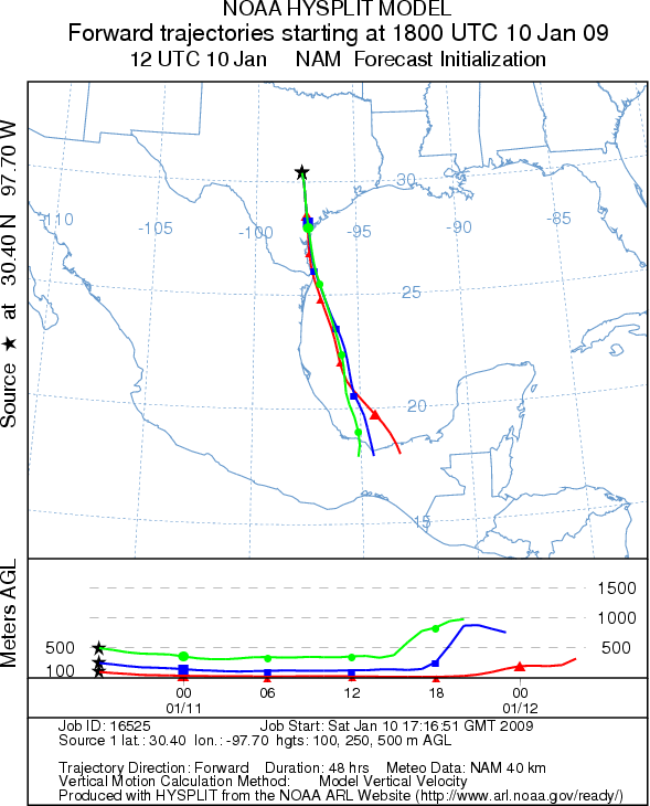
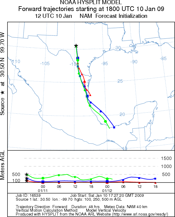
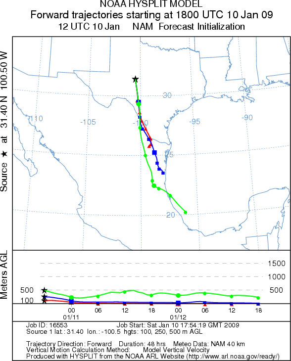
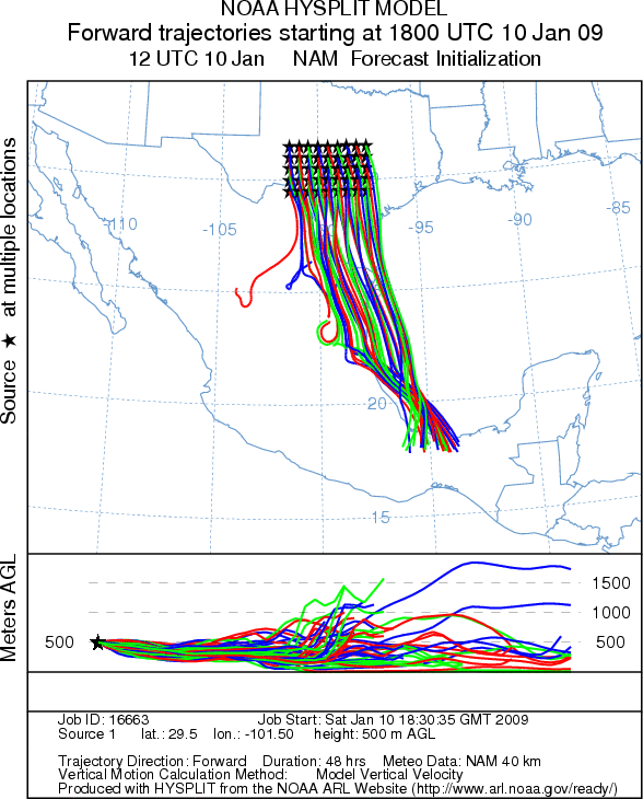
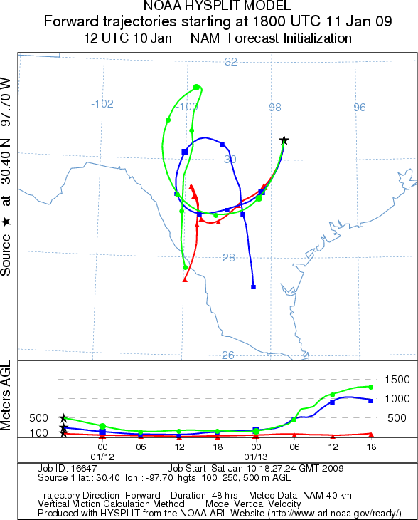
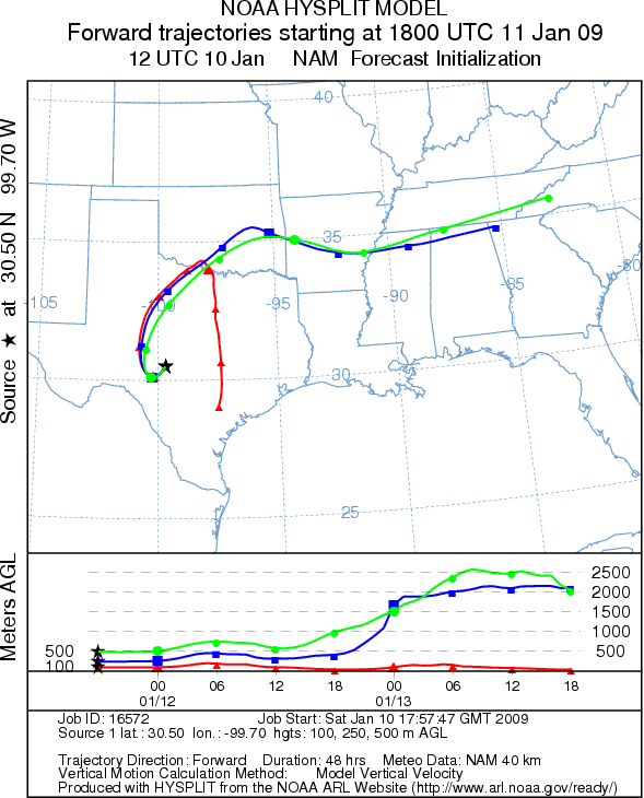
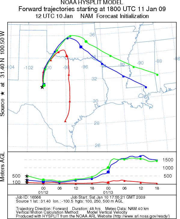
Trajectory weather: The air mass trajectories from the Edwards Plateau today move to the south under the
influence of strong northerly winds. Each of the trajectories show characteristics associated with the cold air
as the air masses sink towards the ground and move primarily at ground level. Conditions at the source areas will
be cold today but dry with sunny clear skies in most areas. The trees are near the peak of the pollen release
season; therefore, some pollen may be released but the cold temperatures should reduce levels today. In addition,
atmospheric conditions are not particularly good for pollen entrainment and transport downwind. Sunday's trajectories
are variable across the Plateau under the influence of the variable winds. Conditions at the source areas will
be again be cold tomorrow morning but warming to the 60s. The cold morning temperatures will limit pollen release
to the afternoon hours. Although there is a significant chance of pollen release tomorrow, conditions for entrainment
and travel will not be ideal.
OUTLOOK: *** Low to Moderate Threat today/ Moderate to
High Threat on Sunday *** Mixed conditions for pollen release today. Sunny
skies with dry windy conditions but cold temperatures coupled with moderate to strong winds across the region result
in mixed conditions for pollen release today. Since the trees are near their peak release period significant amounts
of pollen release might be expected in sheltered areas where localized temperatures may be greater. However, overall
the cold conditions should restrain significant release. The trajectory characteristics show poor atmospheric
conditions for entrainment and travel downwind. Across the region the cold air will move the atmosphere along
the ground, which usually results in the filtration of entrained particles as they travel. As a result any pollen
released today will remain close to the source areas. Conditions for pollen release improve tomorrow. Although
overnight temperatures will be low, it will warm to the 60s throughout the source areas. Significant release may
be expected. Trajectory characteristics are still not ideal for transport tomorrow, so pollen released will again
stay close to the source areas.
Trajectory Start (s) (shown by *
on map): Austin, TX; Junction, TX; San Angelo, TX.
SATURDAY
AUSTIN
JUNCTION
SAN ANGELO
EDWARDS PLATEAU COMPOSITE
SUNDAY
AUSTIN
JUNCTION
SAN ANGELO
Prepared by: Estelle
Levetin (Faculty of Biological
Science, The University
of Tulsa, 800 S. Tucker Dr., Tulsa, OK 74104) and ) and Peter K Van de Water (Department
of Earth and Environmental Science, California State University Fresno, 2576 East San Ramon Avenue, M/S ST24, Fresno
CA 93740-8039). This forecast gives the anticipated future track of released Mountain Cedar pollen, weather conditions
over the region and along the forecast pathway, and an estimated time of arrival for various metropolitan areas.
Questions: Aerobiology Lab e-mail: pollen@utulsa.edu
Return to Forecasting Home Page