The University of Tulsa
Mountain Cedar Pollen Forecast
Metropolitan Area |
Exposure Risk |
|
Dallas/Fort Worth |
Low to Moderate |
|
Austin |
Low to Moderate |
|
San Antonio |
Low to Moderate |
Date Issued: 16 January 2009
Mountain Cedar Location(s): Edwards Plateau, Texas
Regional Weather: Friday,
Jan 16. TX/OK: The
Arctic high continues to push southeast moving out of the region. Winds will gradually return to southerly although
temperatures will still be below normal today. In Oklahoma, highs will range from the mid 30s to 40 degrees under
clear to partly cloudy skies and light to moderate southerly winds. In Texas, cloud cover will keep the temperatures
in the 40s through most of central Texas with a chance of spotty drizzle during the day. Winds in Texas will gradually
shift from easterly to southerly by evening. Overnight lows will be much warmer than last night with temperatures
ranging from the upper 20s in the north to the low 40s in the south. Temperatures tomorrow will continue to warm
up with highs in the mid 50s in Oklahoma and upper 50s to low 60s in Texas. Winds will be from the southwest with
clear skies in Oklahoma and cloudy skies in Texas. A chance of light drizzle continues in central Texas. Winds
will gradually shift to northwesterly late tomorrow as a weak cold front moves in to the region.
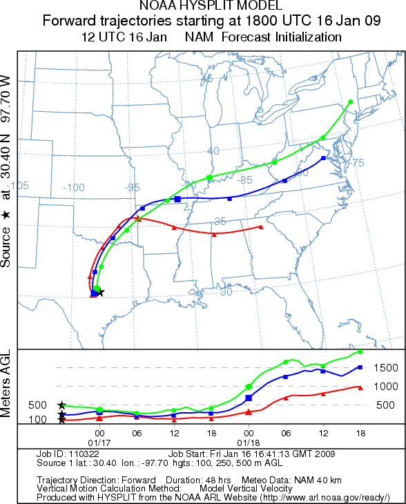
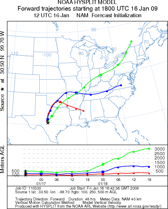
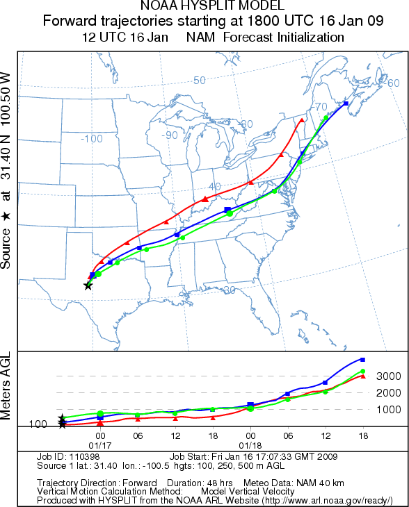
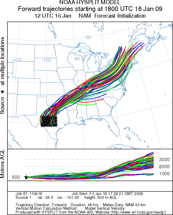
Trajectory weather: The air mass trajectories from eastern
Texas move to the west and then turn northeast over central Texas and Oklahoma, whereas those from the western
side of the Edwards Plateau directly move to the northeast. The trajectories show poor to moderate characteristics
for entrainment and travel. Conditions at the sources will be cool today with cloudy skies and a chance of light
drizzle. Tonight temperatures will stay above freezing with warmer temperatures tomorrow and southwest winds tomorrow.
A chance of drizzle still remains in the forecast for tomorrow in central Texas.
OUTLOOK: *** Low to Moderate Threat today
*** Marginal conditions for pollen release. Temperatures
will reach the favorable range but remain in the 40s through central Texas; however, a slight chance of drizzle
exists for the Plateau region. Since the trees are near the peak release period significant amounts of pollen release
might be expected in areas where localized temperatures may be greater and conditions are drier. Overall the cool
conditions should restrain significant release. Also, the trajectory characteristics do not show perfect atmospheric
conditions leading to entrainment and travel downwind. Warmer temperatures tomorrow may increase the risk of pollen
exposure.
Trajectory Start (s) (shown by *
on map): Austin, TX; Junction, TX; San Angelo, TX.
AUSTIN
JUNCTION
SAN ANGELO
EDWARDS PLATEAU COMPOSITE
Prepared by: Estelle
Levetin (Faculty of Biological
Science, The University
of Tulsa, 800 S. Tucker Dr., Tulsa, OK 74104) and ) and Peter K Van de Water (Department
of Earth and Environmental Science, California State University Fresno, 2576 East San Ramon Avenue, M/S ST24, Fresno
CA 93740-8039). This forecast gives the anticipated future track of released Mountain Cedar pollen, weather conditions
over the region and along the forecast pathway, and an estimated time of arrival for various metropolitan areas.
Questions: Aerobiology Lab e-mail: pollen@utulsa.edu
Return to Forecasting Home Page