Metropolitan Area |
Exposure Risk |
|
Dallas/Fort Worth |
Moderate / Low |
|
Austin |
Moderate to High / High |
|
San Antonio |
Moderate to High / High |
Date Issued: 17 January 2009
Mountain Cedar Location(s): Edwards Plateau, Texas
Regional Weather: Saturday and Sunday, Jan 17 and 18.
TX/OK: A weak frontal system is moving through northern Oklahoma this morning shifting winds from southwest
to northwest and dropping dew points. This front will bring only slightly cooler air into the region. On the whole,
temperatures on Saturday and Sunday will be quite mild. Oklahoma will see daytime temperatures today in the mid
50s to low 60s with clear to partly cloudy skies and moderate winds shifting to northwesterly. Overnight temperatures
will range from the upper 20s to the mid 30s in Oklahoma. On Sunday Oklahoma will have clear to partly cloudy skies
with highs in the 50s and moderate northwesterly winds. Sunday night will have lows in the upper 20s to low 30s
across the state. In Texas high temperatures today will be in the low 60s with partly to mostly cloudy skies. There
will be a chance of light fog or drizzle in some areas. Winds will be from the southwest. Overnight lows tonight
will range from the mid 30s to the upper 40s. On Sunday skies will be clear to partly cloudy with temperatures
ranging from the low 60s to the low 70s and moderate northwest winds across the region. Conditions will be dry.
Sunday night lows will range from the upper 20s to upper 30s.
Trajectory weather: Today the air mass trajectories from Edwards Plateau initially move to the northeast
but then shift to the east and southeast under the influence of the frontal system moving into the state. The trajectories
show mixed characteristics for downwind travel. Conditions at the source areas will be mild today with temperatures
in the 60s although in some areas humidity is running a little high. The trees are near the peak of the pollen
release season therefore pollen release should be expected. Sundays trajectories move to the southeast but show
poor conditions for downwind transport. Conditions will remain mild tomorrow with temperatures in the upper 60s
at the source areas.
OUTLOOK: *** Moderate to High Threat today and tomorrow ***
Good conditions for pollen release although a chance of drizzle in some areas today may limit pollen release.
Partly to mostly cloudy conditions with mild temperatures will occur today. Winds will shift from the southwest
to the northwest as a weak frontal system moves through the region. Pollen released today will travel to the east
for a moderate to high threat. Characteristics for downwind travel are not ideal so much of the pollen will remain
close to the source areas. Tomorrows trajectories travel to southeast but most of the pollen will remain close
to the source area with poor transport conditions.
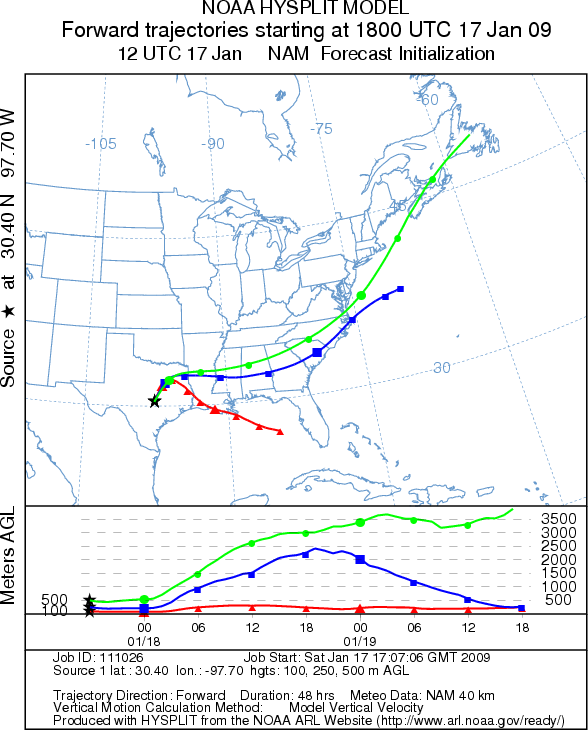
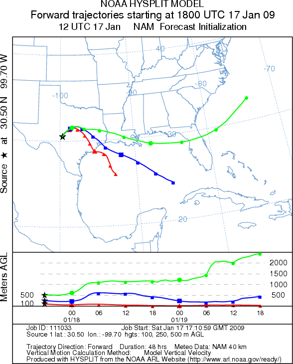
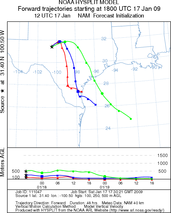
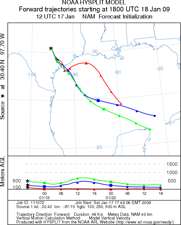
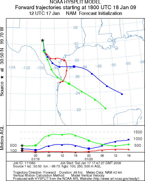
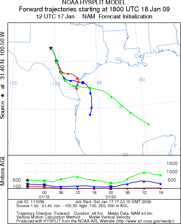
Trajectory Start (s) (shown by *
on map): Austin, TX; Junction, TX; San Angelo, TX.
AUSTIN - SATURDAY
JUNCTION - SATURDAY
SAN ANGELO - SATURDAY
EDWARDS PLATEAU COMPOSITE - SATURDAY
AUSTIN - SUNDAY
JUNCTION - SUNDAY
SAN ANGELO - SUNDAY
Prepared by: Estelle
Levetin (Faculty of Biological
Science, The University
of Tulsa, 800 S. Tucker Dr., Tulsa, OK 74104) and ) and Peter K Van de Water (Department
of Earth and Environmental Science, California State University Fresno, 2576 East San Ramon Avenue, M/S ST24, Fresno
CA 93740-8039). This forecast gives the anticipated future track of released Mountain Cedar pollen, weather conditions
over the region and along the forecast pathway, and an estimated time of arrival for various metropolitan areas.
Questions: Aerobiology Lab e-mail: pollen@utulsa.edu
Return to Forecasting Home Page