Metropolitan Area |
Exposure Risk |
|
Dallas/Fort Worth |
Low / Moderate |
|
Austin |
Low / Moderate to High |
|
San Antonio |
Moderate / Moderate to High |
Date Issued: 24 January 2009
Mountain Cedar Location(s): Edwards Plateau, Texas
Regional Weather: Saturday and Sunday, January 24 and
25 TX/OK: Across the region cold conditions will occur today with some warming tomorrow. Temperatures
will be in the 30s today in Oklahoma with clear to partly cloudy skies and moderate to strong winds from the north.
Overnight temperatures will be in the 20s with winds shifting to easterly. Temperatures tomorrow will be about
10 degrees warmer than today with highs reaching the 40s across Oklahoma. Skies will be partly cloudy and winds
from the east, southeast. Tomorrow night clouds will increase. Temperatures will be in the 20s in the north and
the 30s in the south with a chance of drizzle or freezing drizzle. Today, in north Texas and on the Edwards Plateau
temperatures will be in the 30s and 40s, while slightly warmer conditions, mid-50s, will occur in communities to
the south. Winds will be from the north today switching to a northeasterly direction overnight with skies clear
to partly cloudy. Overnight lows will range from the mid 20s to the upper 30s. Temperatures on Sunday will rebound
back into the mid-to upper 60s across much of Texas with winds coming from the south or southeast. Mostly sunny
skies will return on Sunday but partly cloudy conditions will return Sunday night with the chance of drizzle in
some areas.
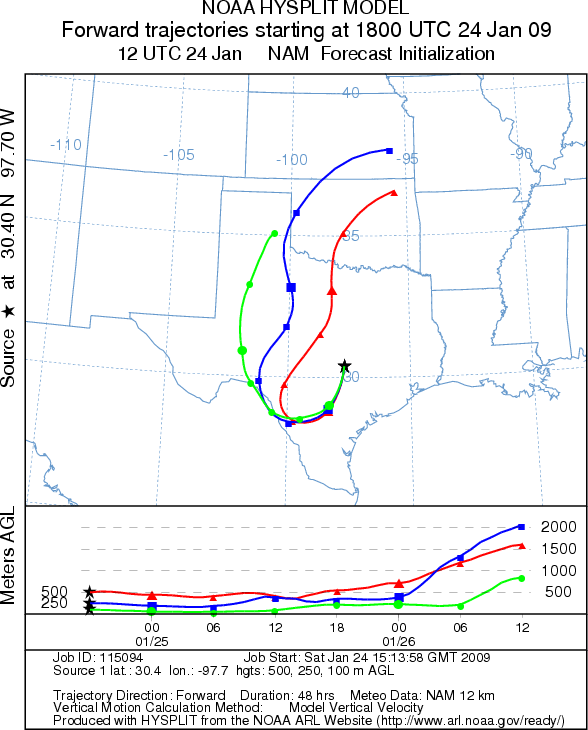
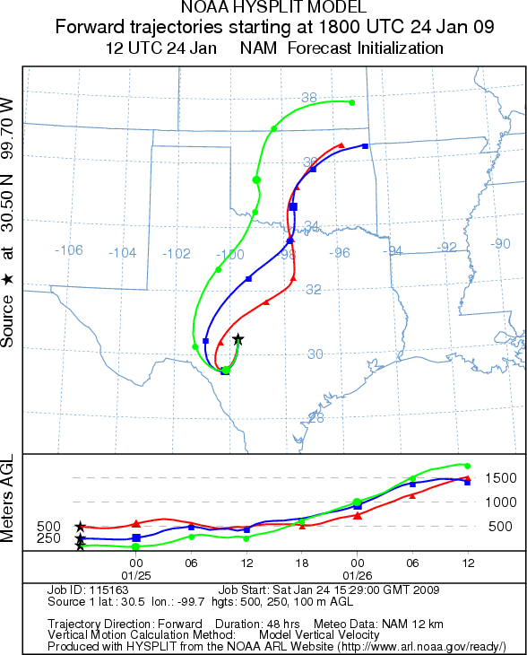
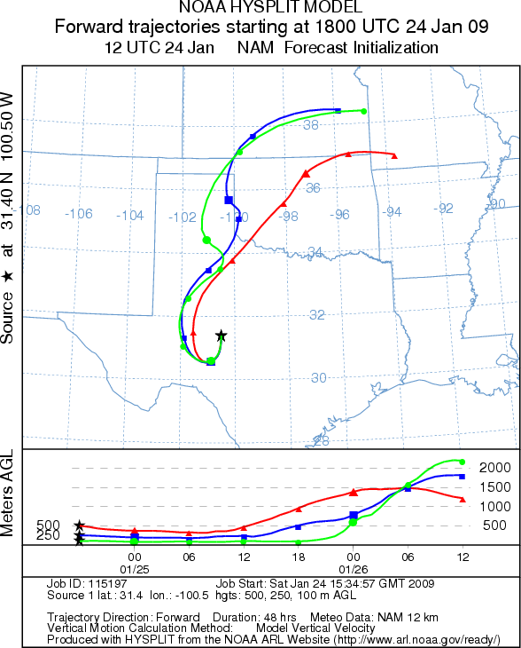
Trajectory weather: The air mass trajectories from the Edwards Plateau initially move to the south, southwest
this afternoon and then curve around to the west and then to the north. Each of the trajectories initially shows
characteristics associated with the cold air as the air masses sink towards the ground and move primarily at ground
level. Conditions at the sources will be cold today only reaching the favorable range in the southern areas of
the Plateau and San Antonio. In addition atmospheric conditions are not particularly good for pollen entrainment
and transport downwind. Tomorrow air mass trajectories move to the north and then turn sharply to the east. Conditions
at the source areas will improve greatly tomorrow after a cold night.
OUTLOOK: *** Low to Moderate Threat today/ Moderate to High Threat Tomorrow *** Generally, poor conditions for pollen release today along with poor
conditions for transport. Some pollen release is likely to occur today in the communities along the southeastern
edge of the Edwards Plateau. Tomorrow should see favorable conditions for pollen release after a cold night. Conditions
for transport should improve slightly tomorrow as well for an increased risk of exposure through the region.
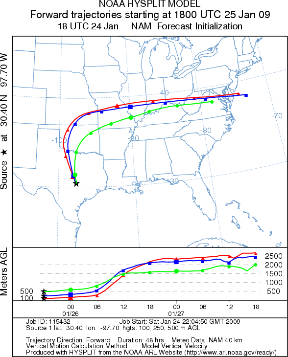
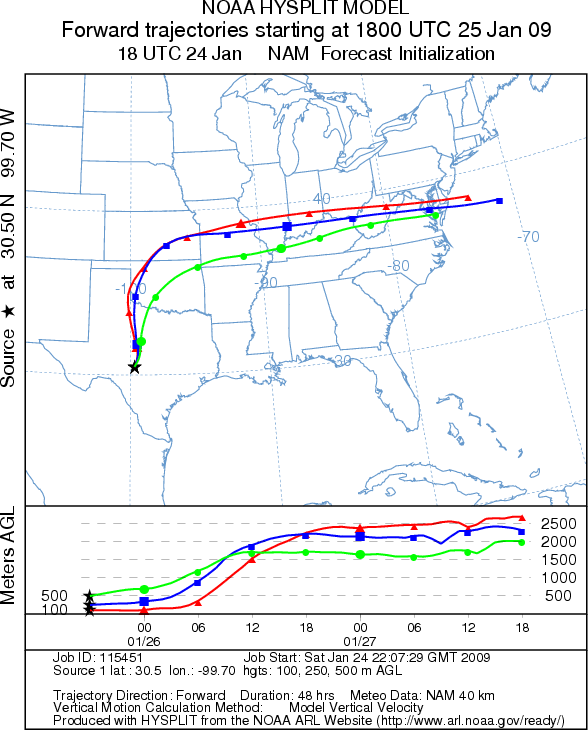
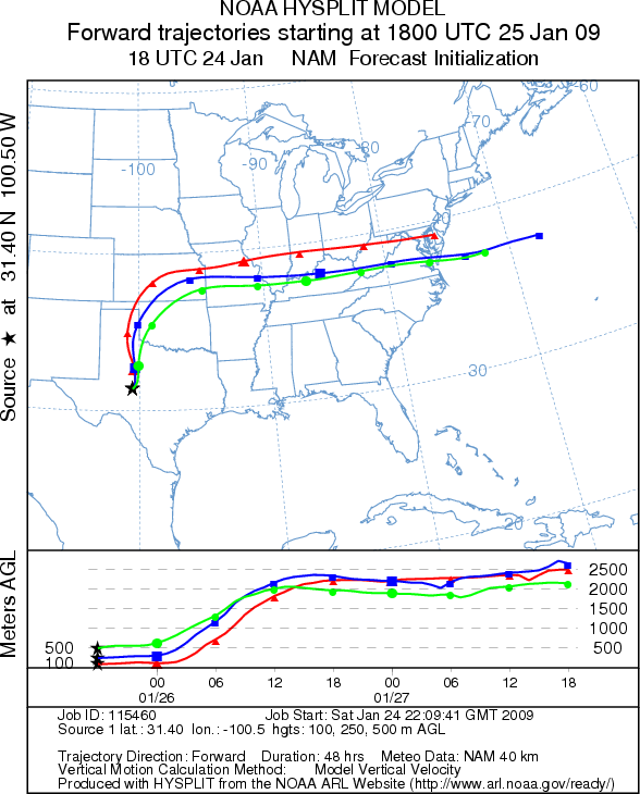
Trajectory Start (s) (shown by *
on map): Austin, TX; Junction, TX; San Angelo, TX.
AUSTIN - SATURDAY
JUNCTION - SATURDAY
SAN ANGELO - SATURDAY
EDWARDS PLATEAU COMPOSITE - SATURDAY
AUSTIN - SUNDAY
JUNCTION - SUNDAY
SAN ANGELO - SUNDAY
EDWARDS PLATEAU COMPOSITE - SUNDAY
Prepared by: Estelle
Levetin (Faculty of Biological
Science, The University
of Tulsa, 800 S. Tucker Dr., Tulsa, OK 74104) and ) and Peter K Van de Water (Department
of Earth and Environmental Science, California State University Fresno, 2576 East San Ramon Avenue, M/S ST24, Fresno
CA 93740-8039). This forecast gives the anticipated future track of released Mountain Cedar pollen, weather conditions
over the region and along the forecast pathway, and an estimated time of arrival for various metropolitan areas.
Questions: Aerobiology Lab e-mail: pollen@utulsa.edu
Return to Forecasting Home Page