The University of Tulsa
Mountain Cedar Pollen Forecast
Metropolitan Area |
Exposure Risk |
|
Dallas/Fort Worth |
Low |
|
Austin |
Low |
|
San Antonio |
Low to Moderate |
Date Issued: 27 January 2009
Mountain Cedar Location(s): Edwards Plateau, Texas
Regional Weather: Tuesday, January 27 TX/OK:
Across the region the weather will be affected by cold air and precipitation from the north today and tomorrow.
In Oklahoma, high temperatures will be in the 20s today. Freezing rain and sleet will continue through most of
the state with moderate to strong northerly winds. Overnight lows will be in the teens and high temperatures in
the 30s tomorrow. Tomorrow winds will decrease and switch first from the west and then tomorrow night from the
south. In Texas, temperatures will range from upper 20 and low 30s in the north after the cold front passes to
the 70s in south ahead of the front. The cold front will continue to move south today. As the cold weather moves
in, light rain will turn to light freezing rain throughout the region. Tonight temperatures will be in the mid
to low 30s on the Plateau and in the mid to upper 30s in the surrounding communities. Winds will be moderate to
strong from the north today and tomorrow. Tomorrow night, winds will begin to turn from the northeast in the surrounding
areas and from the southwest along the western portion of the Edwards Plateau.
Trajectory weather: Air mass trajectories from the Edwards Plateau move to the south today under the influence
of the strong northerly winds associated with the cold front. Cloudy skies today and tonight, with cold conditions
and the chance of precipitation (rain and freezing rain) will occur on the Edwards Plateau and in the surrounding
communities starting late today as the cold front moves into the region. There is a 50% to 80% chance of precipitation
on the Edwards Plateau and the surrounding communities, especially tonight. Winds will be moderate to strong from
the north today, tonight and tomorrow. Conditions in the tree population on the Edwards Plateau and surrounding
communities will be poor for pollen release today and tomorrow because of cold cloudy conditions, a significant
chance of precipitation, moderate winds and a dense heavy atmosphere that will stay near the ground. Similar conditions
will occur tomorrow but with an overall reduction in the chance of rain throughout the region.
OUTLOOK: *** Low Threat *** generally poor conditions for pollen release along
with poor conditions for entrainment and transport. Cold conditions with moderate winds and the chance of precipitation
will present poor conditions for pollen release, and poor conditions for entrainment and travel. Winds today will
be towards the south today, tonight and tomorrow. In San Antonio and surrounding areas there is a moderate risk
of pollen release early today ahead of the cold front. However, humidity is high which will limit the release.
Once the cold front moves through, pollen release will be inhibited.
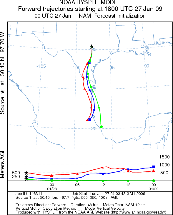
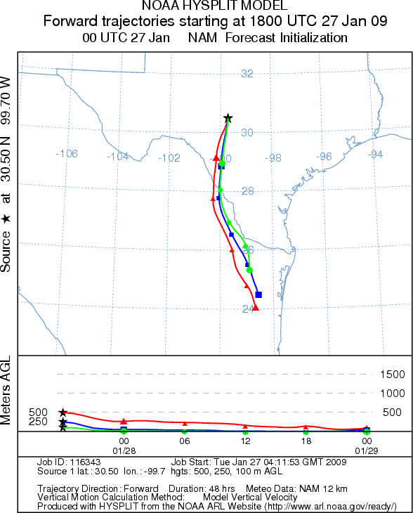
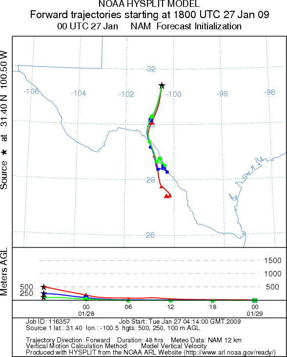
Trajectory Start (s) (shown by *
on map): Austin, TX; Junction, TX; San Angelo, TX.
AUSTIN
JUNCTION
SAN ANGELO
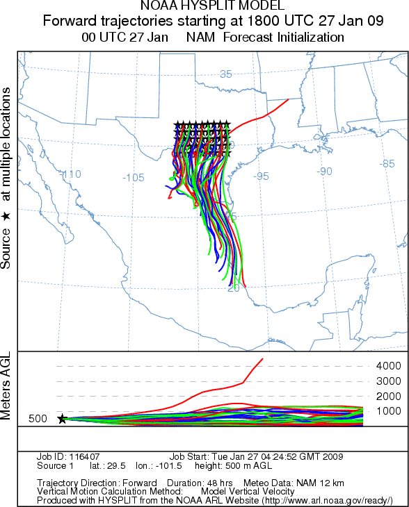
EDWARDS PLATEAU COMPOSITE
Prepared by: Estelle
Levetin (Faculty of Biological
Science, The University
of Tulsa, 800 S. Tucker Dr., Tulsa, OK 74104) and ) and Peter K Van de Water (Department
of Earth and Environmental Science, California State University Fresno, 2576 East San Ramon Avenue, M/S ST24, Fresno
CA 93740-8039). This forecast gives the anticipated future track of released Mountain Cedar pollen, weather conditions
over the region and along the forecast pathway, and an estimated time of arrival for various metropolitan areas.
Questions: Aerobiology Lab e-mail: pollen@utulsa.edu
Return to Forecasting Home Page