
SATURDAY / SUNDAY
The University of Tulsa
Mountain Cedar Pollen Forecast
SATURDAY / SUNDAY
Metropolitan Area |
Exposure Risk |
|
Dallas/Fort Worth |
Low to Moderate |
|
Austin |
High |
|
San Antonio |
High |
Date Issued: 23 January 2010
Mountain Cedar Location(s): Edwards Plateau, Texas
Regional Weather: Sat
and Sun, January 23 and 24 TX/OK: Across the region the weather will be mixed today with rain showers
across Oklahoma and Texas this morning. The system is moving slowly eastward and on the back side will be strong
westerly winds. Temperatures will remain seasonal in the north and warm in the southern areas. The Edwards Plateau
is expected to see temperatures in the mid to upper 60s in the communities surrounding the Plateau temperatures
will be in the 70s. Winds this morning will start at moderate levels and in the afternoon build to very strong
conditions to the west and strong wind strength in the other areas. Tonight will have partly to mostly cloudy skies
with a chance of thunderstorms developing across the region. A 20% to 30% chance of rain remains in northern Texas
and southern Oklahoma. Low temperatures tonight will be in the upper 30s to the north and west with the remaining
areas in the mid to low 40s. Winds will continue from the west at moderate levels. Sunday will be sunny across
Texas with partly cloudy skies across central and southern Oklahoma. Temperatures will once again return into the
70s in the communities surrounding the Plateau and into the lower 60s across the Plateau. In Oklahoma temperatures
will be in the upper 40s north and in the upper 50s in the Arbuckle Mountain region. Winds will continue from the
west at strong levels across the Plateau, and from the northwest at moderate to strong conditions elsewhere. Sunday
night will be mostly clear to clear with temperatures in the 30s in most areas. Western Texas will see temperatures
in the 20s. Winds will begin to calm but remain from the west.
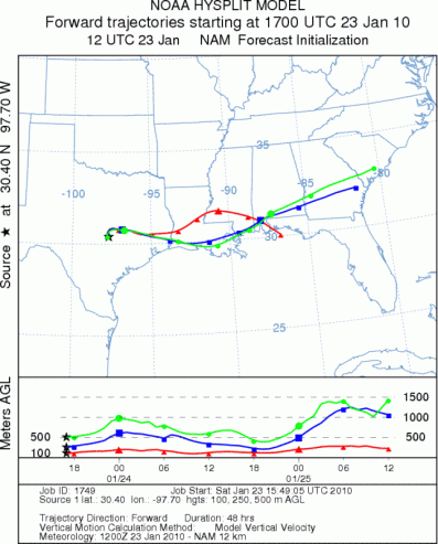
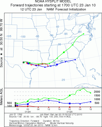
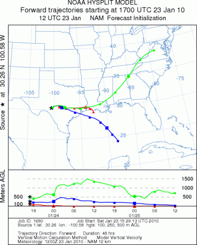
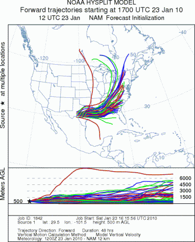
Trajectory weather: Conditions today will be cloudy to mostly cloudy with precipitation and the chance of
thunderstorms today and this afternoon. Strong winds from the west will develop and temperatures will rise into
the 60s and 70s. Tonight a chance of thunderstorms will still be in the area early. Skies will be partly to mostly
cloudy in the surrounding areas and mostly clear over the Plateau. Temperatures will be in the lower 40s and upper
30s with moderate winds from the west. Sunday will be sunny across the region with temperatures in the 60s and
70s once again. Winds will be strong from the west across the Plateau and moderately strong in the surrounding
communities. Sunday night will be mostly clear with cooler condtions. Temperatures are expected in the lower 30s
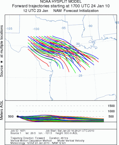
and upper 20s to the west. The trajectories move towards the east today and tonight on strong westerly winds. The
atmosphere is relatively unstable and buoyant. Tomorrow the trajectories move a little more southward and move
out over the Gulf of Mexico..
OUTLOOK: *** High Threat today; High threat tomorrow *** Good conditions for pollen
release today and Good conditions tomorrow; Good conditions for entrainment and transport today, poor to moderate
conditions tomorrow. After the rain moves through the areas today, warm temperatures and very windy conditions
should dry the cones and lead to pollination. Strong westerly winds will move most of the pollen almost directly
eastward. Skies will be partly cloudy today and tonight, although the winds will remain strong to moderately strong
over the period. Tomorrow sunny skies will combine with increasing wind strength during the day and warm temperatures
to make for very good conditions for pollination. Winds will begin to relax Sunday evening and night. The atmosphere
will be relatively buoyant today and tomorrow so not only are conditions for release good today and better tomorrow,
but the conditions for entrainment and travel are excellent as well. Because of the good conditions for pollen
release as well as entrainment and travel a high threat exist today and tomorrow.
Trajectory Start (s) (shown by *
on map): Austin, TX; Junction, TX; Sonora, TX.
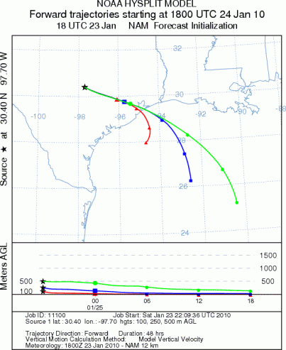
AUSTIN - SATURDAY
JUNCTION - SATURDAY
SONORA - SATURDAY
EDWARDS PLATEAU COMPOSITE - SATURDAY
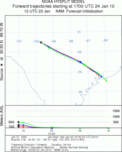
AUSTIN - SUNDAY
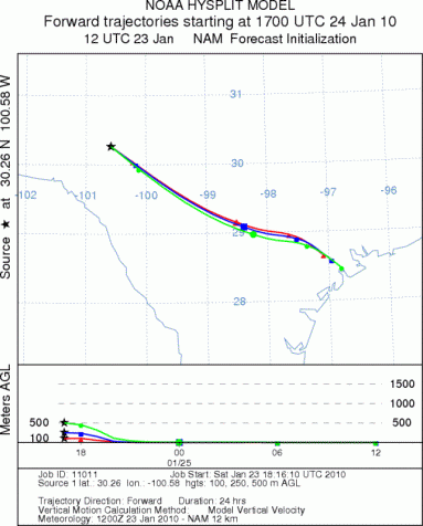
JUNCTION - SUNDAY
SONORA - SUNDAY
EDWARDS PLATEAU COMPOSITE - SUNDAY
Prepared by: Estelle
Levetin (Faculty of Biological
Science, The
University of Tulsa, 800 S. Tucker Dr., Tulsa, OK 74104) and ) and Peter
K Van de Water (Department of Earth and Environmental Science, California State University Fresno,
2576 East San Ramon Avenue, M/S ST24, Fresno CA 93740-8039). This forecast gives the anticipated future track of
released Mountain Cedar pollen, weather conditions over the region and along the forecast pathway, and an estimated
time of arrival for various metropolitan areas.
Questions: Aerobiology Lab e-mail: pollen@utulsa.edu
Return to Forecasting Home Page