
The University of Tulsa
Mountain Cedar Pollen Forecast
Metropolitan Area |
Exposure Risk |
|
Dallas/Fort Worth |
Low |
|
Austin |
Low |
|
San Antonio |
Low |
Date Issued: 4 January 2013
Mountain Cedar Location(s): Edwards Plateau, Texas
Regional Weather: Friday, January 4 TX/OK: Across
the region the weather continues to be seasonally cool with a chance of precipitation today and tonight. Across
Texas today there is a chance of snow and rain developing across most of the region as temperatures warm during
the day. This morning most areas were in the upper 20s to low 30s. There is a 20% chance of rain to the north
in the Dallas/Fort Worth area, with increasing amounts of rain along the edge communities (40% chance) and over
the Edwards Plateau (50% chance). High temperatures today will eventually struggle to get into the mid to lower
40s. Winds will be from the east to northeast as the precipitation slides off to the east. In the north, Oklahoma,
and on the western most side of the Edwards Plateau a more southerly flow will begin to move into the region.
Overnight rain and snow will return to most areas off of the Edwards Plateau. The chance of precipitation will
remain at about 20%. Skies will be cloudy to mostly cloudy and low temperatures will be in the 30s in the surrounding
communities and to the north. On the Edwards Plateau, low temperatures will be in the upper 20s. Winds will
continue to move around, coming from the south overnight. The eastern most communities, around the edge of the
Edwards Plateau will retain the northeasterly winds until the morning hours. Tomorrow mostly sunny skies will
return to the region. Winds will be from the south to southwest bringing warming temperatures. In Oklahoma, tomorrows
temperatures will reach into the high 40s whereas across Texas warmer conditions in the lower 50s will reestablish
themselves. Winds will be lite in most areas. Tomorrow night the surrounding areas will have partly cloudy conditions
with mostly clear to clear conditions elsewhere. Temperatures will return back into the upper 20s as winds reestablish
themselves from the northwest. Along the edge communities northward toward Dallas/Fort Worth winds will begin
from the south but also switch to a northerly direction overnight.
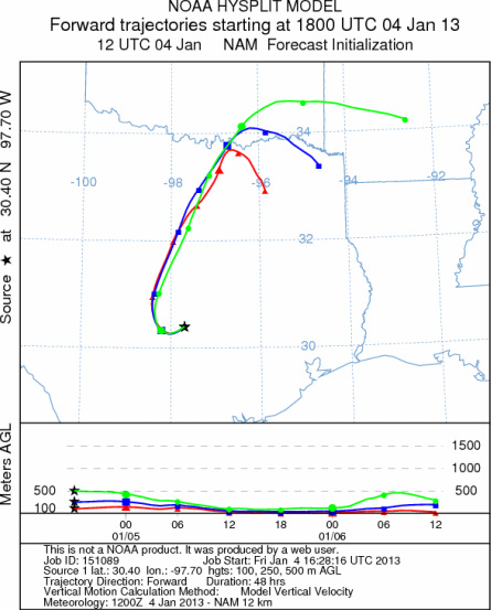
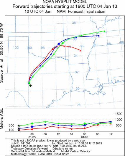
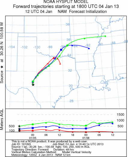
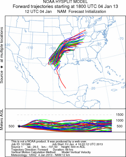
Trajectory weather: Air mass trajectories over the Edwards Plateau move northward then to the east as the
moisture that is currently across the region slides eastward. The trajectories move towards the southeastern portion
of Oklahoma and then northeastward over northern Arkansas and southern Missouri. The air will be buoyant as a
system moves through the area and moisture continues to stream in from the west. The interaction with the dominant
cold conditions from the north and northeast that continues to be entrenched today will result in a chance of frozen
precipitation (snow/sleet) and rain across the region. Over the past 24 hours most of the Edwards Plateau has
seen either frozen precipitation or rain. Conditions will continue to be cold today and tonight. Tomorrow warmer
conditions will return with most areas in Texas heading into the 50s. The Arbuckle Mountains in southern Oklahoma
will remain in the upper 40s. Therefore little pollen release is expected today but tomorrow conditions will improve
significantly. The relatively cold conditions and recent rains, along with the chance of precipitation today into
tonight should stall significant pollen release. Tomorrow the drying of the region will begin in earnest and local
pollen concentrations will begin to build. Minor local releases are always possible and may affect allergy sufferers
directly if they are in close contact with individual trees. Tonight cold conditions will return especially as
skies begin to clear.
OUTLOOK: *** Low Threat today and Moderate Threat tomorrow
*** Cool to moderate temperatures across the region for pollen release today, but tomorrow temperatures warm
and skies clear. Temperatures today will struggle to get into the 40s on the Edwards Plateau and in the surrounding
edge communities. The chance of precipitation will remain across the area today and tonight. The atmosphere will
be buoyant as a moist system from the west and southwest interacts with the dominant north to northeasterly flow
of cold air. For these reasons there will be good conditions for entrainment and travel at times but pollen release
should be minimal today with the precipitation across the area. Tomorrow warm conditions return and pollen should
begin to flow once again. The trees will start slow as the region needs to both warm and dryout. We are approaching
the heart of the historic pollination season and the longterm forecast suggest a string of warmer days on the horizon.
Today there will be low pollen levels if any pollen in the atmosphere. Tomorrow pollen will be on the rise.
Conditions have provided a nice break for allergy sufferers, but as the region dries out the pollination season
will return.
Trajectory Start (s) (shown by *
on map): Austin, TX; Junction, TX; Sonora, TX.
AUSTIN
JUNCTION
SONORA
EDWARDS PLATEAU COMPOSITE
Prepared by: Estelle
Levetin (Faculty of Biological
Science, The
University of Tulsa, 800 S. Tucker Dr., Tulsa, OK 74104) and ) and Peter
K Van de Water (Department of Earth and Environmental Science, California State University Fresno,
2576 East San Ramon Avenue, M/S ST24, Fresno CA 93740-8039). This forecast gives the anticipated future track of
released Mountain Cedar pollen, weather conditions over the region and along the forecast pathway, and an estimated
time of arrival for various metropolitan areas.
Questions: Aerobiology Lab e-mail: pollen@utulsa.edu
Return to Forecasting Home Page