
The University of Tulsa
Mountain Cedar Pollen Forecast
Metropolitan Area |
Exposure Risk |
|
Dallas/Fort Worth |
Low |
|
Austin |
Low |
|
San Antonio |
Low |
Date Issued: 6 January 2014
Mountain Cedar Location(s): Edwards Plateau, Texas
Regional Weather: Monday, January 6 TX/OK: The
region today will be climbing out of the coldest conditions of the season. Overnight low temperatures have toyed
with temperatures below 0 degrees Fahrenheit. To the south lows in San Antonio were well into the lower 20s with
teens on the Edwards Plateau. Most areas today will struggle to get above freezing and only to the far south will
they approach the 40s. Winds will begin from the north today but overnight the direction will begin to shift to
a flow from the south, eventually bringing warmer conditions for tomorrow. Temperatures tonight will remain dangerously
cold with only the furthest south communities in the low 20s, the remainder of the region will be in the teens.
Tomorrow sunny conditions and southerly winds will begin the warm-up from the deep freeze. Skies will be sunny
tomorrow and across Texas and north to Oklahoma the temperatures will build into the mid to upper 40s. Winds
will be from the south at moving between 10 and 20 mph northward. In the surrounding communities a chance of
precipitation will start to build tomorrow night with both Austin and San Antonio having a 20% chance of rain.
The overnight temperatures will stay mostly above the freezing mark, except for the northern area north of Texas
in southern and central Oklahoma.
Trajectory weather: Air mass trajectories over Texas move initially southward, bringing the last of the
frigid air over the region. This afternoon and tonight winds will turn coming from the south to begin to ameliorate
the cold with warmer conditions across the region tomorrow. The air over the region is cold and dense thus the
winds that move northward will override many areas leaving pools of very cold air throughout the day tomorrow and
into tomorrow evening. Winds tomorrow and tomorrow night will work to push the remaining cold conditions further
northward. It is not expected that conditions today and tomorrow will be conducive for pollen release. If any
pollen is shed it would be tomorrow as conditions strive to get into the upper40s. Then tomorrow night in the
communities surrounding the Edwards Plateau the southerly winds will bring moisture northward with a 20% chance
of showers overnight in Austin westward to San Antonio.
OUTLOOK: *** Low Threat Today and Low Threat Tomorrow *** Very Poor conditions
for pollen release today in the Texas populations as the frigid weather keeps temperatures well below the level
that is good for pollen release. Today temperatures will struggle to get into the 40s with most areas staying
in the 30s. Winds will switch this afternoon and this evening starting a warm up with southerly breezes bringing
milder conditions. Tomorrow, temperatures will begin to build but still remain at levels that are not particularly
conducive for pollen release. Conditions for entrainment and travel will be poor both days with heavy dense cold
air moving at ground level.
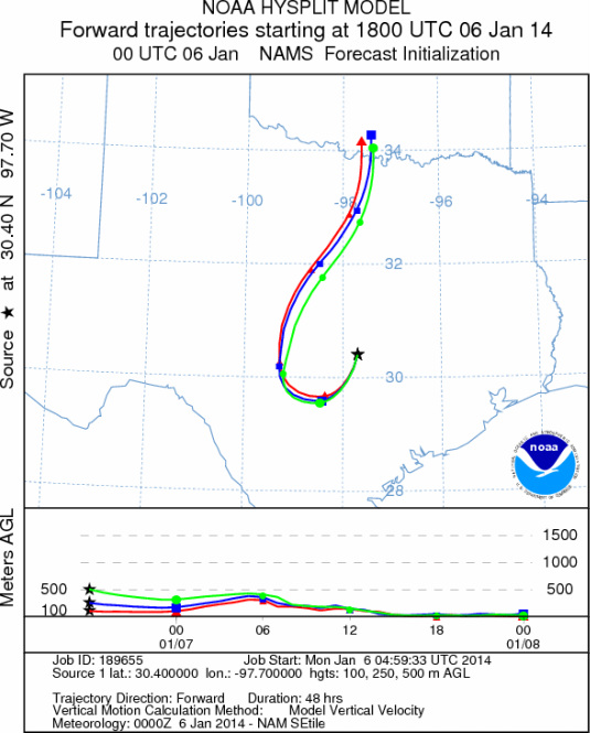
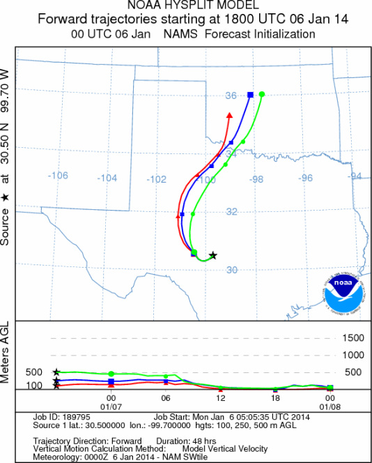
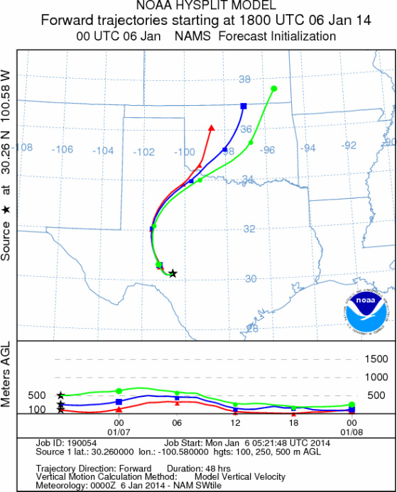
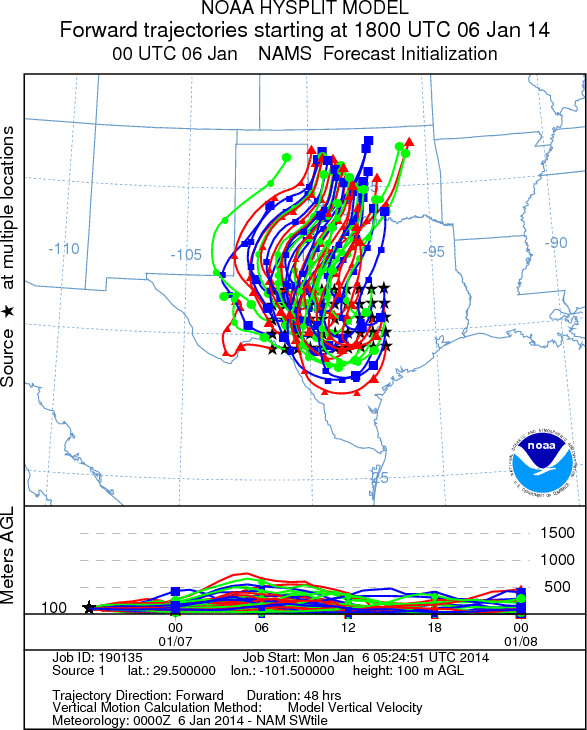
Trajectory Start (s) (shown by *
on map): Austin, TX; Junction, TX; Sonora, TX.
AUSTIN
JUNCTION
SONORA
EDWARDS PLATEAU COMPOSITE
Prepared by: Estelle
Levetin (Faculty of Biological
Science, The
University of Tulsa, 800 S. Tucker Dr., Tulsa, OK 74104) and ) and Peter
K Van de Water (Department of Earth and Environmental Science, California State University Fresno,
2576 East San Ramon Avenue, M/S ST24, Fresno CA 93740-8039). This forecast gives the anticipated future track of
released Mountain Cedar pollen, weather conditions over the region and along the forecast pathway, and an estimated
time of arrival for various metropolitan areas.
Questions: Aerobiology Lab e-mail: pollen@utulsa.edu
Return to Forecasting Home Page