
The University of Tulsa
Mountain Cedar Pollen Forecast
Metropolitan Area |
Exposure Risk |
|
Dallas/Fort Worth |
Low |
|
Austin |
High |
|
San Antonio |
High |
Date Issued: 21 January 2014
Mountain Cedar Location(s): Edwards Plateau, Texas
Regional Weather: Tuesday, January 21 TX/OK:
The region remains under sunny skies today and tomorrow. Southern Oklahoma will be sunny today with high temperatures
only reaching the mid-40s, it will be clear tonight and sunny again tomorrow. Tomorrow temperatures will warm
into the upper 50s. This morning the areas surrounding the Edwards Plateau will be mostly sunny with high temperatures
in the mid- to upper 50s. Areas on the Plateau will be in the mid to upper 50s. Cooler conditions will occur
to the north with the Dallas/Ft. Worth area just reaching 50 degrees, winds will be from the north at moderate
levels. Tonight the low temperatures will drop into the mid-20s across the Edwards Plateau and north towards Oklahoma.
In the areas surrounding the Plateau the lows will be at or near 30 degrees. The entire region is expected to
dip below freezing. Winds in the communities surrounding the Plateau and the corridor north towards the Dallas/Ft.
Worth area will continue to see winds from the north. The Plateau and northward into Oklahoma will have a southwesterly
flow that will start to warm the area tomorrow. Wednesday will see sunny and mostly sunny skies. Temperatures
will bounce back into the mid to upper 60s across Texas. It will climb into the mid to upper 50s in southern Oklahoma.
Winds will be out of the southwest at light to moderate conditions. Tomorrow night the southwesterly flow will
bring greater moisture to the area and partly cloudy to mostly cloudy conditions. Low temperatures will be in
the mid to upper 30s overnight, except in Oklahoma where cold northeasterly breezes will keep temperatures in the
teens to low 20s. Winds will be from the east and southeast across central Texas and very gusty in places. On
the plateau gusts of 20 to 25 miles per hour are expected.
Trajectory weather: Air mass trajectories over the Edwards Plateau will begin the day under sunny skies
with moderate winds from the north bringing cold conditions. Temperatures today will be 10 to 20 degrees cooler
than conditions over the past few days. Winds will be moderate to strong over central Texas. The cooling winds
will be from the north during the day switching coming from the southwest tonight. The cold conditions should
result in less pollen being dispersed, however the stronger winds will be able to shake out and disperse pollen
from the previously opened cones. The winds will move southward on the north to south flow. This flow will bring
cold air across the northern regions tonight. Low temperatures across southern Oklahoma and Texas will be at or
below freezing. Overnight the winds will switch with a southwesterly flow building back in. This change will
begin in the southern Oklahoma and Edwards Plateau region first. The eastern Plateau and surrounding communities
will see the switch in the morning. Tomorrow temperatures begin to warm again under sunny and mostly sunny skies.
Winds will be from the south and southwest at light to moderate conditions. Trajectories heading southward today
will be moving northward tomorrow. Tomorrow night easterly winds will push the air over Texas and southern Oklahoma
towards the west on an easterly flow.
OUTLOOK: *** High Threat today and High Threat Tomorrow *** Conditions for pollen
release today remain are moderate with temperatures in the upper 50s across the Texas region. Temperatures tomorrow
will begin to warm as cold air will be displaced by warmer air from the southwest. Winds will be moderate today
and the air will be cold and dense at the ground surface. The trajectories appear to move small distances at the
surface because of the cold dense air. At upper levels the trajectories will be stronger and move greater distances.
The northerly flow will keep surface pollen mostly over the population areas. If it gets entrained it will move
some distance with stronger winds aloft and will move off to a northeasterly direction. It does not appear that
today will be a significant exporter of pollen from the region with the cooler temperatures. The region has also
had a significant run of very good days of pollination and the overall counts across the region have been stabilizing
and in some places decreasing. This may only be a lull while more pollen matures and gets ready to be released.
Indications are that pollen remains ready to be released and entrained into the atmosphere. High levels continue
to be recorded at reporting stations across the region.
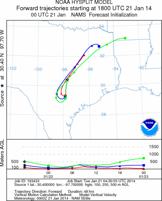
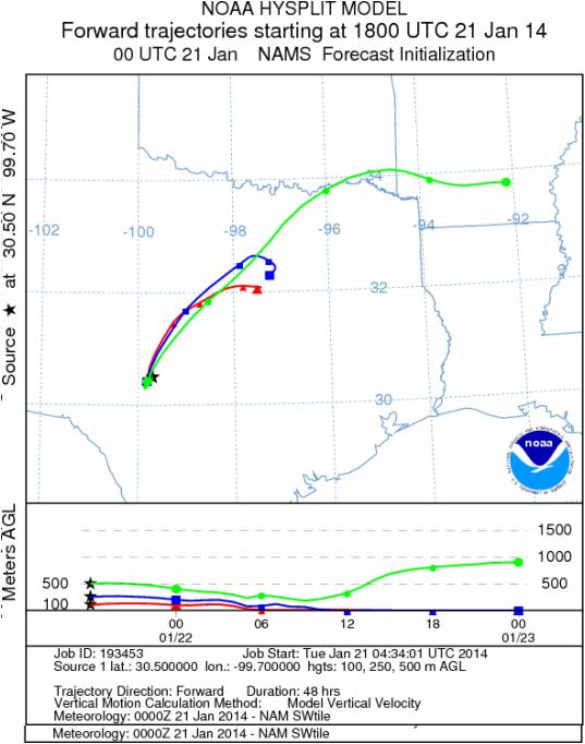
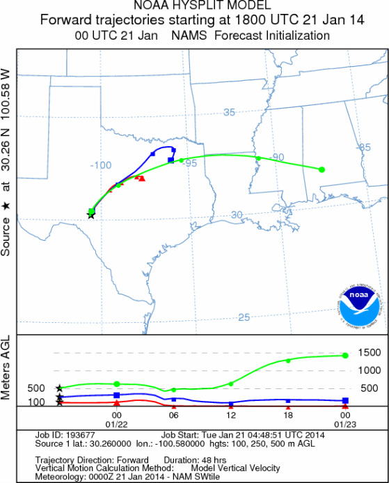
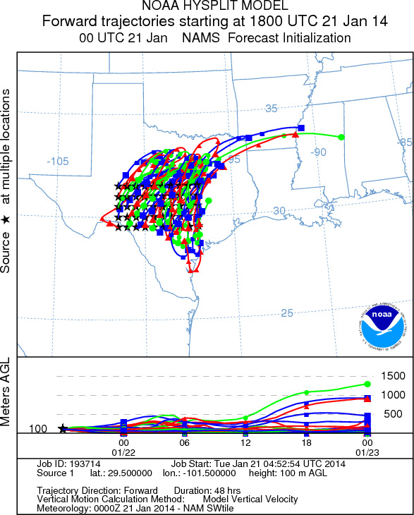
Trajectory Start (s) (shown by *
on map): Austin, TX; Junction, TX; Sonora, TX.
AUSTIN
JUNCTION
SONORA
EDWARDS PLATEAU COMPOSITE
Prepared by: Estelle
Levetin (Faculty of Biological
Science, The
University of Tulsa, 800 S. Tucker Dr., Tulsa, OK 74104) and ) and Peter
K Van de Water (Department of Earth and Environmental Science, California State University Fresno,
2576 East San Ramon Avenue, M/S ST24, Fresno CA 93740-8039). This forecast gives the anticipated future track of
released Mountain Cedar pollen, weather conditions over the region and along the forecast pathway, and an estimated
time of arrival for various metropolitan areas.
Questions: Aerobiology Lab e-mail: pollen@utulsa.edu
Return to Forecasting Home Page