
The University of Tulsa
Mountain Cedar Pollen Forecast
Metropolitan Area |
Exposure Risk |
|
Dallas/Fort Worth |
Low |
|
Austin |
Low |
|
San Antonio |
Low |
Date Issued: 24 January 2014
Mountain Cedar Location(s): Edwards Plateau, Texas
Regional Weather: Friday, January 24 TX/OK:.
Cold air from the northeast and the possibility of rain and freezing precipitation arrived yesterday evening across
the region with a wintery mix of precipitation occurring over the Edwards Plateau. Today Texas will be recovering
from this blast of winter and begin a warming period that will quickly bring temperatures back into the 60s by
the weekend. However, today the region will be under the grips of very cold conditions with a slight chance of
continued precipitation as rain or freezing rain in the communities surrounding the edge of the Edwards Plateau.
In Oklahoma the clouds will be leaving and sunny skies will dominate. Overnight conditions were very cold with
southern Oklahoma in the teens and most of Texas dropping into the 20s. As the day begins temperatures will be
warming but highs across the region will struggle to get into the 40s. The warmer conditions will begin to the
southwest with southwesterly breezes moving warmer air across the region starting this afternoon. Southern Oklahoma
will start the day sunny and cold but will also see the southwesterly flow build in as conditions begin to improve.
Tonight temperatures will again drop below freezing with the Plateau and Oklahoma falling into the 20s and the
edge communities and along the I-35 corridor being in the low 30s. The mostly cloudy skies will begin to break-up
to partly cloudy conditions and winds will be light from the southwest to west. Tomorrow mostly sunny conditions
will dominate the region from Oklahoma through Texas, with partly cloudy skies to the west and southwest. High
temperatures will return back into the 60s across the region. Winds will be from the west in the edge communities
at light levels whereas more of a northerly flow will occur in the other areas. Winds will be light. It will
be a return to conditions of a week ago with warm temperatures and good conditions. Tomorrow night the region
will be partly cloudy with lows above freezing but in the 30s to low 40s and light southerly winds.
Trajectory weather: Air mass trajectories over southern central Texas will begin the day under cloudy to
mostly cloudy conditions initially with northerly breezes, turning quickly during the day with a dominant southwesterly
flow. The very cold conditions overnight, temperatures into teens will begin to warm as the colder northerly air
gives way. The trajectories move initially towards the south but then turn towards a northeasterly flow. The
winds will be very light thus the overall distance that the air moves will not be great. There is still a potential
of precipitation across the region this morning although it appears to be tapering off significantly. With the
light winds and the atmosphere starting dense and cold the trajectories will move mostly at ground level. The
very low temperatures overnight should impede the release of large amounts of pollen today, but conditions from
tomorrow are improving significantly. Today should be a period of recovery for the trees and then tomorrows 60
degrees should initiate pollination once again. Tomorrow skies will be partly cloudy to mostly sunny, highs in
the 60s, and light winds from the southwest. Tomorrow night lows will remain above freezing dropping into the
upper 30s and low 40s.
OUTLOOK: *** Low Threat Today and High Threat Tomorrow
*** Conditions for pollen release today and will be poor but much better tomorrow. Temperatures will be climbing
from the low teens this morning and highs are expected to only get briefly into the low to mid 40s. Over the region
conditions will be improving tomorrow with warming into the 60s and light winds from the southwest. The changes
that occurred with the colder air from the northeast chilled the region and should restrict any pollen release
today. High temperatures tomorrow are expected to return back into the 60s with light winds and much better conditions
for release. Winds will be light and thus pollen entrainment and travel is not expected to be significant, but
within the areas of the tree populations pollen may be prevalent. We will be watching to see how well the pollen
in the atmosphere returns from these cold conditions. Just prior to the incursion of yesterdays weather system
pollen counts had begun to diminish a bit but there still seems to be ample pollen ready to be released.
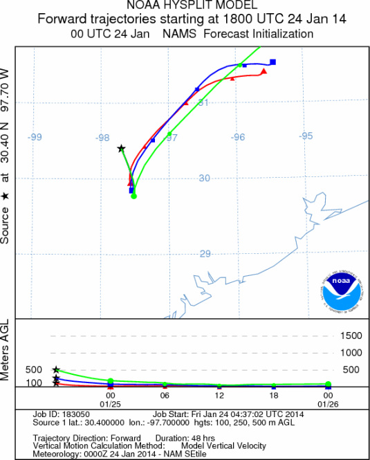
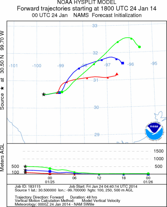
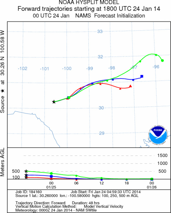
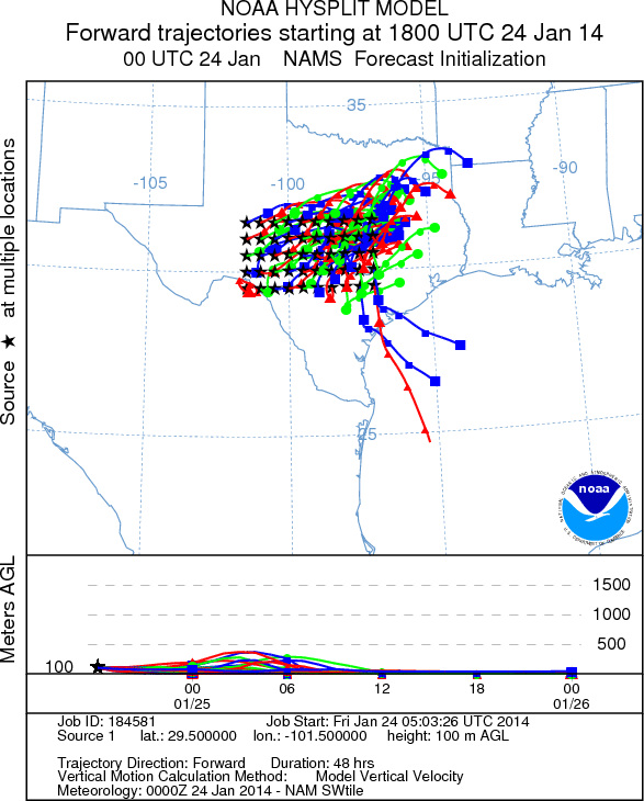
Trajectory Start (s) (shown by *
on map): Austin, TX; Junction, TX; Sonora, TX.
AUSTIN
JUNCTION
SONORA
EDWARDS PLATEAU COMPOSITE
Prepared by: Estelle
Levetin (Faculty of Biological
Science, The
University of Tulsa, 800 S. Tucker Dr., Tulsa, OK 74104) and ) and Peter
K Van de Water (Department of Earth and Environmental Science, California State University Fresno,
2576 East San Ramon Avenue, M/S ST24, Fresno CA 93740-8039). This forecast gives the anticipated future track of
released Mountain Cedar pollen, weather conditions over the region and along the forecast pathway, and an estimated
time of arrival for various metropolitan areas.
Questions: Aerobiology Lab e-mail: pollen@utulsa.edu
Return to Forecasting Home Page