The University of Tulsa
Mountain Cedar Pollen Forecast

Metropolitan Area |
Exposure Risk |
|
Oklahoma City |
Low |
|
Tulsa |
Low |
|
St. Louis MO |
Low |
Date Issued: 1 February 2014
Mountain Cedar Location(s): Arbuckle Mountains, OK
Regional Weather: Saturday/Sunday, February 1/2 TX/OK:
The region today will have a mix of conditions with overall warm weather for the forecast period to the south and
a push of much colder air over Oklahoma moving into northern Texas. In Oklahoma today mostly cloudy conditions
will occur with the chance of precipitation. There is a 20% chance of rain along the border area, with areas to
the north having more frozen precipitation. In southern Oklahoma high temperatures will move into the mid-50s during
the day. Winds will be between 10 and 15 miles per hour from the north. The northerly winds will occur as far south
as the front that is pushing into Texas. Winds will be from the south at light to moderate conditions in the edge
communities and from the west to northwest over the Plateau. As the front moves through an area the switch in wind
direction will cause gusty conditions. Tonight mostly cloudy conditions will build in to the north and partly cloudy
changing to cloudy conditions will occur over the Plateau and its surrounding communities. Low temperatures in
Oklahoma will be well below freezing. Across Texas low temperatures will be above freezing and seasonal. The Plateau
will be in the upper 30s and the surrounding communities in the mid to upper 40s. Winds will be switching from
todays southerly flow to a north and northeasterly flow with colder atmosphere behind them. The edge communities
should expect gusty conditions as the change occurs. Tomorrow cloudy conditions will cover the region. There will
be a 70% chance of rain from the Dallas/Ft. Worth metro region north into southern Oklahoma. The Oklahoma region
will be in the lower 30s thus some of the precipitation may fall as snow, sleet or freezing rain. In the Dallas/Ft.
Worth area low temperatures are expected to be in the upper 30s so precipitation will fall as rain. Winds will
be from the north at light to moderate conditions. Southward, by tomorrow the front will have pushed south of the
Edwards Plateau. The western area of the Plateau will have a 40% chance of showers declining to the east side of
the plateau where a 20% chance of rain showers will occur. Winds will be from the north at moderately strong levels.
The edge communities should expect gusty conditions. High temperatures will be mostly in the 30s during the day.
The edge communities will rise to the mid-40s to low 50s. Winds will be moderately strong from the north. Tomorrow
night low temperatures will fall into the 20s across Oklahoma and on the Edwards Plateau. The edge communities
will be in the lower 30s. Winds will remain from the north at light levels over the Plateau and strong gusty conditions
in the edge communities.
Trajectory weather: The air mass over southern Oklahoma will begin the day with mostly cloudy conditions
and a northerly flow over the region at light levels. There is a 20% chance of rain along the southern Oklahoma
border. To the north in the Oklahoma City area the precipitation will be freezing drizzle, to frozen rain. Temperatures
were expected to rise into the mid 50s but a cold front has passed over and pushed into Texas thus colder conditions
are expected. Tonight temperatures will fall into the upper teens and low twenties. Winds will build from the north
to moderate levels. Mostly cloudy skies will remain from today and continue into tomorrow. Tomorrow during the
day the chance of precipitation will climb to a 70% chance. The high temperature will be in the low 30s. Winds
will remain from the north and northeast at moderate levels. Tomorrow night lows will be in the lower 20s and winds
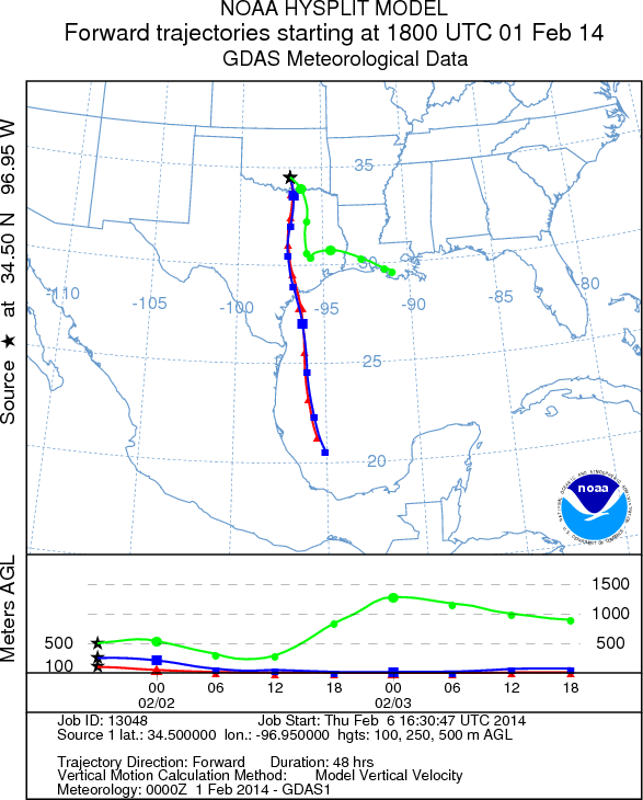
will continue from the northeast at light levels. The trajectories will travel southward on both days. The trajectories
show that the air will be dense moving at ground level.
OUTLOOK: *** Low Threat today and Low Threat Tomorrow *** Conditions for pollen
release today and tomorrow will be marginal with slightly warmer conditions today. However, there is a 20% chance
of showers today and that will build to a 70% chance of rain tomorrow. Tomorrow will also bring colder conditions
along with the moisture and the chance of precipitation tomorrow will include snow, sleet and freezing rain. The
trajectories travel due south on the northerly winds that are pushing southward across Texas today. The greater
humidity and the increasing chance of showers across the region results in a forecast of a low threat for tomorrow
and Sunday. Overall conditions during the forecast period will be deteriorating with many areas in store for cold
conditions and precipitation in one form or another. These conditions are generally poor for pollen release and
transport. The potential for pollen release is better today than tomorrow. We continue to watch to see if and by
how much the pollen counts rebound as the warm-up occurs this week. As we look back to the last really good conditions
pollen had begun to diminish a bit. We continue to test the overall progress of the pollination season.
Trajectory Start (s) (shown by black
star on map): Davis, OK.
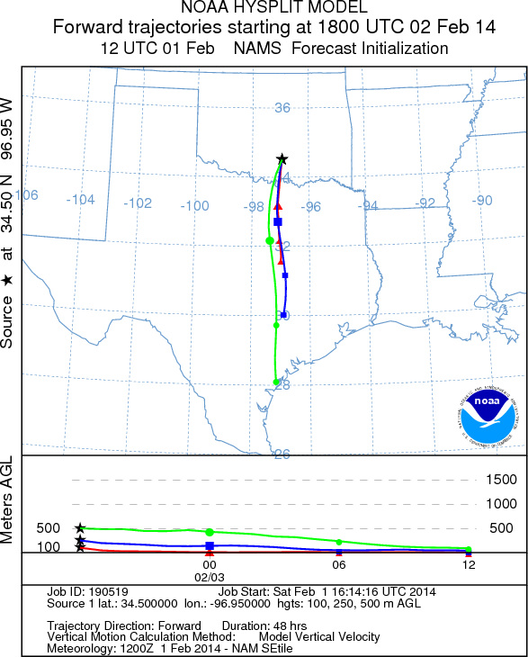
Saturday, February 1
Sunday, February 2
Prepared by: Estelle
Levetin
(Faculty
of Biological Science, The University of Tulsa, 800 S. Tucker Dr., Tulsa, OK 74104) and Peter
K Van de Water
(Department of Earth and Environmental Science, California State University Fresno, 2576 East San Ramon Avenue,
M/S ST24, Fresno CA 93740-8039). This forecast gives the anticipated future track of released Mountain Cedar pollen,
weather conditions over the region and along the forecast pathway, and an estimated time of arrival for various
metropolitan areas.
Questions: Aerobiology Lab e-mail: pollen@utulsa.edu
Return to Forecasting Home Page